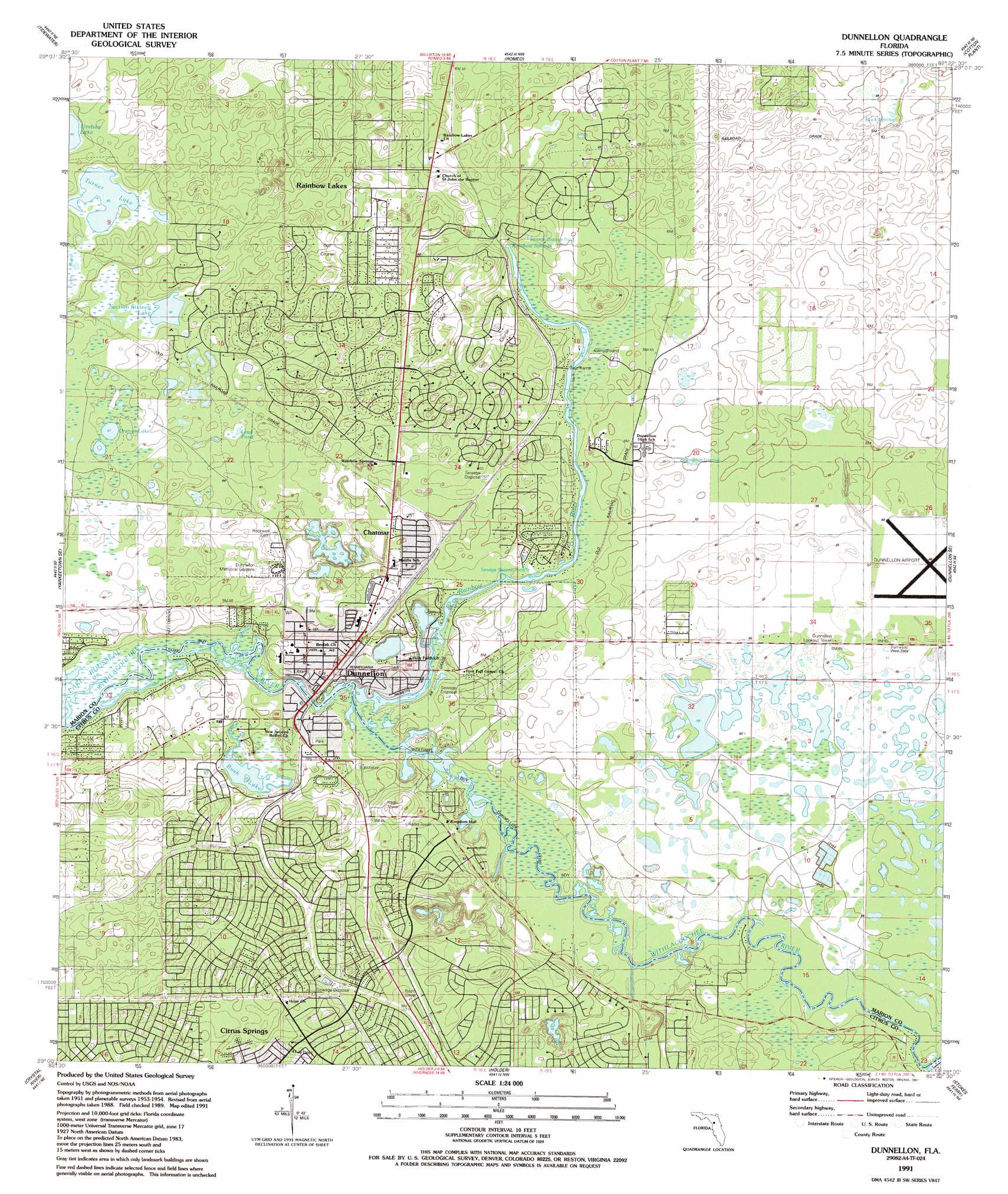
Dunnellon Topo Map Florida
To zoom in, hover over the map of Dunnellon
USGS Topo Quad 29082a4 - 1:24,000 scale
| Topo Map Name: | Dunnellon |
| USGS Topo Quad ID: | 29082a4 |
| Print Size: | ca. 21 1/4" wide x 27" high |
| Southeast Coordinates: | 29° N latitude / 82.375° W longitude |
| Map Center Coordinates: | 29.0625° N latitude / 82.4375° W longitude |
| U.S. State: | FL |
| Filename: | O29082A4.jpg |
| Download Map JPG Image: | Dunnellon topo map 1:24,000 scale |
| Map Type: | Topographic |
| Topo Series: | 7.5´ |
| Map Scale: | 1:24,000 |
| Source of Map Images: | United States Geological Survey (USGS) |
| Alternate Map Versions: |
Dunnellon FL 1954, updated 1955 Download PDF Buy paper map Dunnellon FL 1954, updated 1964 Download PDF Buy paper map Dunnellon FL 1954, updated 1974 Download PDF Buy paper map Dunnellon FL 1991, updated 1991 Download PDF Buy paper map Dunnellon FL 2012 Download PDF Buy paper map Dunnellon FL 2015 Download PDF Buy paper map |
1:24,000 Topo Quads surrounding Dunnellon
Bronson Sw |
Bronson Se |
Morriston |
Fairfield |
Reddick |
Lebanon Station |
Tidewater |
Romeo |
Cotton Plant |
Ocala West |
Yankeetown |
Yankeetown Se |
Dunnellon |
Dunnellon Se |
Shady |
Red Level |
Crystal River |
Holder |
Stokes Ferry |
Lake Panasoffkee Nw |
Ozello |
Homosassa |
Lecanto |
Inverness |
Rutland |
> Back to 29082a1 at 1:100,000 scale
> Back to 29082a1 at 1:250,000 scale
> Back to U.S. Topo Maps home
Dunnellon topo map: Gazetteer
Dunnellon: Airports
Marion County - Dunnellon Airport elevation 19m 62′Dunnellon: Lakes
Lead Pond elevation 18m 59′Orange Lake elevation 21m 68′
Rush Lake elevation 10m 32′
Section Sixteen Lake elevation 18m 59′
Turner Lake elevation 18m 59′
Dunnellon: Parks
Rainbow Springs State Park elevation 22m 72′Dunnellon: Populated Places
Chatmire elevation 17m 55′Dunnellon elevation 15m 49′
Dunnellon Square Mobile Home Village elevation 15m 49′
Rainbow Falls elevation 15m 49′
Rocksprings elevation 21m 68′
Dunnellon: Post Offices
Dunnellon Post Office elevation 15m 49′Dunnellon: Springs
Rainbow Springs elevation 9m 29′Rock Spring elevation 13m 42′
Dunnellon: Streams
Rainbow River elevation 7m 22′Dunnellon digital topo map on disk
Buy this Dunnellon topo map showing relief, roads, GPS coordinates and other geographical features, as a high-resolution digital map file on DVD: