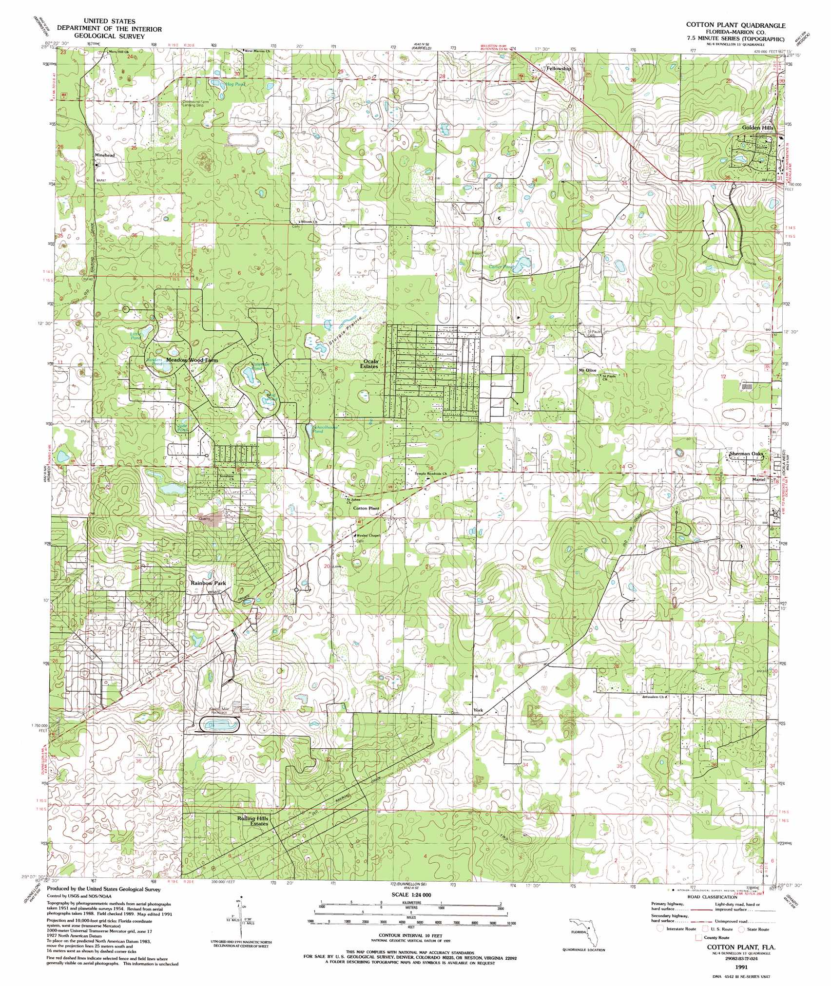
Cotton Plant Topo Map Florida
To zoom in, hover over the map of Cotton Plant
USGS Topo Quad 29082b3 - 1:24,000 scale
| Topo Map Name: | Cotton Plant |
| USGS Topo Quad ID: | 29082b3 |
| Print Size: | ca. 21 1/4" wide x 27" high |
| Southeast Coordinates: | 29.125° N latitude / 82.25° W longitude |
| Map Center Coordinates: | 29.1875° N latitude / 82.3125° W longitude |
| U.S. State: | FL |
| Filename: | O29082B3.jpg |
| Download Map JPG Image: | Cotton Plant topo map 1:24,000 scale |
| Map Type: | Topographic |
| Topo Series: | 7.5´ |
| Map Scale: | 1:24,000 |
| Source of Map Images: | United States Geological Survey (USGS) |
| Alternate Map Versions: |
Cotton Plant FL 1954, updated 1955 Download PDF Buy paper map Cotton Plant FL 1954, updated 1977 Download PDF Buy paper map Cotton Plant FL 1991, updated 1991 Download PDF Buy paper map Cotton Plant FL 2012 Download PDF Buy paper map Cotton Plant FL 2015 Download PDF Buy paper map |
1:24,000 Topo Quads surrounding Cotton Plant
Bronson Ne |
Williston |
Flemington |
Mcintosh |
Citra |
Bronson Se |
Morriston |
Fairfield |
Reddick |
Anthony |
Tidewater |
Romeo |
Cotton Plant |
Ocala West |
Ocala East |
Yankeetown Se |
Dunnellon |
Dunnellon Se |
Shady |
Belleview |
Crystal River |
Holder |
Stokes Ferry |
Lake Panasoffkee Nw |
Oxford |
> Back to 29082a1 at 1:100,000 scale
> Back to 29082a1 at 1:250,000 scale
> Back to U.S. Topo Maps home
Cotton Plant topo map: Gazetteer
Cotton Plant: Airports
Crosswind Farm Airport elevation 21m 68′Cotton Plant: Flats
Sturgis Prairie elevation 18m 59′Cotton Plant: Lakes
Bird Pond elevation 15m 49′Carter Pond elevation 26m 85′
Coleman Pond elevation 14m 45′
Hog Pond elevation 15m 49′
Jude Pond elevation 16m 52′
Little Pond elevation 14m 45′
Sanders Pond elevation 14m 45′
Schoolhouse Pond elevation 13m 42′
Cotton Plant: Parks
Classic Mile Race Track elevation 23m 75′Cotton Plant: Populated Places
Cotton Plant elevation 19m 62′Early Bird elevation 23m 75′
Fellowship elevation 54m 177′
Leroy (historical) elevation 24m 78′
Mount Olive elevation 22m 72′
Ocala Estates elevation 21m 68′
Rainbow Park elevation 23m 75′
Sherman Oaks elevation 25m 82′
York elevation 24m 78′
Cotton Plant digital topo map on disk
Buy this Cotton Plant topo map showing relief, roads, GPS coordinates and other geographical features, as a high-resolution digital map file on DVD: