Lebanon Station Topo Map Florida
To zoom in, hover over the map of Lebanon Station
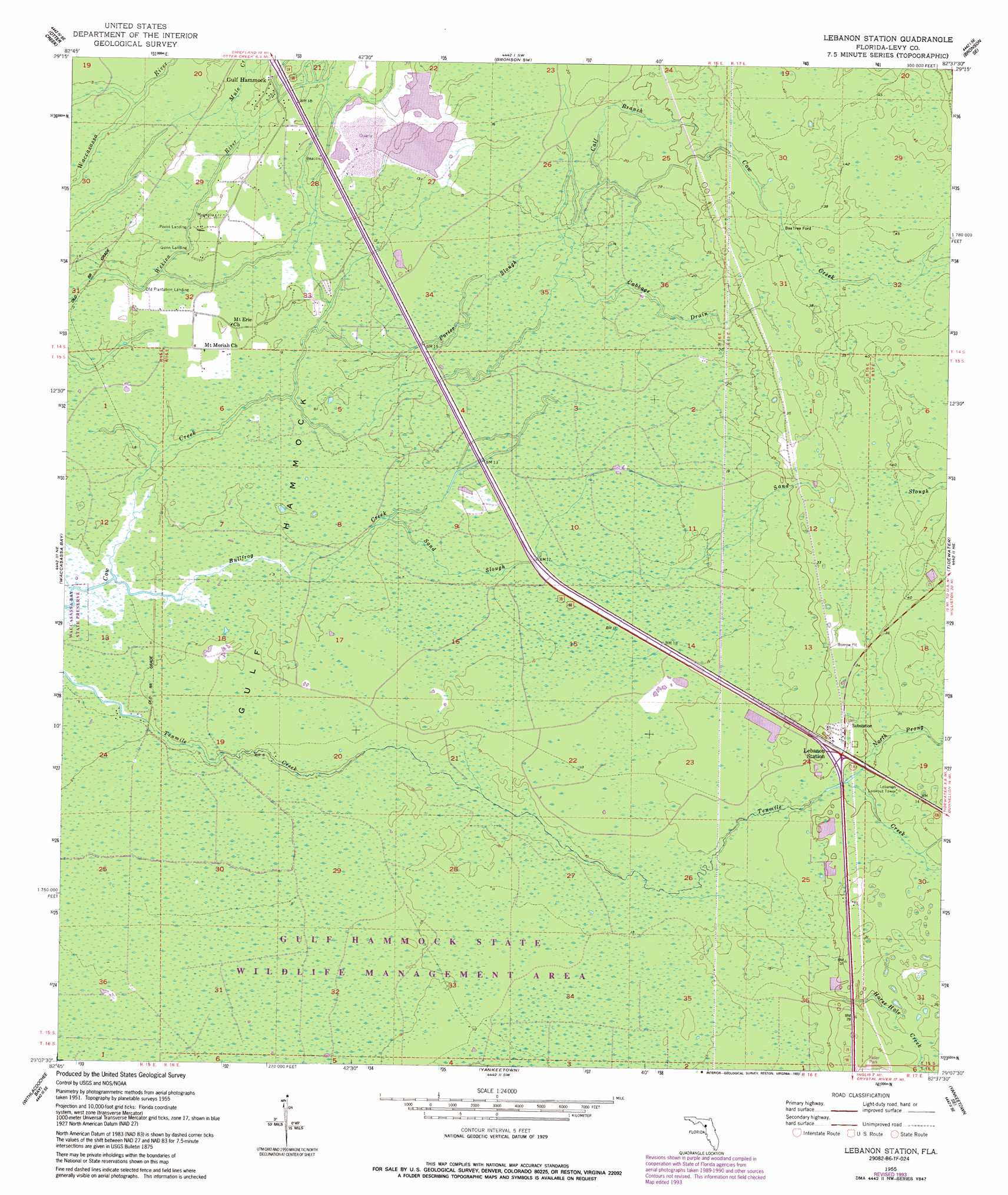
USGS Topo Quad 29082b6 - 1:24,000 scale
| Topo Map Name: | Lebanon Station |
| USGS Topo Quad ID: | 29082b6 |
| Print Size: | ca. 21 1/4" wide x 27" high |
| Southeast Coordinates: | 29.125° N latitude / 82.625° W longitude |
| Map Center Coordinates: | 29.1875° N latitude / 82.6875° W longitude |
| U.S. State: | FL |
| Filename: | O29082B6.jpg |
| Download Map JPG Image: | Lebanon Station topo map 1:24,000 scale |
| Map Type: | Topographic |
| Topo Series: | 7.5´ |
| Map Scale: | 1:24,000 |
| Source of Map Images: | United States Geological Survey (USGS) |
| Alternate Map Versions: |
Lebanon Station FL 1955, updated 1956 Download PDF Buy paper map Lebanon Station FL 1955, updated 1988 Download PDF Buy paper map Lebanon Station FL 1955, updated 1993 Download PDF Buy paper map Lebanon Station FL 1968, updated 1968 Download PDF Buy paper map Lebanon Station FL 2012 Download PDF Buy paper map Lebanon Station FL 2015 Download PDF Buy paper map |
1:24,000 Topo Quads surrounding Lebanon Station
Manatee Springs |
Chiefland |
Bronson |
Bronson Ne |
Williston |
Chiefland Sw |
Otter Creek |
Bronson Sw |
Bronson Se |
Morriston |
Sumner |
Waccasassa Bay |
Lebanon Station |
Tidewater |
Romeo |
Withlacoochee Bay |
Yankeetown |
Yankeetown Se |
Dunnellon |
|
Red Level |
Crystal River |
Holder |
> Back to 29082a1 at 1:100,000 scale
> Back to 29082a1 at 1:250,000 scale
> Back to U.S. Topo Maps home
Lebanon Station topo map: Gazetteer
Lebanon Station: Populated Places
Beetree Ford elevation 10m 32′Lebanon Station: Streams
Bullfrog Creek elevation 1m 3′Cabbage Drain elevation 4m 13′
Calf Branch elevation 4m 13′
Horse Hole Creek elevation 7m 22′
Mule Creek elevation 2m 6′
North Prong Tenmile Creek elevation 8m 26′
Porter Slough elevation 1m 3′
Sand Slough elevation 1m 3′
Lebanon Station digital topo map on disk
Buy this Lebanon Station topo map showing relief, roads, GPS coordinates and other geographical features, as a high-resolution digital map file on DVD: