Bronson Se Topo Map Florida
To zoom in, hover over the map of Bronson Se
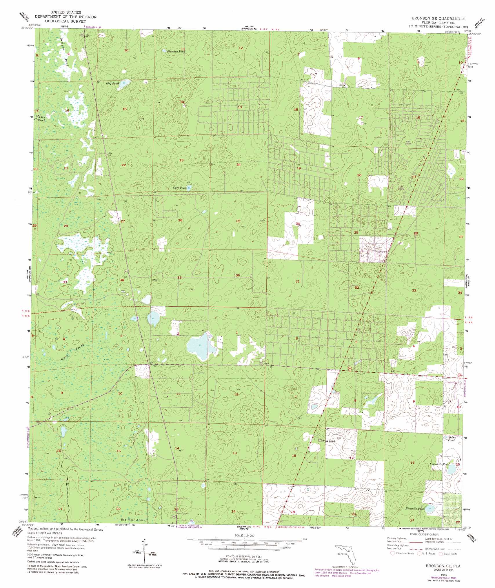
USGS Topo Quad 29082c5 - 1:24,000 scale
| Topo Map Name: | Bronson Se |
| USGS Topo Quad ID: | 29082c5 |
| Print Size: | ca. 21 1/4" wide x 27" high |
| Southeast Coordinates: | 29.25° N latitude / 82.5° W longitude |
| Map Center Coordinates: | 29.3125° N latitude / 82.5625° W longitude |
| U.S. State: | FL |
| Filename: | O29082C5.jpg |
| Download Map JPG Image: | Bronson Se topo map 1:24,000 scale |
| Map Type: | Topographic |
| Topo Series: | 7.5´ |
| Map Scale: | 1:24,000 |
| Source of Map Images: | United States Geological Survey (USGS) |
| Alternate Map Versions: |
Bronson SE FL 1955, updated 1956 Download PDF Buy paper map Bronson SE FL 1955, updated 1988 Download PDF Buy paper map Bronson SE FL 2012 Download PDF Buy paper map Bronson SE FL 2015 Download PDF Buy paper map |
1:24,000 Topo Quads surrounding Bronson Se
Trenton |
Newberry Sw |
Archer |
Arredondo |
Micanopy |
Chiefland |
Bronson |
Bronson Ne |
Williston |
Flemington |
Otter Creek |
Bronson Sw |
Bronson Se |
Morriston |
Fairfield |
Waccasassa Bay |
Lebanon Station |
Tidewater |
Romeo |
Cotton Plant |
Withlacoochee Bay |
Yankeetown |
Yankeetown Se |
Dunnellon |
Dunnellon Se |
> Back to 29082a1 at 1:100,000 scale
> Back to 29082a1 at 1:250,000 scale
> Back to U.S. Topo Maps home
Bronson Se topo map: Gazetteer
Bronson Se: Basins
Wolf Sink elevation 14m 45′Bronson Se: Lakes
Fivemile Pond elevation 17m 55′Fletcher Pond elevation 17m 55′
Fourmile Pond elevation 17m 55′
Hog Pond elevation 17m 55′
Sage Pond elevation 17m 55′
Shine Pond elevation 17m 55′
Bronson Se: Populated Places
Williston Highlands elevation 26m 85′Bronson Se: Streams
Black Prong elevation 13m 42′Bronson Se: Swamps
Deerpen Pond elevation 16m 52′Bronson Se digital topo map on disk
Buy this Bronson Se topo map showing relief, roads, GPS coordinates and other geographical features, as a high-resolution digital map file on DVD: