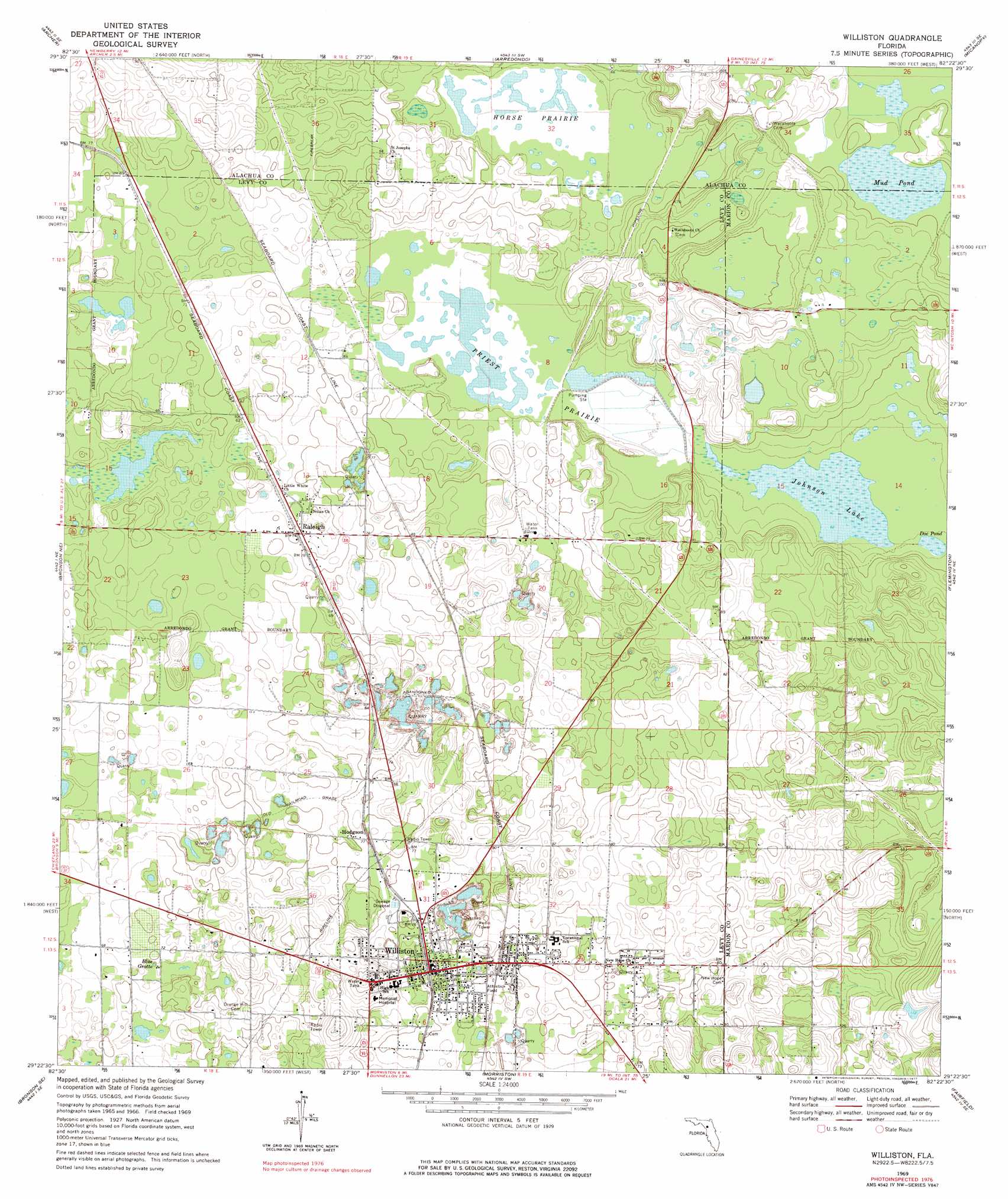
Williston Topo Map Florida
To zoom in, hover over the map of Williston
USGS Topo Quad 29082d4 - 1:24,000 scale
| Topo Map Name: | Williston |
| USGS Topo Quad ID: | 29082d4 |
| Print Size: | ca. 21 1/4" wide x 27" high |
| Southeast Coordinates: | 29.375° N latitude / 82.375° W longitude |
| Map Center Coordinates: | 29.4375° N latitude / 82.4375° W longitude |
| U.S. State: | FL |
| Filename: | O29082D4.jpg |
| Download Map JPG Image: | Williston topo map 1:24,000 scale |
| Map Type: | Topographic |
| Topo Series: | 7.5´ |
| Map Scale: | 1:24,000 |
| Source of Map Images: | United States Geological Survey (USGS) |
| Alternate Map Versions: |
Williston FL 1969, updated 1971 Download PDF Buy paper map Williston FL 1969, updated 1977 Download PDF Buy paper map Williston FL 2012 Download PDF Buy paper map Williston FL 2015 Download PDF Buy paper map |
1:24,000 Topo Quads surrounding Williston
Waters Lake |
Newberry |
Gainesville West |
Gainesville East |
Orange Heights |
Newberry Sw |
Archer |
Arredondo |
Micanopy |
Rochelle |
Bronson |
Bronson Ne |
Williston |
Flemington |
Mcintosh |
Bronson Sw |
Bronson Se |
Morriston |
Fairfield |
Reddick |
Lebanon Station |
Tidewater |
Romeo |
Cotton Plant |
Ocala West |
> Back to 29082a1 at 1:100,000 scale
> Back to 29082a1 at 1:250,000 scale
> Back to U.S. Topo Maps home
Williston topo map: Gazetteer
Williston: Airports
Williston Memorial Hospital Heliport elevation 22m 72′Williston: Flats
Horse Prairie elevation 17m 55′Priest Prairie elevation 18m 59′
Williston: Lakes
Doe Pond elevation 20m 65′Johnson Lake elevation 19m 62′
Mud Pond elevation 22m 72′
Williston: Populated Places
Hodgson elevation 23m 75′Raleigh elevation 22m 72′
Williston elevation 23m 75′
Williston: Post Offices
Williston Post Office elevation 23m 75′Williston digital topo map on disk
Buy this Williston topo map showing relief, roads, GPS coordinates and other geographical features, as a high-resolution digital map file on DVD: