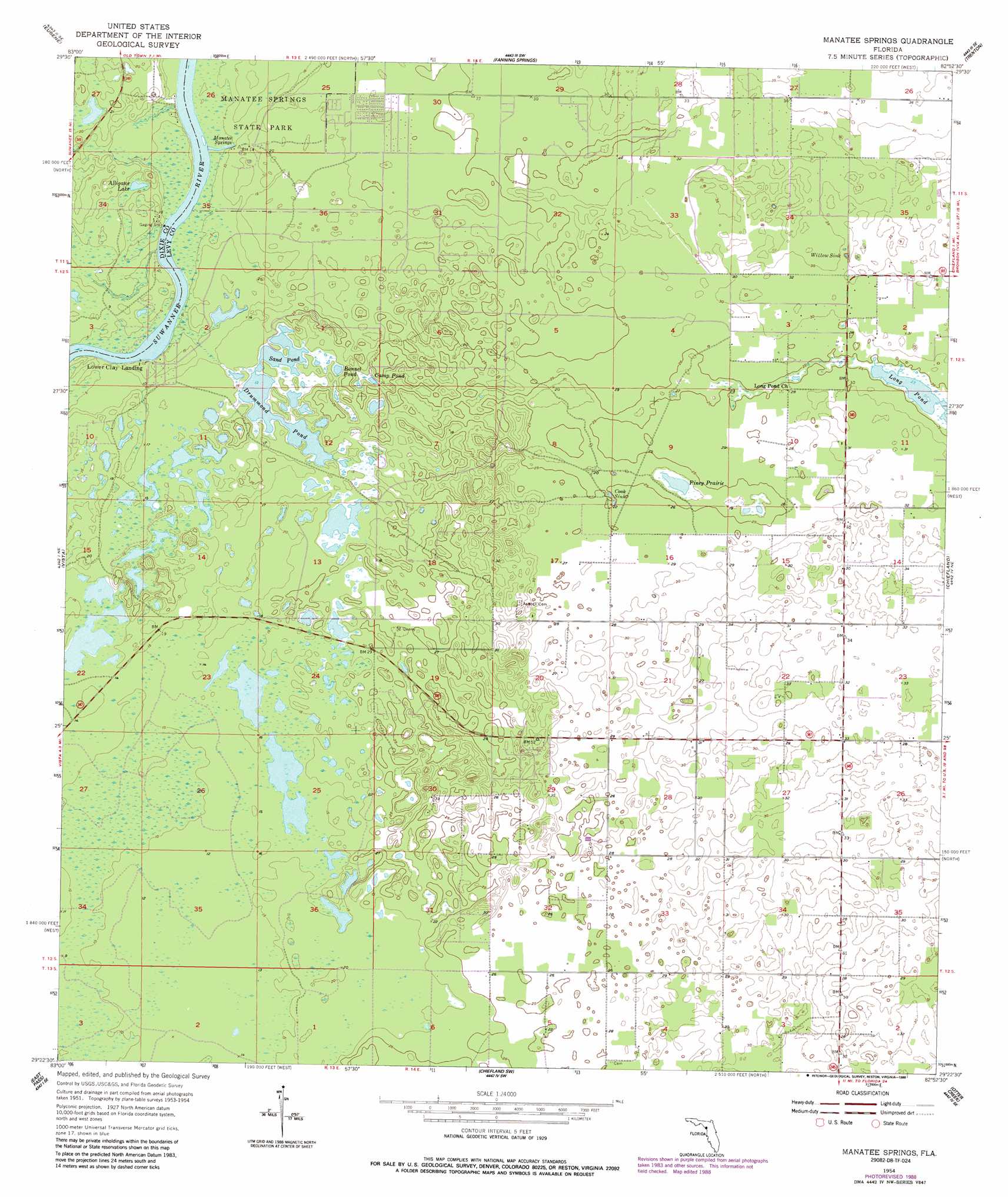
Manatee Springs Topo Map Florida
To zoom in, hover over the map of Manatee Springs
USGS Topo Quad 29082d8 - 1:24,000 scale
| Topo Map Name: | Manatee Springs |
| USGS Topo Quad ID: | 29082d8 |
| Print Size: | ca. 21 1/4" wide x 27" high |
| Southeast Coordinates: | 29.375° N latitude / 82.875° W longitude |
| Map Center Coordinates: | 29.4375° N latitude / 82.9375° W longitude |
| U.S. State: | FL |
| Filename: | O29082D8.jpg |
| Download Map JPG Image: | Manatee Springs topo map 1:24,000 scale |
| Map Type: | Topographic |
| Topo Series: | 7.5´ |
| Map Scale: | 1:24,000 |
| Source of Map Images: | United States Geological Survey (USGS) |
| Alternate Map Versions: |
Manatee Springs FL 1954, updated 1956 Download PDF Buy paper map Manatee Springs FL 1954, updated 1966 Download PDF Buy paper map Manatee Springs FL 1954, updated 1988 Download PDF Buy paper map Manatee Springs FL 2012 Download PDF Buy paper map Manatee Springs FL 2015 Download PDF Buy paper map |
1:24,000 Topo Quads surrounding Manatee Springs
Cross City West |
Cross City East |
Wannee |
Fourmile Lake |
Waters Lake |
Cross City Sw |
Eugene |
Suwannee River |
Trenton |
Newberry Sw |
Shired Island |
Vista |
Manatee Springs |
Chiefland |
Bronson |
Suwannee |
East Pass |
Chiefland Sw |
Otter Creek |
Bronson Sw |
Cedar Key |
Sumner |
Waccasassa Bay |
Lebanon Station |
> Back to 29082a1 at 1:100,000 scale
> Back to 29082a1 at 1:250,000 scale
> Back to U.S. Topo Maps home
Manatee Springs topo map: Gazetteer
Manatee Springs: Airports
Dipple Field elevation 6m 19′Manatee Springs Airport elevation 4m 13′
Manatee Springs: Basins
Cook Sink elevation 6m 19′Willow Sink elevation 7m 22′
Manatee Springs: Flats
Piney Prairie elevation 5m 16′Manatee Springs: Lakes
Alligator Lake elevation 2m 6′Bonnet Pond elevation 4m 13′
Camp Pond elevation 4m 13′
Drummond Pond elevation 4m 13′
Long Pond elevation 7m 22′
Sand Pond elevation 4m 13′
Manatee Springs: Parks
Manatee Springs State Park elevation 4m 13′Manatee Springs: Springs
Manatee Springs elevation 2m 6′Manatee Springs digital topo map on disk
Buy this Manatee Springs topo map showing relief, roads, GPS coordinates and other geographical features, as a high-resolution digital map file on DVD: