Rochelle Topo Map Florida
To zoom in, hover over the map of Rochelle
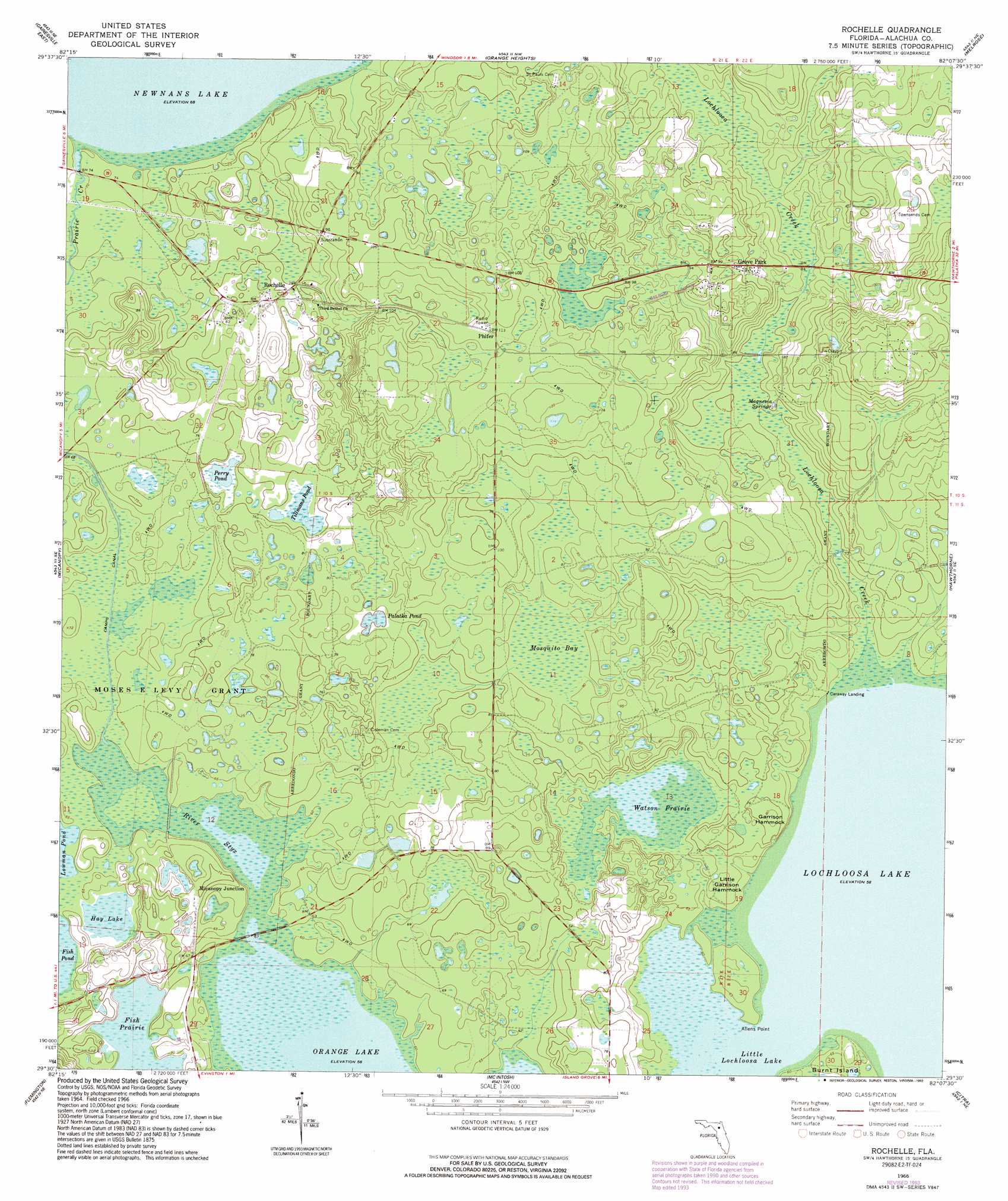
USGS Topo Quad 29082e2 - 1:24,000 scale
| Topo Map Name: | Rochelle |
| USGS Topo Quad ID: | 29082e2 |
| Print Size: | ca. 21 1/4" wide x 27" high |
| Southeast Coordinates: | 29.5° N latitude / 82.125° W longitude |
| Map Center Coordinates: | 29.5625° N latitude / 82.1875° W longitude |
| U.S. State: | FL |
| Filename: | O29082E2.jpg |
| Download Map JPG Image: | Rochelle topo map 1:24,000 scale |
| Map Type: | Topographic |
| Topo Series: | 7.5´ |
| Map Scale: | 1:24,000 |
| Source of Map Images: | United States Geological Survey (USGS) |
| Alternate Map Versions: |
Rochelle FL 1966, updated 1967 Download PDF Buy paper map Rochelle FL 1966, updated 1988 Download PDF Buy paper map Rochelle FL 1966, updated 1993 Download PDF Buy paper map Rochelle FL 2012 Download PDF Buy paper map Rochelle FL 2015 Download PDF Buy paper map |
1:24,000 Topo Quads surrounding Rochelle
Alachua |
Monteocha |
Waldo |
Keystone Heights |
Gold Head Branch |
Gainesville West |
Gainesville East |
Orange Heights |
Melrose |
Putnam Hall |
Arredondo |
Micanopy |
Rochelle |
Hawthorne |
Keuka |
Williston |
Flemington |
Mcintosh |
Citra |
Eureka Dam |
Morriston |
Fairfield |
Reddick |
Anthony |
Fort Mccoy |
> Back to 29082e1 at 1:100,000 scale
> Back to 29082a1 at 1:250,000 scale
> Back to U.S. Topo Maps home
Rochelle topo map: Gazetteer
Rochelle: Canals
Camps Canal elevation 19m 62′Rochelle: Capes
Allens Point elevation 19m 62′Rochelle: Lakes
Fish Prairie elevation 19m 62′Gamble Pond elevation 21m 68′
Hay Lake elevation 19m 62′
Little Lochloosa Lake elevation 17m 55′
Lochloosa Lake elevation 17m 55′
Palatka Pond elevation 22m 72′
Perry Pond elevation 20m 65′
Tillmans Pond elevation 22m 72′
Watson Prairie elevation 20m 65′
Rochelle: Parks
Lochloosa Wildlife Management Area elevation 27m 88′Rochelle: Populated Places
Grove Park elevation 30m 98′Micanopy Junction elevation 22m 72′
Phifer elevation 34m 111′
Rochelle elevation 23m 75′
Rochelle: Springs
Magnesia Springs elevation 23m 75′Rochelle: Streams
Lochloosa Creek elevation 17m 55′Rochelle: Summits
Garrison Hammock elevation 25m 82′Little Garrison Hammock elevation 21m 68′
Rochelle: Swamps
Mosquito Bay elevation 24m 78′River Styx elevation 17m 55′
Rochelle digital topo map on disk
Buy this Rochelle topo map showing relief, roads, GPS coordinates and other geographical features, as a high-resolution digital map file on DVD: