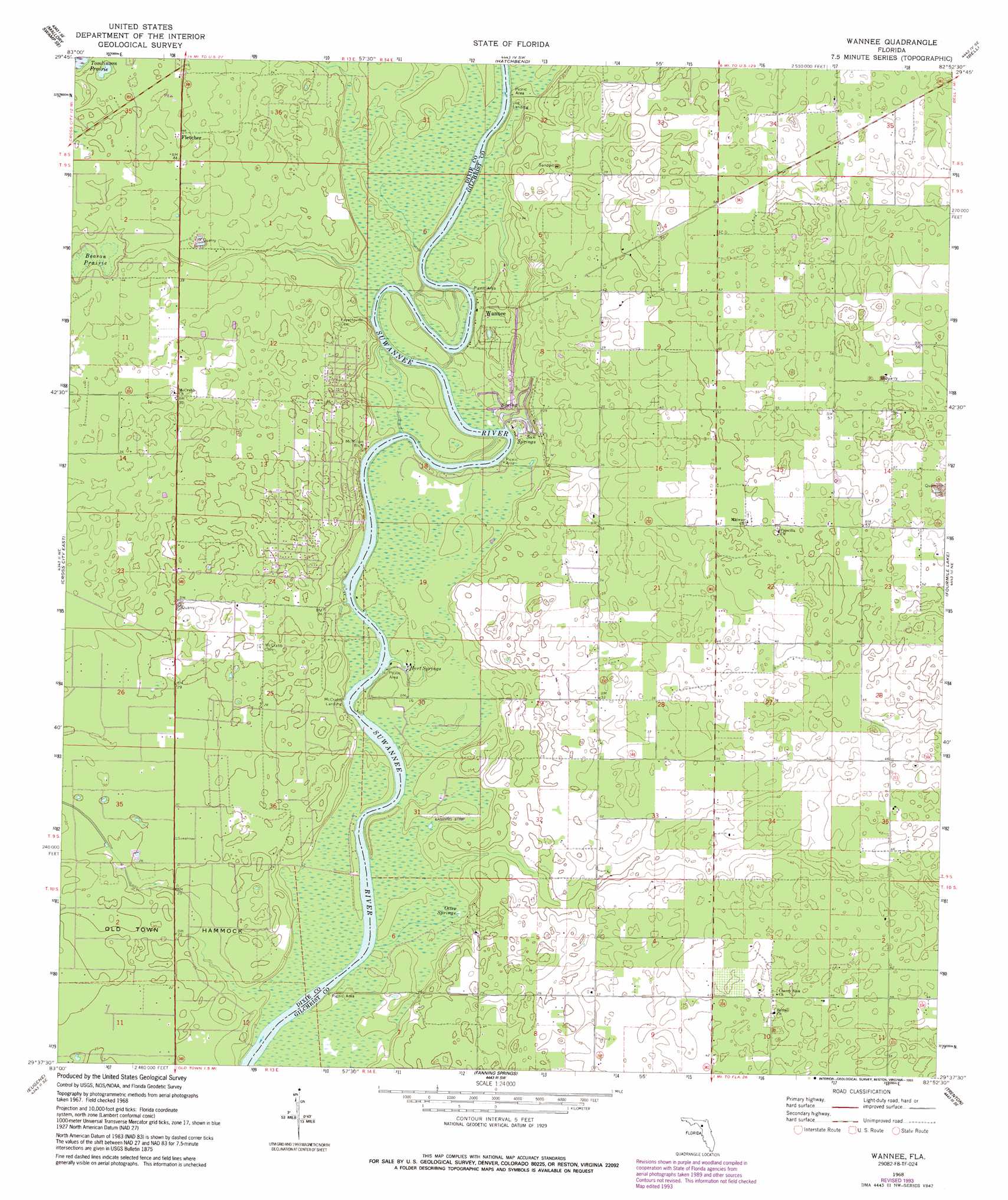
Wannee Topo Map Florida
To zoom in, hover over the map of Wannee
USGS Topo Quad 29082f8 - 1:24,000 scale
| Topo Map Name: | Wannee |
| USGS Topo Quad ID: | 29082f8 |
| Print Size: | ca. 21 1/4" wide x 27" high |
| Southeast Coordinates: | 29.625° N latitude / 82.875° W longitude |
| Map Center Coordinates: | 29.6875° N latitude / 82.9375° W longitude |
| U.S. State: | FL |
| Filename: | O29082F8.jpg |
| Download Map JPG Image: | Wannee topo map 1:24,000 scale |
| Map Type: | Topographic |
| Topo Series: | 7.5´ |
| Map Scale: | 1:24,000 |
| Source of Map Images: | United States Geological Survey (USGS) |
| Alternate Map Versions: |
Wannee FL 1968, updated 1971 Download PDF Buy paper map Wannee FL 1968, updated 1977 Download PDF Buy paper map Wannee FL 1968, updated 1988 Download PDF Buy paper map Wannee FL 1968, updated 1993 Download PDF Buy paper map Wannee FL 2012 Download PDF Buy paper map Wannee FL 2015 Download PDF Buy paper map |
1:24,000 Topo Quads surrounding Wannee
Mallory Swamp Nw |
Mallory Swamp Ne |
Branford |
Hildreth |
Fort White |
Mallory Swamp Sw |
Mallory Swamp Se |
Hatchbend |
Bell |
High Springs Sw |
Cross City West |
Cross City East |
Wannee |
Fourmile Lake |
Waters Lake |
Cross City Sw |
Eugene |
Suwannee River |
Trenton |
Newberry Sw |
Shired Island |
Vista |
Manatee Springs |
Chiefland |
Bronson |
> Back to 29082e1 at 1:100,000 scale
> Back to 29082a1 at 1:250,000 scale
> Back to U.S. Topo Maps home
Wannee topo map: Gazetteer
Wannee: Airports
Otter Springs Resort Airport elevation 6m 19′Wannee: Cliffs
McMillan Bluff elevation 6m 19′Wannee: Flats
Beason Prairie elevation 11m 36′Wannee: Populated Places
Blitchville elevation 14m 45′Curtis elevation 18m 59′
Dixietown elevation 12m 39′
Fletcher elevation 14m 45′
Wannee elevation 7m 22′
Wannee: Springs
Hart Springs elevation 3m 9′Lumber Camp Springs elevation 3m 9′
Otter Springs elevation 3m 9′
Sun Springs elevation 4m 13′
Wannee digital topo map on disk
Buy this Wannee topo map showing relief, roads, GPS coordinates and other geographical features, as a high-resolution digital map file on DVD: