Monteocha Topo Map Florida
To zoom in, hover over the map of Monteocha
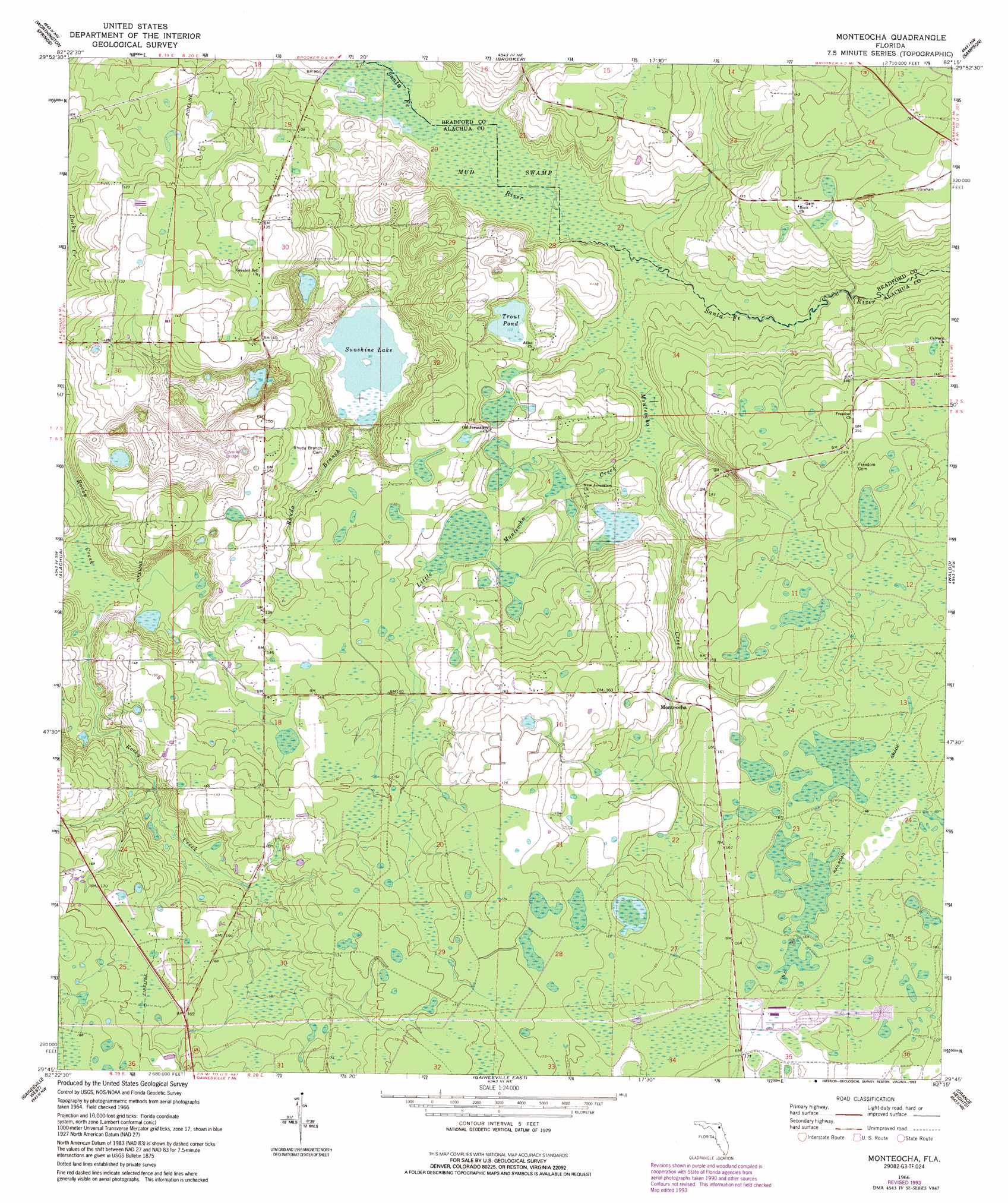
USGS Topo Quad 29082g3 - 1:24,000 scale
| Topo Map Name: | Monteocha |
| USGS Topo Quad ID: | 29082g3 |
| Print Size: | ca. 21 1/4" wide x 27" high |
| Southeast Coordinates: | 29.75° N latitude / 82.25° W longitude |
| Map Center Coordinates: | 29.8125° N latitude / 82.3125° W longitude |
| U.S. State: | FL |
| Filename: | O29082G3.jpg |
| Download Map JPG Image: | Monteocha topo map 1:24,000 scale |
| Map Type: | Topographic |
| Topo Series: | 7.5´ |
| Map Scale: | 1:24,000 |
| Source of Map Images: | United States Geological Survey (USGS) |
| Alternate Map Versions: |
Monteocha FL 1966, updated 1967 Download PDF Buy paper map Monteocha FL 1966, updated 1993 Download PDF Buy paper map Monteocha FL 2012 Download PDF Buy paper map Monteocha FL 2015 Download PDF Buy paper map |
1:24,000 Topo Quads surrounding Monteocha
Ellisville |
Lulu |
Lake Butler |
Raiford |
Lawtey |
Mikesville |
Worthington Springs |
Brooker |
Sampson |
Starke |
High Springs |
Alachua |
Monteocha |
Waldo |
Keystone Heights |
Newberry |
Gainesville West |
Gainesville East |
Orange Heights |
Melrose |
Archer |
Arredondo |
Micanopy |
Rochelle |
Hawthorne |
> Back to 29082e1 at 1:100,000 scale
> Back to 29082a1 at 1:250,000 scale
> Back to U.S. Topo Maps home
Monteocha topo map: Gazetteer
Monteocha: Lakes
Sunshine Lake elevation 24m 78′Trout Pond elevation 34m 111′
Monteocha: Parks
Gainesville Raceway elevation 51m 167′Monteocha Park elevation 27m 88′
Monteocha: Populated Places
Monteocha elevation 45m 147′Monteocha: Streams
Little Monteocha Creek elevation 30m 98′Monteocha Creek elevation 26m 85′
Rhuda Branch elevation 28m 91′
Monteocha: Swamps
Mud Swamp elevation 24m 78′Monteocha digital topo map on disk
Buy this Monteocha topo map showing relief, roads, GPS coordinates and other geographical features, as a high-resolution digital map file on DVD: