Mikesville Topo Map Florida
To zoom in, hover over the map of Mikesville
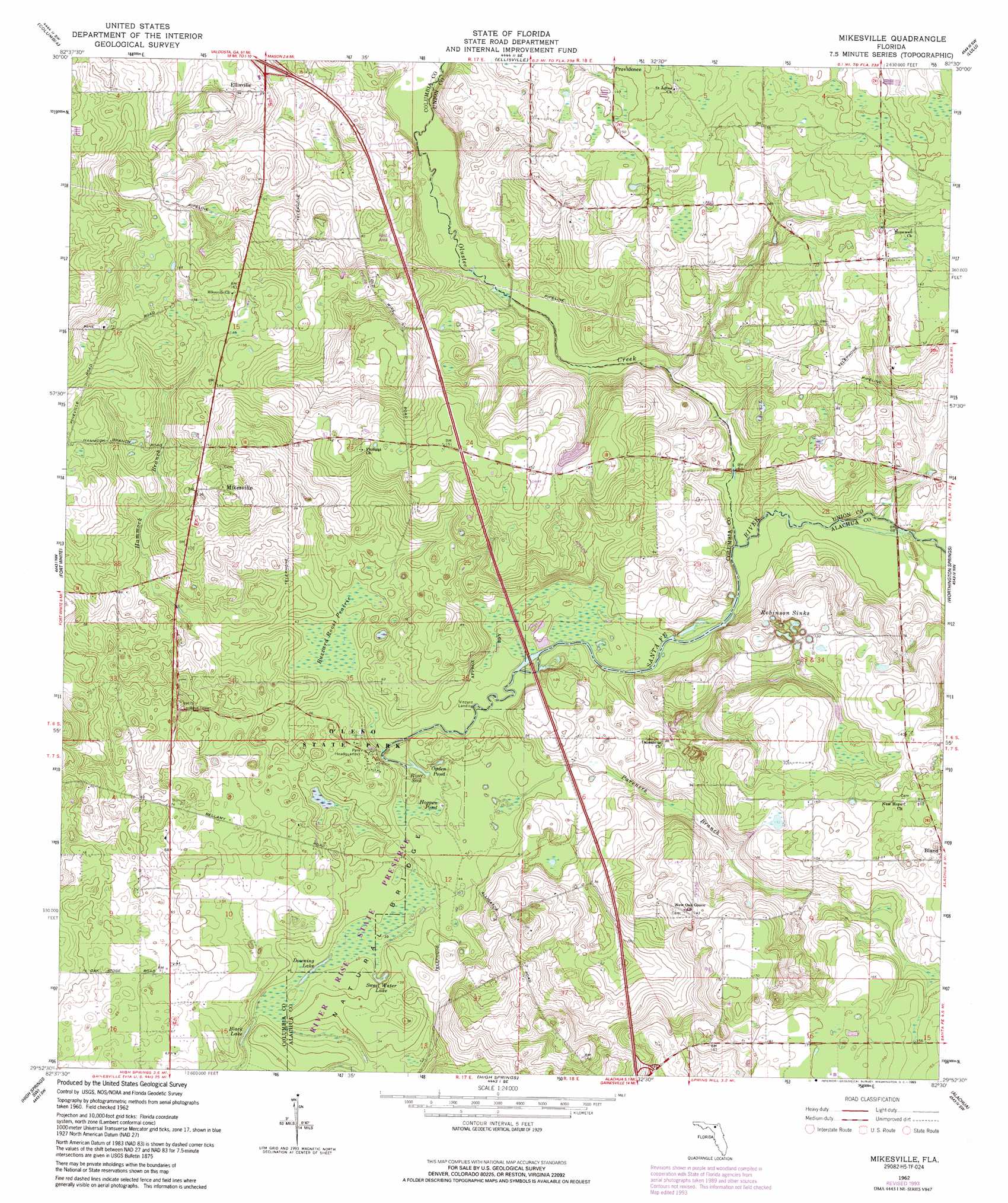
USGS Topo Quad 29082h5 - 1:24,000 scale
| Topo Map Name: | Mikesville |
| USGS Topo Quad ID: | 29082h5 |
| Print Size: | ca. 21 1/4" wide x 27" high |
| Southeast Coordinates: | 29.875° N latitude / 82.5° W longitude |
| Map Center Coordinates: | 29.9375° N latitude / 82.5625° W longitude |
| U.S. State: | FL |
| Filename: | O29082H5.jpg |
| Download Map JPG Image: | Mikesville topo map 1:24,000 scale |
| Map Type: | Topographic |
| Topo Series: | 7.5´ |
| Map Scale: | 1:24,000 |
| Source of Map Images: | United States Geological Survey (USGS) |
| Alternate Map Versions: |
Mikesville FL 1962, updated 1964 Download PDF Buy paper map Mikesville FL 1962, updated 1991 Download PDF Buy paper map Mikesville FL 1962, updated 1993 Download PDF Buy paper map Mikesville FL 2012 Download PDF Buy paper map Mikesville FL 2015 Download PDF Buy paper map |
1:24,000 Topo Quads surrounding Mikesville
Wellborn |
Lake City West |
Lake City East |
Olustee |
Sanderson South |
O'Brien Se |
Columbia |
Ellisville |
Lulu |
Lake Butler |
Hildreth |
Fort White |
Mikesville |
Worthington Springs |
Brooker |
Bell |
High Springs Sw |
High Springs |
Alachua |
Monteocha |
Fourmile Lake |
Waters Lake |
Newberry |
Gainesville West |
Gainesville East |
> Back to 29082e1 at 1:100,000 scale
> Back to 29082a1 at 1:250,000 scale
> Back to U.S. Topo Maps home
Mikesville topo map: Gazetteer
Mikesville: Areas
Natural Bridge elevation 12m 39′Mikesville: Basins
Robinson Sinks elevation 31m 101′Mikesville: Lakes
Black Lake elevation 13m 42′Downing Lake elevation 10m 32′
Hogpen Pond elevation 12m 39′
Ogden Pond elevation 14m 45′
River Sink elevation 11m 36′
Sweet Water Lake elevation 12m 39′
Mikesville: Parks
O'Leno State Park elevation 18m 59′Sarah Community Park elevation 42m 137′
Mikesville: Populated Places
Mikesville elevation 47m 154′San Francisco Potano (historical) elevation 35m 114′
Mikesville: Streams
Hammock Branch elevation 15m 49′Olustee Creek elevation 12m 39′
Pareners Branch elevation 10m 32′
Mikesville: Swamps
Buzzard Roost Prairie elevation 13m 42′Mikesville digital topo map on disk
Buy this Mikesville topo map showing relief, roads, GPS coordinates and other geographical features, as a high-resolution digital map file on DVD: