Steinhatchee Sw Topo Map Florida
To zoom in, hover over the map of Steinhatchee Sw
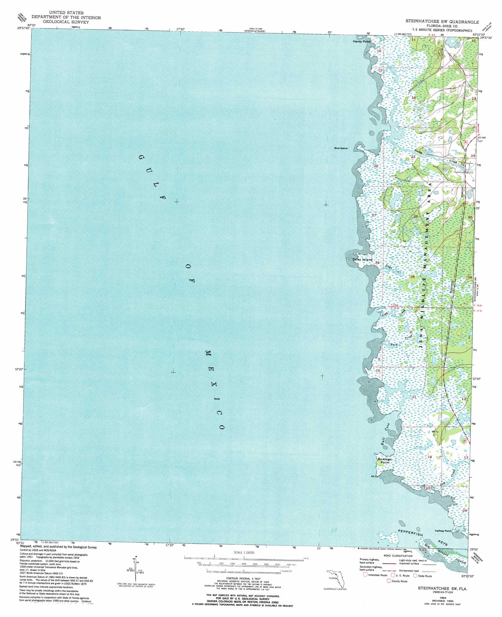
USGS Topo Quad 29083e4 - 1:24,000 scale
| Topo Map Name: | Steinhatchee Sw |
| USGS Topo Quad ID: | 29083e4 |
| Print Size: | ca. 21 1/4" wide x 27" high |
| Southeast Coordinates: | 29.5° N latitude / 83.375° W longitude |
| Map Center Coordinates: | 29.5625° N latitude / 83.4375° W longitude |
| U.S. State: | FL |
| Filename: | O29083E4.jpg |
| Download Map JPG Image: | Steinhatchee Sw topo map 1:24,000 scale |
| Map Type: | Topographic |
| Topo Series: | 7.5´ |
| Map Scale: | 1:24,000 |
| Source of Map Images: | United States Geological Survey (USGS) |
| Alternate Map Versions: |
Steinhatchee SW FL 1954, updated 1955 Download PDF Buy paper map Steinhatchee SW FL 1954, updated 1965 Download PDF Buy paper map Steinhatchee SW FL 1954, updated 1980 Download PDF Buy paper map Steinhatchee SW FL 1954, updated 1990 Download PDF Buy paper map Steinhatchee SW FL 1954, updated 1993 Download PDF Buy paper map Steinhatchee SW FL 2012 Download PDF Buy paper map Steinhatchee SW FL 2015 Download PDF Buy paper map |
1:24,000 Topo Quads surrounding Steinhatchee Sw
Keaton Beach |
Salem Sw |
Clara |
Mallory Swamp Sw |
|
Crooked Point |
Steinhatchee |
Jena |
Cross City West |
|
Steinhatchee Sw |
Steinhatchee Se |
Cross City Sw |
||
Horseshoe Beach |
Shired Island |
|||
Suwannee |
> Back to 29083e1 at 1:100,000 scale
> Back to 29082a1 at 1:250,000 scale
> Back to U.S. Topo Maps home
Steinhatchee Sw topo map: Gazetteer
Steinhatchee Sw: Bays
Bull Cove elevation 0m 0′Steinhatchee Sw: Capes
Bowlegs Point elevation 0m 0′Halfway Point elevation 0m 0′
Hardy Point elevation 1m 3′
Steinhatchee Sw: Guts
Days Creek elevation 1m 3′Sink Creek elevation 1m 3′
Steinhatchee Sw: Islands
Bird Island elevation 0m 0′Tater Island elevation 0m 0′
Steinhatchee Sw: Parks
Jena Wildlife Management Area elevation 1m 3′Steinhatchee Sw: Streams
Buck Creek elevation 0m 0′Cow Creek elevation 0m 0′
Rocky Creek elevation 0m 0′
Steinhatchee Sw digital topo map on disk
Buy this Steinhatchee Sw topo map showing relief, roads, GPS coordinates and other geographical features, as a high-resolution digital map file on DVD: