Cross City West Topo Map Florida
To zoom in, hover over the map of Cross City West
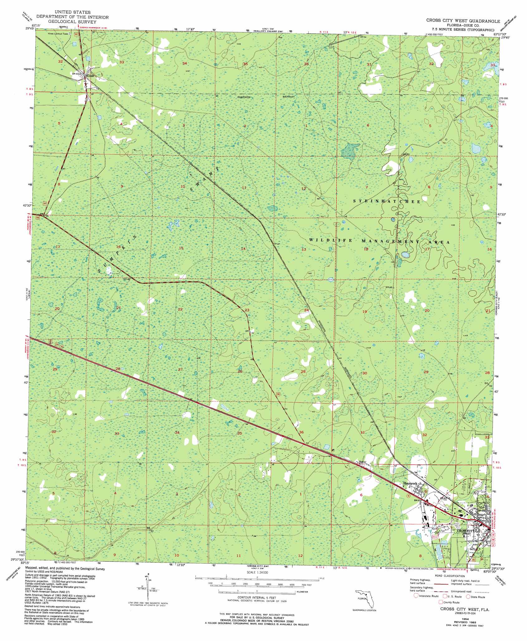
USGS Topo Quad 29083f2 - 1:24,000 scale
| Topo Map Name: | Cross City West |
| USGS Topo Quad ID: | 29083f2 |
| Print Size: | ca. 21 1/4" wide x 27" high |
| Southeast Coordinates: | 29.625° N latitude / 83.125° W longitude |
| Map Center Coordinates: | 29.6875° N latitude / 83.1875° W longitude |
| U.S. State: | FL |
| Filename: | O29083F2.jpg |
| Download Map JPG Image: | Cross City West topo map 1:24,000 scale |
| Map Type: | Topographic |
| Topo Series: | 7.5´ |
| Map Scale: | 1:24,000 |
| Source of Map Images: | United States Geological Survey (USGS) |
| Alternate Map Versions: |
Cross City West FL 1954, updated 1955 Download PDF Buy paper map Cross City West FL 1954, updated 1988 Download PDF Buy paper map Cross City West FL 1954, updated 1993 Download PDF Buy paper map Cross City West FL 2012 Download PDF Buy paper map Cross City West FL 2015 Download PDF Buy paper map |
1:24,000 Topo Quads surrounding Cross City West
Salem |
Cooks Hammock |
Mallory Swamp Nw |
Mallory Swamp Ne |
Branford |
Salem Sw |
Clara |
Mallory Swamp Sw |
Mallory Swamp Se |
Hatchbend |
Steinhatchee |
Jena |
Cross City West |
Cross City East |
Wannee |
Steinhatchee Sw |
Steinhatchee Se |
Cross City Sw |
Eugene |
Suwannee River |
Horseshoe Beach |
Shired Island |
Vista |
Manatee Springs |
> Back to 29083e1 at 1:100,000 scale
> Back to 29082a1 at 1:250,000 scale
> Back to U.S. Topo Maps home
Cross City West topo map: Gazetteer
Cross City West: Parks
Steinhatchee Wildlife Management Area elevation 15m 49′Cross City West: Populated Places
Cross City elevation 12m 39′Hines elevation 12m 39′
Shamrock elevation 13m 42′
Cross City West: Swamps
Pumpkin Swamp elevation 11m 36′Cross City West digital topo map on disk
Buy this Cross City West topo map showing relief, roads, GPS coordinates and other geographical features, as a high-resolution digital map file on DVD: