Steinhatchee Topo Map Florida
To zoom in, hover over the map of Steinhatchee
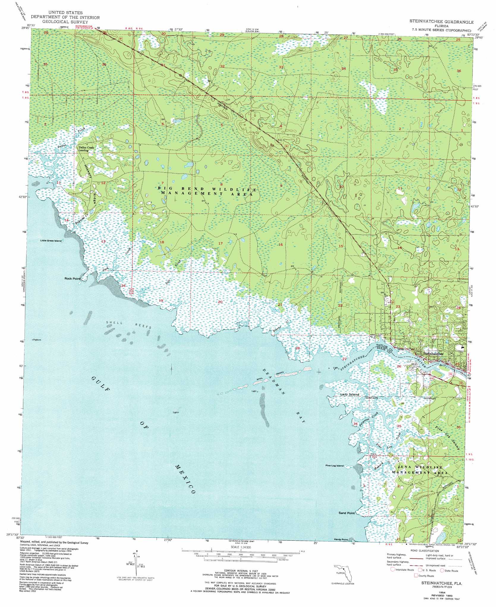
USGS Topo Quad 29083f4 - 1:24,000 scale
| Topo Map Name: | Steinhatchee |
| USGS Topo Quad ID: | 29083f4 |
| Print Size: | ca. 21 1/4" wide x 27" high |
| Southeast Coordinates: | 29.625° N latitude / 83.375° W longitude |
| Map Center Coordinates: | 29.6875° N latitude / 83.4375° W longitude |
| U.S. State: | FL |
| Filename: | O29083F4.jpg |
| Download Map JPG Image: | Steinhatchee topo map 1:24,000 scale |
| Map Type: | Topographic |
| Topo Series: | 7.5´ |
| Map Scale: | 1:24,000 |
| Source of Map Images: | United States Geological Survey (USGS) |
| Alternate Map Versions: |
Steinhatchee FL 1954, updated 1955 Download PDF Buy paper map Steinhatchee FL 1954, updated 1973 Download PDF Buy paper map Steinhatchee FL 1954, updated 1984 Download PDF Buy paper map Steinhatchee FL 1954, updated 1993 Download PDF Buy paper map Steinhatchee FL 2012 Download PDF Buy paper map Steinhatchee FL 2015 Download PDF Buy paper map |
1:24,000 Topo Quads surrounding Steinhatchee
Okefenokee Slough |
Warrior Swamp |
Salem |
Cooks Hammock |
Mallory Swamp Nw |
Keaton Beach |
Salem Sw |
Clara |
Mallory Swamp Sw |
|
Crooked Point |
Steinhatchee |
Jena |
Cross City West |
|
Steinhatchee Sw |
Steinhatchee Se |
Cross City Sw |
||
Horseshoe Beach |
Shired Island |
> Back to 29083e1 at 1:100,000 scale
> Back to 29082a1 at 1:250,000 scale
> Back to U.S. Topo Maps home
Steinhatchee topo map: Gazetteer
Steinhatchee: Bars
Shell Reefs elevation 0m 0′Steinhatchee: Bays
Deadman Bay elevation 0m 0′Steinhatchee: Capes
Rock Point elevation 0m 0′Sand Point elevation 0m 0′
Steinhatchee: Islands
Lazy Island elevation 0m 0′Little Grass Island elevation 0m 0′
Pine Log Island elevation 0m 0′
Steinhatchee: Parks
Tide Swamp Wildlife Management Area elevation 1m 3′Steinhatchee: Populated Places
Dallus Creek Landing elevation 0m 0′Steinhatchee elevation 2m 6′
Steward City elevation 0m 0′
Steinhatchee: Ridges
Hickory Ridge elevation 2m 6′Steinhatchee: Streams
Bayview Creek elevation 0m 0′Bivens Creek elevation 0m 0′
Dallus Creek elevation 0m 0′
Howard Creek elevation 0m 0′
Jack Creek elevation 0m 0′
Pine Log Creek elevation 0m 0′
Porpoise Creek elevation 0m 0′
Salt Creek elevation 0m 0′
Steinhatchee River elevation 0m 0′
Steinhatchee: Swamps
Pine Log Swamp elevation 1m 3′Steinhatchee digital topo map on disk
Buy this Steinhatchee topo map showing relief, roads, GPS coordinates and other geographical features, as a high-resolution digital map file on DVD: