Mallory Swamp Sw Topo Map Florida
To zoom in, hover over the map of Mallory Swamp Sw
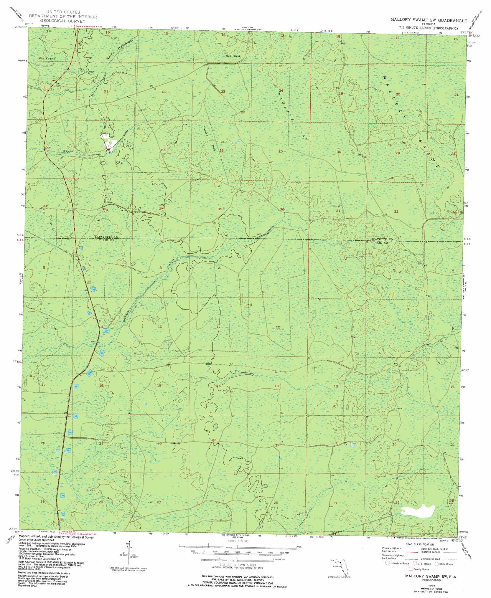
USGS Topo Quad 29083g2 - 1:24,000 scale
| Topo Map Name: | Mallory Swamp Sw |
| USGS Topo Quad ID: | 29083g2 |
| Print Size: | ca. 21 1/4" wide x 27" high |
| Southeast Coordinates: | 29.75° N latitude / 83.125° W longitude |
| Map Center Coordinates: | 29.8125° N latitude / 83.1875° W longitude |
| U.S. State: | FL |
| Filename: | O29083G2.jpg |
| Download Map JPG Image: | Mallory Swamp Sw topo map 1:24,000 scale |
| Map Type: | Topographic |
| Topo Series: | 7.5´ |
| Map Scale: | 1:24,000 |
| Source of Map Images: | United States Geological Survey (USGS) |
| Alternate Map Versions: |
Mallory Swamp SW FL 1954, updated 1955 Download PDF Buy paper map Mallory Swamp SW FL 1954, updated 1973 Download PDF Buy paper map Mallory Swamp SW FL 1954, updated 1993 Download PDF Buy paper map Mallory Swamp SW FL 2012 Download PDF Buy paper map Mallory Swamp SW FL 2015 Download PDF Buy paper map |
1:24,000 Topo Quads surrounding Mallory Swamp Sw
Fenholloway |
Day Se |
Mayo |
Mayo Se |
O'Brien |
Salem |
Cooks Hammock |
Mallory Swamp Nw |
Mallory Swamp Ne |
Branford |
Salem Sw |
Clara |
Mallory Swamp Sw |
Mallory Swamp Se |
Hatchbend |
Steinhatchee |
Jena |
Cross City West |
Cross City East |
Wannee |
Steinhatchee Sw |
Steinhatchee Se |
Cross City Sw |
Eugene |
Suwannee River |
> Back to 29083e1 at 1:100,000 scale
> Back to 29082a1 at 1:250,000 scale
> Back to U.S. Topo Maps home
Mallory Swamp Sw topo map: Gazetteer
Mallory Swamp Sw: Islands
Buck Island elevation 35m 114′Knife Hammock elevation 16m 52′
Mallory Swamp Sw: Swamps
Mud Swamp elevation 33m 108′Rawhide Sog elevation 29m 95′
Tooles Bay elevation 30m 98′
Mallory Swamp Sw digital topo map on disk
Buy this Mallory Swamp Sw topo map showing relief, roads, GPS coordinates and other geographical features, as a high-resolution digital map file on DVD: