New Inlet Topo Map Florida
To zoom in, hover over the map of New Inlet
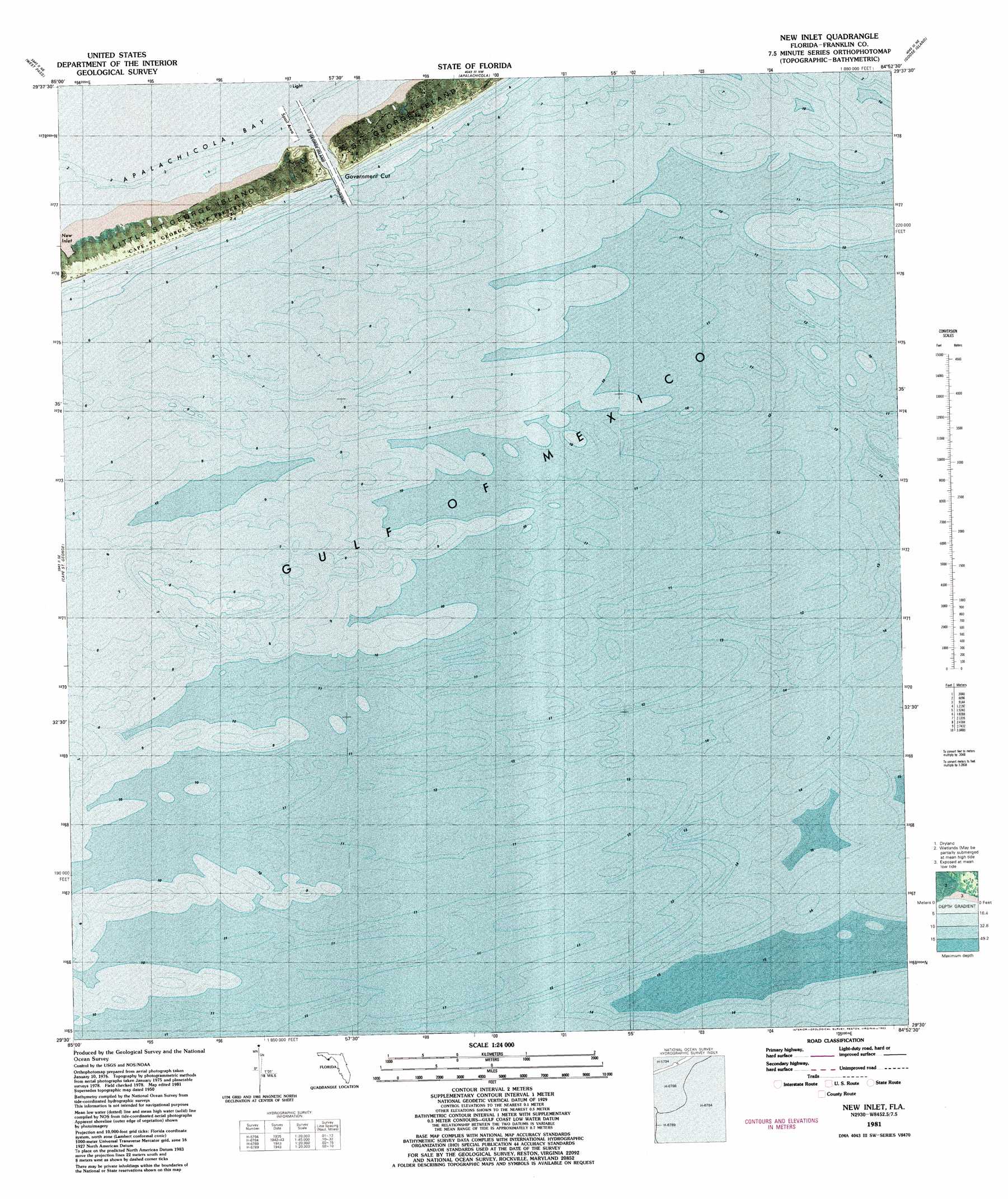
USGS Topo Quad 29084e8 - 1:24,000 scale
| Topo Map Name: | New Inlet |
| USGS Topo Quad ID: | 29084e8 |
| Print Size: | ca. 21 1/4" wide x 27" high |
| Southeast Coordinates: | 29.5° N latitude / 84.875° W longitude |
| Map Center Coordinates: | 29.5625° N latitude / 84.9375° W longitude |
| U.S. State: | FL |
| Filename: | P29084e8.jpg |
| Download Map JPG Image: | New Inlet topo map 1:24,000 scale |
| Map Type: | Orthophoto |
| Topo Series: | 7.5´ |
| Map Scale: | 1:24,000 |
| Source of Map Images: | United States Geological Survey (USGS) |
| Alternate Map Versions: |
New Inlet FL 1950, updated 1960 Download PDF Buy paper map New Inlet FL 1981, updated 1983 Download PDF Buy paper map New Inlet FL 2012 Download PDF Buy paper map New Inlet FL 2015 Download PDF Buy paper map |
1:24,000 Topo Quads surrounding New Inlet
Lake Wimico |
Jackson River |
Beverly |
Green Point |
Carrabelle |
Indian Pass |
West Pass |
Apalachicola |
Goose Island |
Sugar Hill |
Cape Saint George |
New Inlet |
|||
> Back to 29084e1 at 1:100,000 scale
> Back to 29084a1 at 1:250,000 scale
> Back to U.S. Topo Maps home
New Inlet topo map: Gazetteer
New Inlet: Bays
New Inlet elevation 0m 0′New Inlet: Guts
Government Cut elevation 0m 0′New Inlet: Islands
Little Saint George Island elevation 0m 0′New Inlet digital topo map on disk
Buy this New Inlet topo map showing relief, roads, GPS coordinates and other geographical features, as a high-resolution digital map file on DVD:
Gulf Coast (LA, MS, AL, FL) & Southwestern Georgia
Buy digital topo maps: Gulf Coast (LA, MS, AL, FL) & Southwestern Georgia
 & Southwestern Georgia map DVD")