Freemason Islands Topo Map Louisiana
To zoom in, hover over the map of Freemason Islands
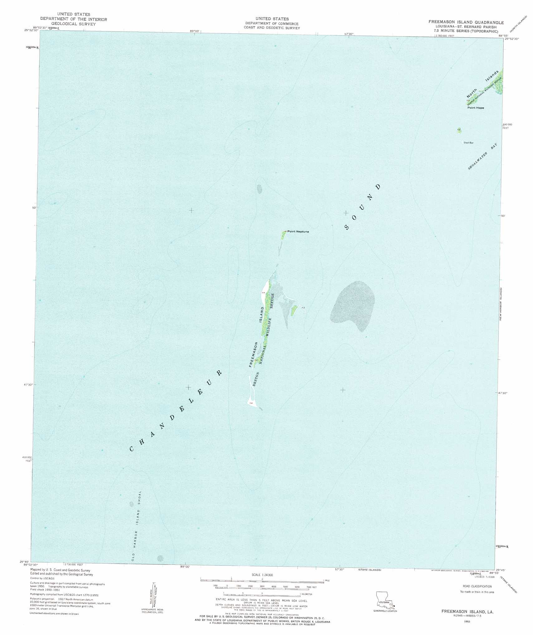
USGS Topo Quad 29088g8 - 1:24,000 scale
| Topo Map Name: | Freemason Islands |
| USGS Topo Quad ID: | 29088g8 |
| Print Size: | ca. 21 1/4" wide x 27" high |
| Southeast Coordinates: | 29.75° N latitude / 88.875° W longitude |
| Map Center Coordinates: | 29.8125° N latitude / 88.9375° W longitude |
| U.S. State: | LA |
| Filename: | o29088g8.jpg |
| Download Map JPG Image: | Freemason Islands topo map 1:24,000 scale |
| Map Type: | Topographic |
| Topo Series: | 7.5´ |
| Map Scale: | 1:24,000 |
| Source of Map Images: | United States Geological Survey (USGS) |
| Alternate Map Versions: |
Freemason Island LA 2012 Download PDF Buy paper map Freemason Island LA 2015 Download PDF Buy paper map |
1:24,000 Topo Quads surrounding Freemason Islands
Door Point |
Chandeleur Light |
|||
Mitchell Key |
North Islands |
|||
Freemason Islands |
New Harbor Islands |
|||
> Back to 29088e1 at 1:100,000 scale
> Back to 29088a1 at 1:250,000 scale
> Back to U.S. Topo Maps home
Freemason Islands topo map: Gazetteer
Freemason Islands: Bays
Shoalwater Bay elevation 0m 0′Freemason Islands: Capes
Point Hope elevation 0m 0′Point Neptune elevation 1m 3′
Freemason Islands: Islands
Freemason Island elevation 1m 3′Shell Bar elevation 1m 3′
Freemason Islands digital topo map on disk
Buy this Freemason Islands topo map showing relief, roads, GPS coordinates and other geographical features, as a high-resolution digital map file on DVD:
Gulf Coast (LA, MS, AL, FL) & Southwestern Georgia
Buy digital topo maps: Gulf Coast (LA, MS, AL, FL) & Southwestern Georgia
 & Southwestern Georgia map DVD")