Breton Islands Topo Map Louisiana
To zoom in, hover over the map of Breton Islands
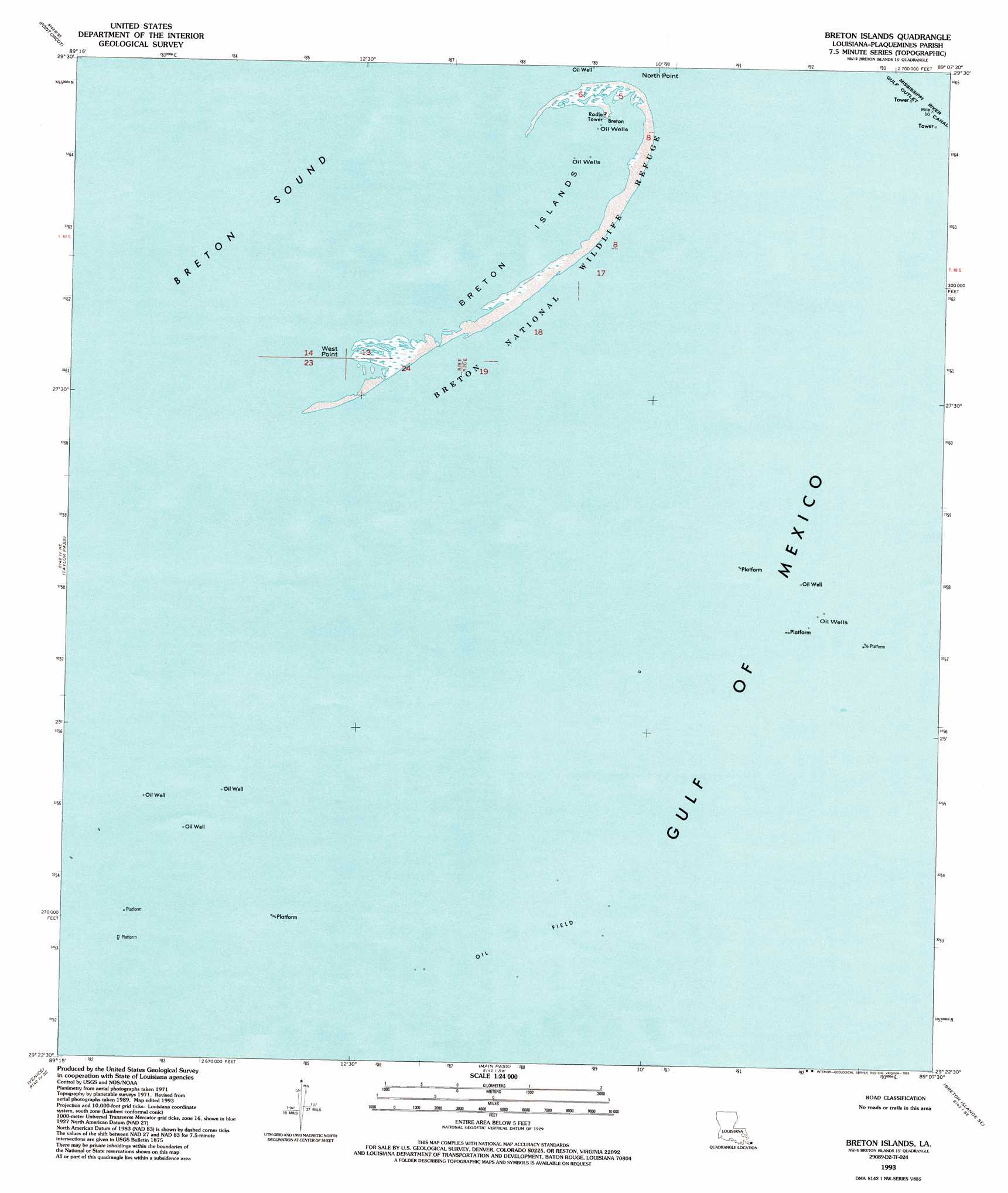
USGS Topo Quad 29089d2 - 1:24,000 scale
| Topo Map Name: | Breton Islands |
| USGS Topo Quad ID: | 29089d2 |
| Print Size: | ca. 21 1/4" wide x 27" high |
| Southeast Coordinates: | 29.375° N latitude / 89.125° W longitude |
| Map Center Coordinates: | 29.4375° N latitude / 89.1875° W longitude |
| U.S. State: | LA |
| Filename: | o29089d2.jpg |
| Download Map JPG Image: | Breton Islands topo map 1:24,000 scale |
| Map Type: | Topographic |
| Topo Series: | 7.5´ |
| Map Scale: | 1:24,000 |
| Source of Map Images: | United States Geological Survey (USGS) |
| Alternate Map Versions: |
Breton Islands LA 1950, updated 1958 Download PDF Buy paper map Breton Islands LA 1971, updated 1972 Download PDF Buy paper map Breton Islands LA 1993, updated 1993 Download PDF Buy paper map Breton Islands LA 2012 Download PDF Buy paper map Breton Islands LA 2015 Download PDF Buy paper map |
1:24,000 Topo Quads surrounding Breton Islands
Lake Athanasio |
Point Chicot |
|||
Coquille Point |
Taylor Pass |
Breton Islands |
||
Triumph |
Venice |
Main Pass |
Breton Islands Se |
|
Pass Tante Phine |
Pilottown |
Pass A Loutre West |
Pass A Loutre East |
> Back to 29089a1 at 1:100,000 scale
> Back to 29088a1 at 1:250,000 scale
> Back to U.S. Topo Maps home
Breton Islands topo map: Gazetteer
Breton Islands: Capes
North Point elevation 0m 0′Breton Islands: Islands
Breton Islands elevation 0m 0′Breton Islands: Populated Places
Breton elevation 0m 0′West Point elevation 0m 0′
Breton Islands digital topo map on disk
Buy this Breton Islands topo map showing relief, roads, GPS coordinates and other geographical features, as a high-resolution digital map file on DVD:
Gulf Coast (LA, MS, AL, FL) & Southwestern Georgia
Buy digital topo maps: Gulf Coast (LA, MS, AL, FL) & Southwestern Georgia
 & Southwestern Georgia map DVD")