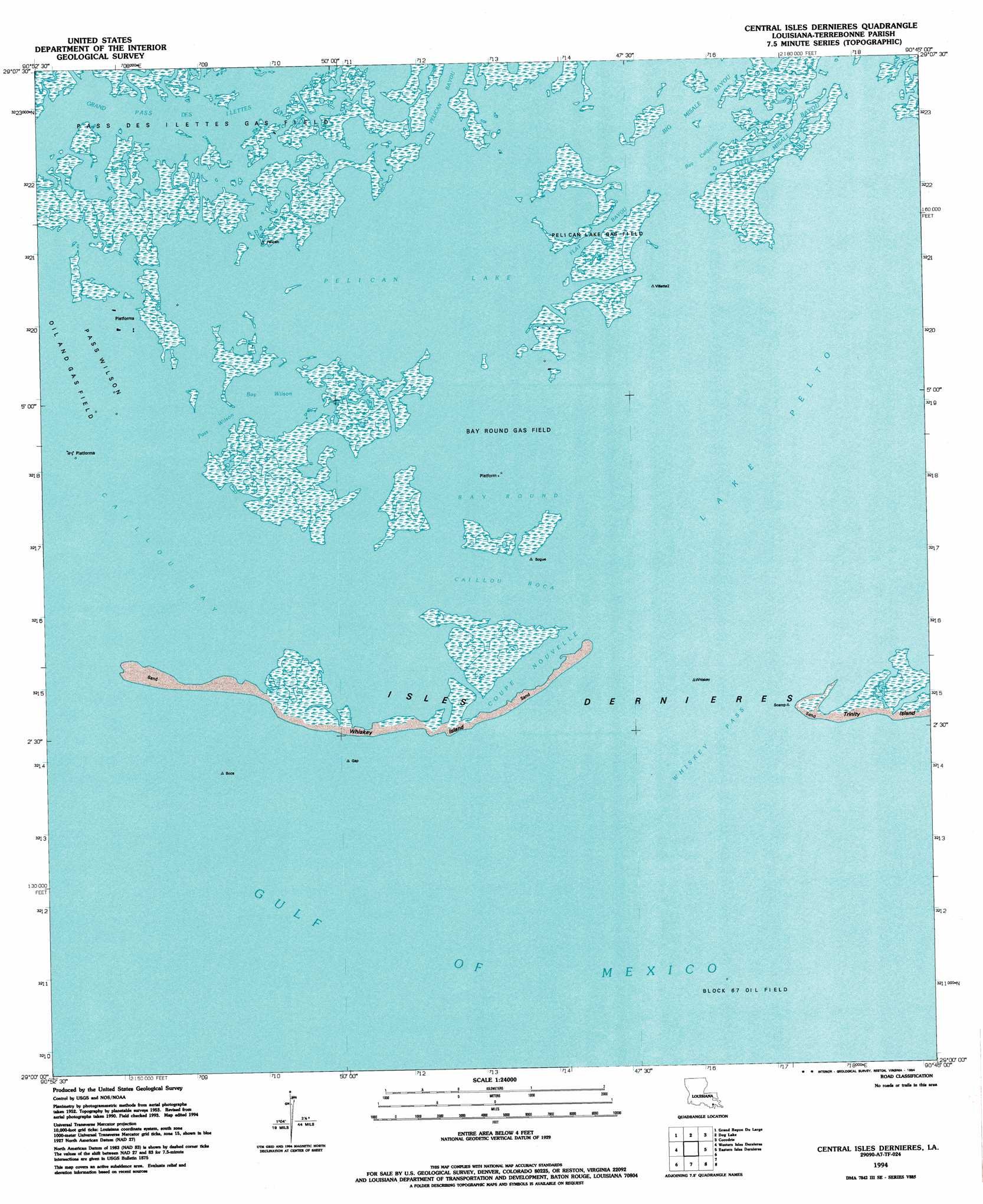
Central Isles Derniere Topo Map Louisiana
To zoom in, hover over the map of Central Isles Derniere
USGS Topo Quad 29090a7 - 1:24,000 scale
| Topo Map Name: | Central Isles Derniere |
| USGS Topo Quad ID: | 29090a7 |
| Print Size: | ca. 21 1/4" wide x 27" high |
| Southeast Coordinates: | 29° N latitude / 90.75° W longitude |
| Map Center Coordinates: | 29.0625° N latitude / 90.8125° W longitude |
| U.S. State: | LA |
| Filename: | o29090a7.jpg |
| Download Map JPG Image: | Central Isles Derniere topo map 1:24,000 scale |
| Map Type: | Topographic |
| Topo Series: | 7.5´ |
| Map Scale: | 1:24,000 |
| Source of Map Images: | United States Geological Survey (USGS) |
| Alternate Map Versions: |
Central Isles Dernieres LA 1953, updated 1959 Download PDF Buy paper map Central Isles Dernieres LA 1953, updated 1965 Download PDF Buy paper map Central Isles Dernieres LA 1953, updated 1977 Download PDF Buy paper map Central Isles Dernieres LA 1953, updated 1981 Download PDF Buy paper map Central Isles Dernieres LA 1994, updated 1994 Download PDF Buy paper map Central Isles Dernieres LA 1998, updated 2001 Download PDF Buy paper map Central Isles Dernieres LA 2012 Download PDF Buy paper map Central Isles Dernieres LA 2015 Download PDF Buy paper map |
1:24,000 Topo Quads surrounding Central Isles Derniere
Lost Lake |
Lake Mechant |
Bayou Sauveur |
Lake Quitman |
Lake Tambour |
East Bay Junop |
Grand Bayou Du Large |
Dog Lake |
Cocodrie |
Lake La Graisse |
Western Isles Dernieres |
Central Isles Derniere |
Eastern Isles Dernieres |
Cat Island Pass |
|
> Back to 29090a1 at 1:100,000 scale
> Back to 29090a1 at 1:250,000 scale
> Back to U.S. Topo Maps home
Central Isles Derniere topo map: Gazetteer
Central Isles Derniere: Bays
Bay Round elevation 0m 0′Coupe Nouvelle elevation 0m 0′
Central Isles Derniere: Channels
Caillou Boca elevation 0m 0′Pass Wilson elevation 0m 0′
Whiskey Pass elevation 0m 0′
Central Isles Derniere: Guts
Flat Bayou elevation 0m 0′Grand Pass des Ilettes elevation 0m 0′
Pelican Bayou elevation 0m 0′
Central Isles Derniere: Islands
Isles Dernieres elevation 0m 0′Whiskey Island elevation 1m 3′
Central Isles Derniere: Lakes
Bay California elevation 0m 0′Bay Wilson elevation 0m 0′
Pelican Lake elevation 0m 0′
Central Isles Derniere: Oilfields
Pelican Lake Gas Field elevation 1m 3′Central Isles Derniere digital topo map on disk
Buy this Central Isles Derniere topo map showing relief, roads, GPS coordinates and other geographical features, as a high-resolution digital map file on DVD: