Jacko Bay Topo Map Louisiana
To zoom in, hover over the map of Jacko Bay
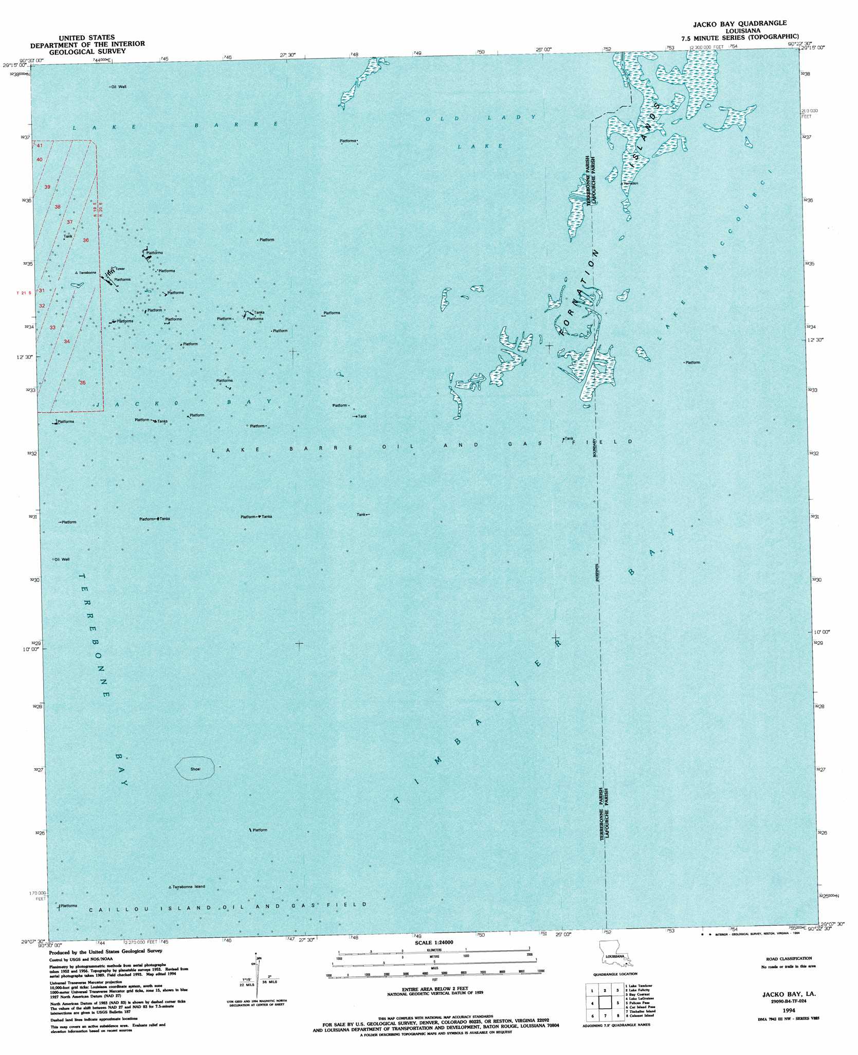
USGS Topo Quad 29090b4 - 1:24,000 scale
| Topo Map Name: | Jacko Bay |
| USGS Topo Quad ID: | 29090b4 |
| Print Size: | ca. 21 1/4" wide x 27" high |
| Southeast Coordinates: | 29.125° N latitude / 90.375° W longitude |
| Map Center Coordinates: | 29.1875° N latitude / 90.4375° W longitude |
| U.S. State: | LA |
| Filename: | o29090b4.jpg |
| Download Map JPG Image: | Jacko Bay topo map 1:24,000 scale |
| Map Type: | Topographic |
| Topo Series: | 7.5´ |
| Map Scale: | 1:24,000 |
| Source of Map Images: | United States Geological Survey (USGS) |
| Alternate Map Versions: |
Jacko Bay LA 1953, updated 1959 Download PDF Buy paper map Jacko Bay LA 1953, updated 1968 Download PDF Buy paper map Jacko Bay LA 1953, updated 1980 Download PDF Buy paper map Jacko Bay LA 1994, updated 1994 Download PDF Buy paper map Jacko Bay LA 2012 Download PDF Buy paper map Jacko Bay LA 2015 Download PDF Buy paper map |
1:24,000 Topo Quads surrounding Jacko Bay
Dulac |
Montegut |
Lake Bully Camp |
Golden Meadow |
Golden Meadow Farms |
Lake Quitman |
Lake Tambour |
Lake Felicity |
Bay Courant |
Mink Bayou |
Cocodrie |
Lake La Graisse |
Jacko Bay |
Pelican Pass |
Leeville |
Eastern Isles Dernieres |
Cat Island Pass |
Timbalier Island |
Calumet Island |
Belle Pass |
> Back to 29090a1 at 1:100,000 scale
> Back to 29090a1 at 1:250,000 scale
> Back to U.S. Topo Maps home
Jacko Bay topo map: Gazetteer
Jacko Bay: Bays
Jacko Bay elevation 0m 0′Old Lady Lake elevation 0m 0′
Jacko Bay: Islands
Bull Islands elevation 1m 3′Cat Island elevation 0m 0′
Fornation Islands elevation 1m 3′
Terrebonne Island elevation 1m 3′
Jacko Bay: Oilfields
Lake Barre Oil Field elevation 0m 0′Jacko Bay digital topo map on disk
Buy this Jacko Bay topo map showing relief, roads, GPS coordinates and other geographical features, as a high-resolution digital map file on DVD: