Lake Theriot Topo Map Louisiana
To zoom in, hover over the map of Lake Theriot
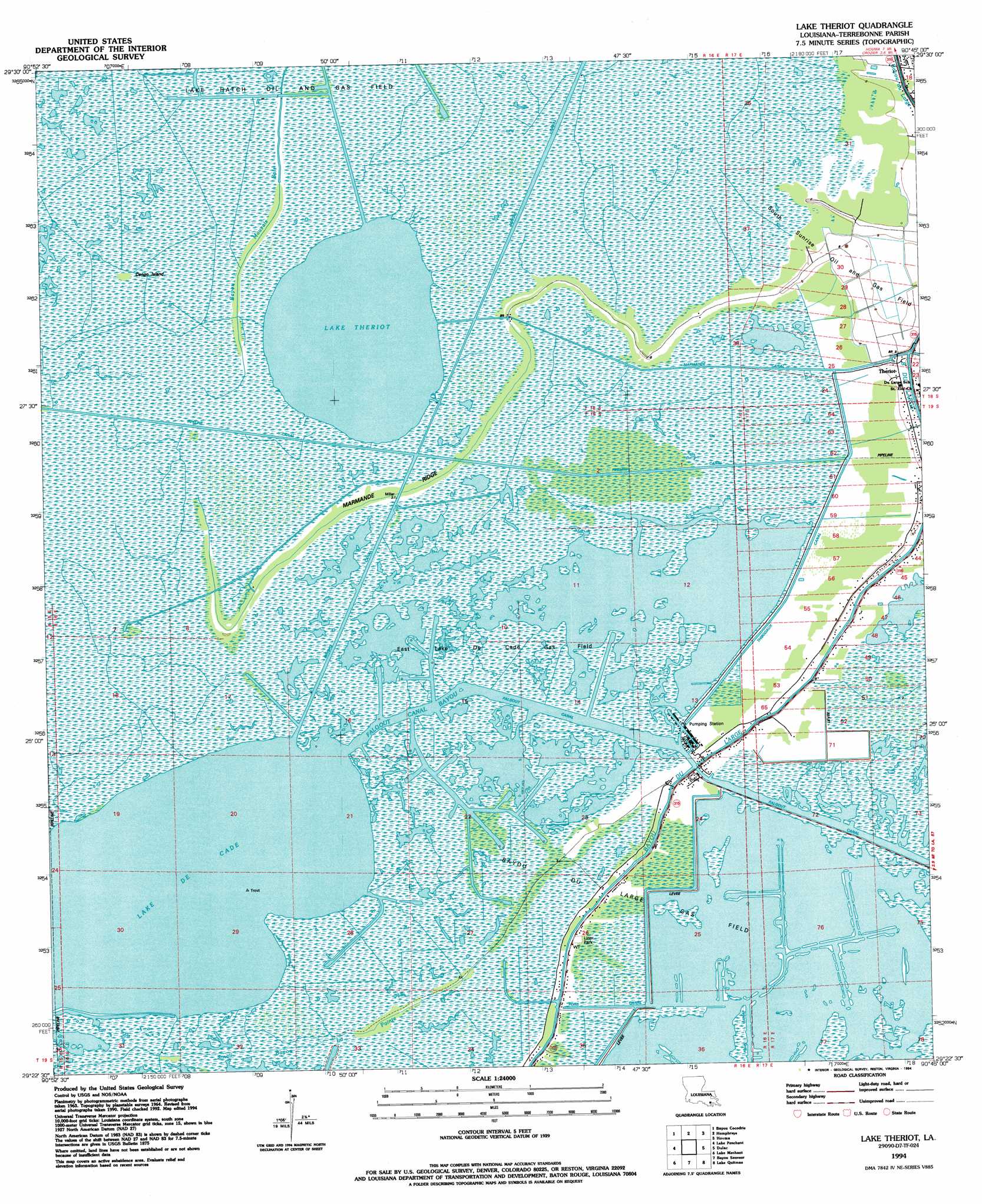
USGS Topo Quad 29090d7 - 1:24,000 scale
| Topo Map Name: | Lake Theriot |
| USGS Topo Quad ID: | 29090d7 |
| Print Size: | ca. 21 1/4" wide x 27" high |
| Southeast Coordinates: | 29.375° N latitude / 90.75° W longitude |
| Map Center Coordinates: | 29.4375° N latitude / 90.8125° W longitude |
| U.S. State: | LA |
| Filename: | o29090d7.jpg |
| Download Map JPG Image: | Lake Theriot topo map 1:24,000 scale |
| Map Type: | Topographic |
| Topo Series: | 7.5´ |
| Map Scale: | 1:24,000 |
| Source of Map Images: | United States Geological Survey (USGS) |
| Alternate Map Versions: |
Lake Theriot LA 1964, updated 1965 Download PDF Buy paper map Lake Theriot LA 1964, updated 1973 Download PDF Buy paper map Lake Theriot LA 1964, updated 1981 Download PDF Buy paper map Lake Theriot LA 1994, updated 1994 Download PDF Buy paper map Lake Theriot LA 2012 Download PDF Buy paper map Lake Theriot LA 2015 Download PDF Buy paper map |
1:24,000 Topo Quads surrounding Lake Theriot
Amelia |
Gibson |
Gray |
Savoie |
Lockport |
Morgan City Se |
Bayou Cocodrie |
Humphreys |
Houma |
Bourg |
Carencro Bayou |
Lake Penchant |
Lake Theriot |
Dulac |
Montegut |
Lost Lake |
Lake Mechant |
Bayou Sauveur |
Lake Quitman |
Lake Tambour |
East Bay Junop |
Grand Bayou Du Large |
Dog Lake |
Cocodrie |
Lake La Graisse |
> Back to 29090a1 at 1:100,000 scale
> Back to 29090a1 at 1:250,000 scale
> Back to U.S. Topo Maps home
Lake Theriot topo map: Gazetteer
Lake Theriot: Canals
Falgout Canal elevation 0m 0′Marmande Canal elevation 0m 0′
Minors Canal elevation 0m 0′
Lake Theriot: Guts
Falgout Canal Bayou elevation 0m 0′Lake Theriot: Islands
Congo Island elevation 3m 9′Lake Theriot: Lakes
Lake De Cade elevation 0m 0′Lake Theriot elevation 0m 0′
Lake Theriot: Oilfields
Du Large Gas Field elevation 0m 0′East Lake De Cade Gas Field elevation 0m 0′
South Sunrise Oil and Gas Field elevation 1m 3′
Lake Theriot: Populated Places
Theriot elevation 1m 3′Lake Theriot: Post Offices
Theriot Post Office elevation 2m 6′Lake Theriot: Ridges
Marmande Ridge elevation 1m 3′Lake Theriot digital topo map on disk
Buy this Lake Theriot topo map showing relief, roads, GPS coordinates and other geographical features, as a high-resolution digital map file on DVD: