Cut Off Topo Map Louisiana
To zoom in, hover over the map of Cut Off
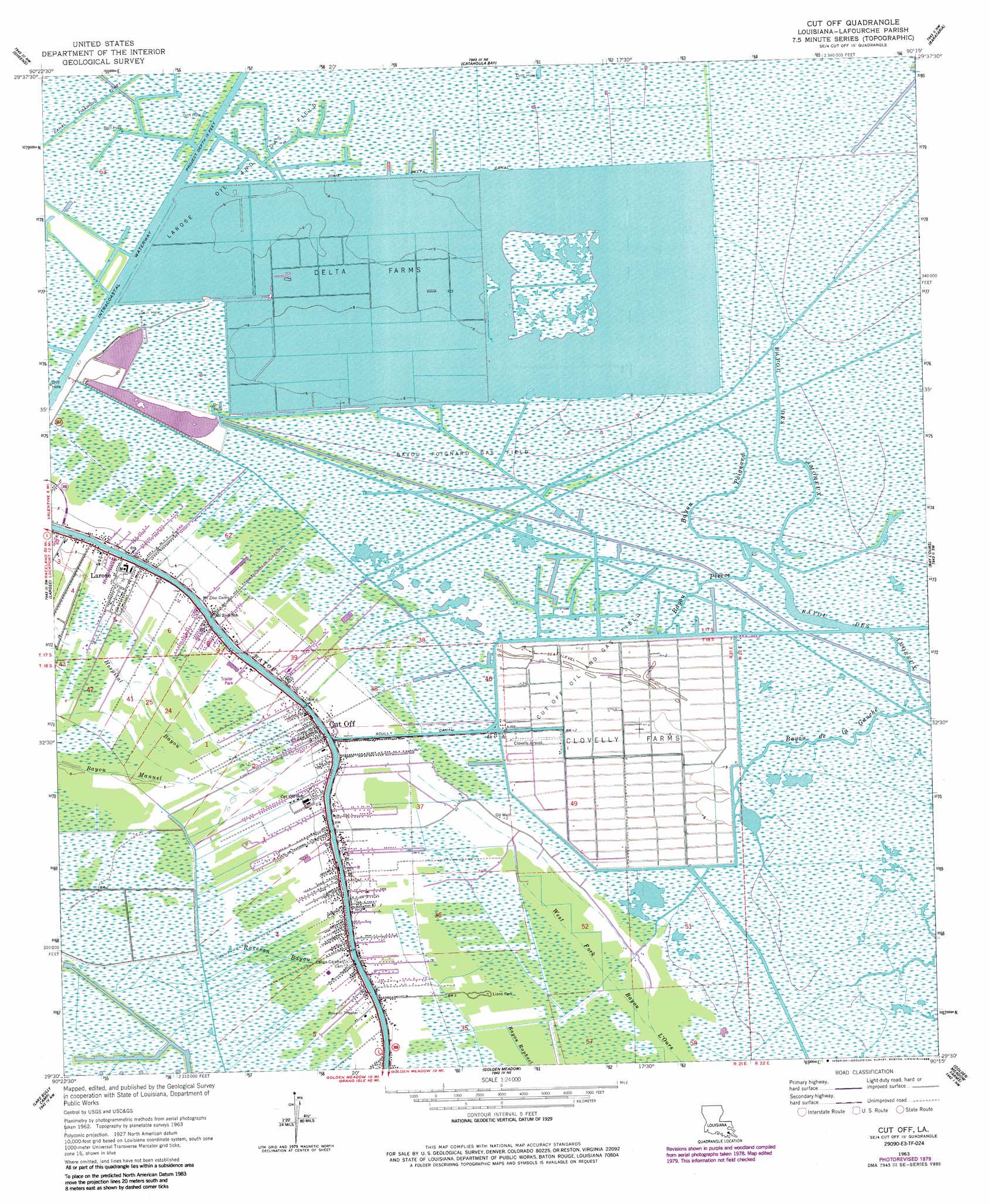
USGS Topo Quad 29090e3 - 1:24,000 scale
| Topo Map Name: | Cut Off |
| USGS Topo Quad ID: | 29090e3 |
| Print Size: | ca. 21 1/4" wide x 27" high |
| Southeast Coordinates: | 29.5° N latitude / 90.25° W longitude |
| Map Center Coordinates: | 29.5625° N latitude / 90.3125° W longitude |
| U.S. State: | LA |
| Filename: | o29090e3.jpg |
| Download Map JPG Image: | Cut Off topo map 1:24,000 scale |
| Map Type: | Topographic |
| Topo Series: | 7.5´ |
| Map Scale: | 1:24,000 |
| Source of Map Images: | United States Geological Survey (USGS) |
| Alternate Map Versions: |
Cut Off LA 1963, updated 1964 Download PDF Buy paper map Cut Off LA 1963, updated 1975 Download PDF Buy paper map Cut Off LA 1963, updated 1980 Download PDF Buy paper map Cut Off LA 1963, updated 1988 Download PDF Buy paper map Cut Off LA 1998, updated 2001 Download PDF Buy paper map Cut Off LA 2012 Download PDF Buy paper map Cut Off LA 2015 Download PDF Buy paper map |
1:24,000 Topo Quads surrounding Cut Off
Bayou Boeuf |
Des Allemands |
Lake Cataouatche West |
Lake Cataouatche East |
Bertrandville |
Lockport |
Gheens |
Catahoula Bay |
Barataria |
Lafitte |
Bourg |
Larose |
Cut Off |
Bay L'Ours |
Three Bayou Bay |
Montegut |
Lake Bully Camp |
Golden Meadow |
Golden Meadow Farms |
Bay Dosgris |
Lake Tambour |
Lake Felicity |
Bay Courant |
Mink Bayou |
Bay Tambour |
> Back to 29090e1 at 1:100,000 scale
> Back to 29090a1 at 1:250,000 scale
> Back to U.S. Topo Maps home
Cut Off topo map: Gazetteer
Cut Off: Airports
Clovelly Airport elevation -2m -7′Clovelly Farms Seaplane Base elevation 0m 0′
Lady of the Sea Hospital Heliport elevation 0m 0′
Ledet Airfield elevation -1m -4′
Cut Off: Bridges
Cote Blanche Bridge elevation 0m 0′Cut Off: Canals
Dixie Delta Canal elevation 0m 0′Scully Canal elevation 0m 0′
Cut Off: Guts
Bayou de la Gauche elevation 0m 0′Bayou Des Amoreux elevation 0m 0′
Bayou Pierce elevation 0m 0′
Bayou Poignard elevation 0m 0′
Raccoon Bayou elevation -1m -4′
Cut Off: Oilfields
Bayou Poignard Gas Field elevation 1m 3′Cut Off Oil and Gas Field elevation -1m -4′
Larose Oil and Gas Field elevation 0m 0′
Cut Off: Parks
Lions Park elevation 0m 0′Cut Off: Populated Places
Clovelly Farms elevation -2m -7′Cut Off elevation 2m 6′
Cut Off digital topo map on disk
Buy this Cut Off topo map showing relief, roads, GPS coordinates and other geographical features, as a high-resolution digital map file on DVD: