Bourg Topo Map Louisiana
To zoom in, hover over the map of Bourg
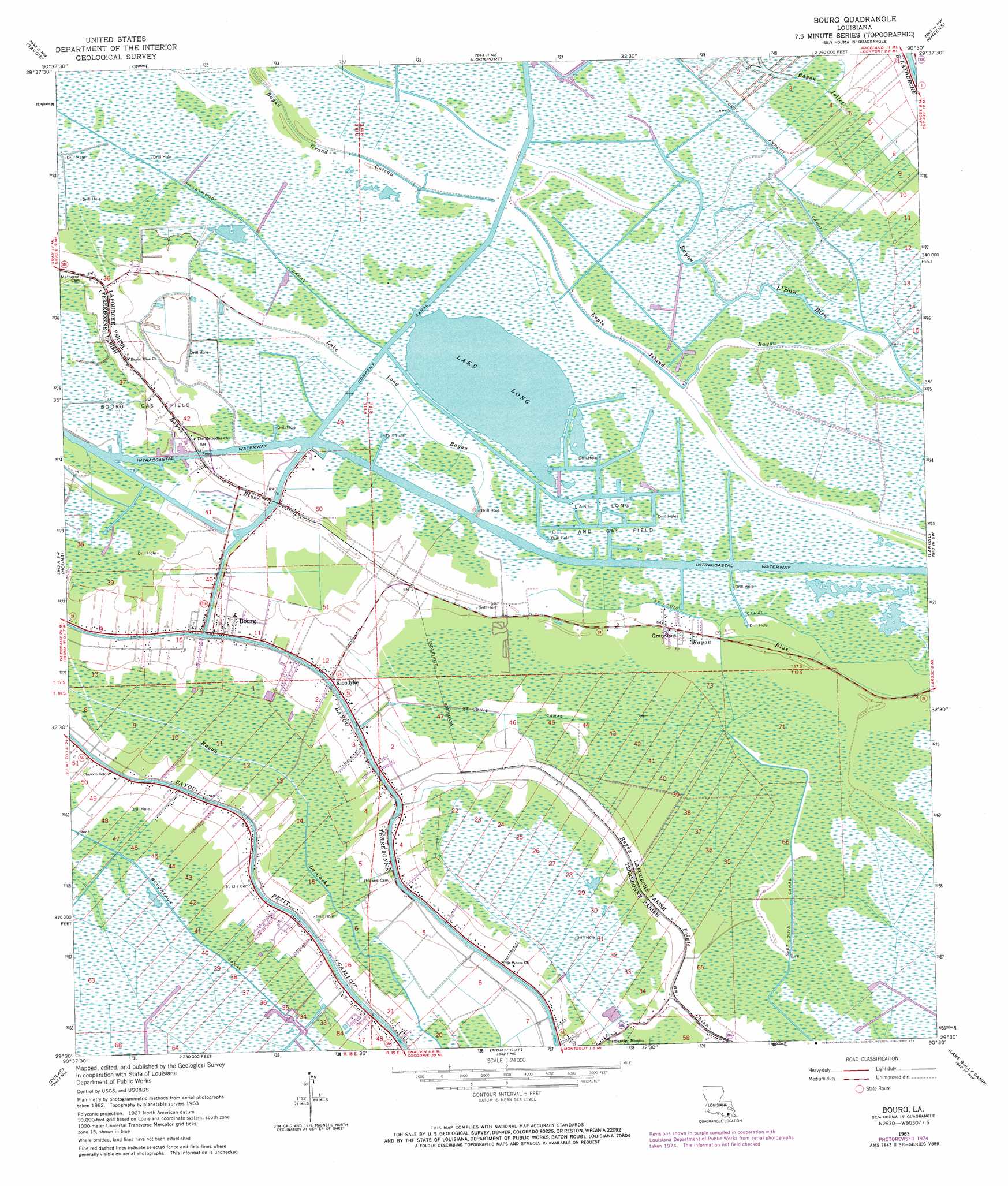
USGS Topo Quad 29090e5 - 1:24,000 scale
| Topo Map Name: | Bourg |
| USGS Topo Quad ID: | 29090e5 |
| Print Size: | ca. 21 1/4" wide x 27" high |
| Southeast Coordinates: | 29.5° N latitude / 90.5° W longitude |
| Map Center Coordinates: | 29.5625° N latitude / 90.5625° W longitude |
| U.S. State: | LA |
| Filename: | o29090e5.jpg |
| Download Map JPG Image: | Bourg topo map 1:24,000 scale |
| Map Type: | Topographic |
| Topo Series: | 7.5´ |
| Map Scale: | 1:24,000 |
| Source of Map Images: | United States Geological Survey (USGS) |
| Alternate Map Versions: |
Bourg LA 1963, updated 1964 Download PDF Buy paper map Bourg LA 1963, updated 1975 Download PDF Buy paper map Bourg LA 1998, updated 2003 Download PDF Buy paper map Bourg LA 2012 Download PDF Buy paper map Bourg LA 2015 Download PDF Buy paper map |
1:24,000 Topo Quads surrounding Bourg
Thibodaux |
Kraemer |
Bayou Boeuf |
Des Allemands |
Lake Cataouatche West |
Gray |
Savoie |
Lockport |
Gheens |
Catahoula Bay |
Humphreys |
Houma |
Bourg |
Larose |
Cut Off |
Lake Theriot |
Dulac |
Montegut |
Lake Bully Camp |
Golden Meadow |
Bayou Sauveur |
Lake Quitman |
Lake Tambour |
Lake Felicity |
Bay Courant |
> Back to 29090e1 at 1:100,000 scale
> Back to 29090a1 at 1:250,000 scale
> Back to U.S. Topo Maps home
Bourg topo map: Gazetteer
Bourg: Guts
Bayou Jollet elevation 0m 0′Bourg: Lakes
Lake Long elevation 0m 0′Bourg: Oilfields
Bourg Gas Field elevation 1m 3′Lake Long Oil and Gas Field elevation 0m 0′
North Montegut Gas Field elevation 1m 3′
Bourg: Populated Places
Bourg elevation 2m 6′Grandbois elevation 1m 3′
Klondyke elevation 2m 6′
Bourg: Post Offices
Bourg Post Office elevation 3m 9′Bourg: Streams
Bayou Grand Coteau elevation 1m 3′Eagle Island Bayou elevation 0m 0′
Lake Long Bayou elevation 0m 0′
Bourg digital topo map on disk
Buy this Bourg topo map showing relief, roads, GPS coordinates and other geographical features, as a high-resolution digital map file on DVD: