Oyster Bayou Topo Map Louisiana
To zoom in, hover over the map of Oyster Bayou
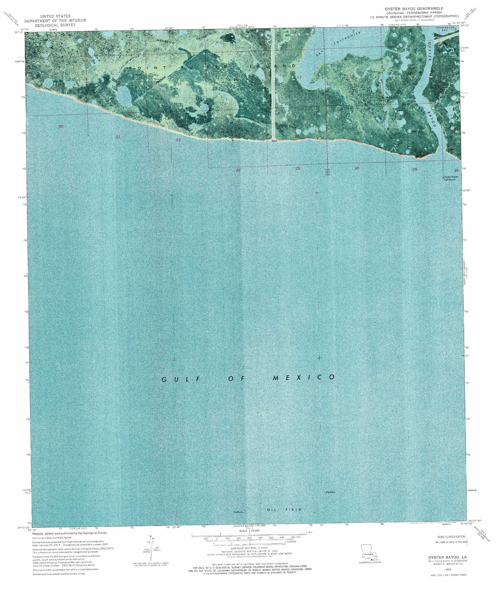
USGS Topo Quad 29091b2 - 1:24,000 scale
| Topo Map Name: | Oyster Bayou |
| USGS Topo Quad ID: | 29091b2 |
| Print Size: | ca. 21 1/4" wide x 27" high |
| Southeast Coordinates: | 29.125° N latitude / 91.125° W longitude |
| Map Center Coordinates: | 29.1875° N latitude / 91.1875° W longitude |
| U.S. State: | LA |
| Filename: | p29091b2.jpg |
| Download Map JPG Image: | Oyster Bayou topo map 1:24,000 scale |
| Map Type: | Orthophoto |
| Topo Series: | 7.5´ |
| Map Scale: | 1:24,000 |
| Source of Map Images: | United States Geological Survey (USGS) |
| Alternate Map Versions: |
Oyster Bayou LA 1974, updated 1976 Download PDF Buy paper map Oyster Bayou LA 2012 Download PDF Buy paper map Oyster Bayou LA 2015 Download PDF Buy paper map |
1:24,000 Topo Quads surrounding Oyster Bayou
Point Au Fer Ne |
Plumb Bayou |
Carencro Bayou |
Lake Penchant |
|
Point Au Fer |
Fourleague Bay |
Lost Lake |
Lake Mechant |
|
Oyster Bayou |
East Bay Junop |
Grand Bayou Du Large |
||
Western Isles Dernieres |
||||
> Back to 29091a1 at 1:100,000 scale
> Back to 29090a1 at 1:250,000 scale
> Back to U.S. Topo Maps home
Oyster Bayou topo map: Gazetteer
Oyster Bayou: Bays
Bay Castagnier elevation 0m 0′Oyster Bayou: Guts
Oyster Bayou elevation 0m 0′Oyster Bayou: Streams
Little Mosquito Bayou elevation 0m 0′Oyster Bayou digital topo map on disk
Buy this Oyster Bayou topo map showing relief, roads, GPS coordinates and other geographical features, as a high-resolution digital map file on DVD: