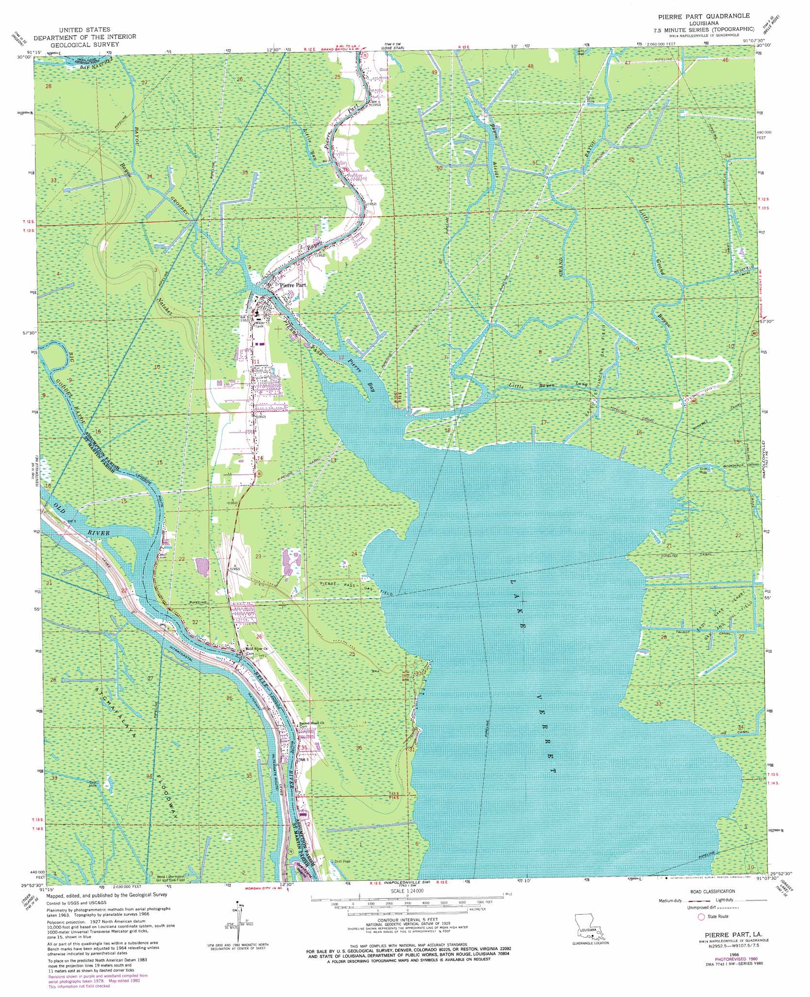
Pierre Part Topo Map Louisiana
To zoom in, hover over the map of Pierre Part
USGS Topo Quad 29091h2 - 1:24,000 scale
| Topo Map Name: | Pierre Part |
| USGS Topo Quad ID: | 29091h2 |
| Print Size: | ca. 21 1/4" wide x 27" high |
| Southeast Coordinates: | 29.875° N latitude / 91.125° W longitude |
| Map Center Coordinates: | 29.9375° N latitude / 91.1875° W longitude |
| U.S. State: | LA |
| Filename: | o29091h2.jpg |
| Download Map JPG Image: | Pierre Part topo map 1:24,000 scale |
| Map Type: | Topographic |
| Topo Series: | 7.5´ |
| Map Scale: | 1:24,000 |
| Source of Map Images: | United States Geological Survey (USGS) |
| Alternate Map Versions: |
Pierre Part LA 1966, updated 1967 Download PDF Buy paper map Pierre Part LA 1966, updated 1973 Download PDF Buy paper map Pierre Part LA 1966, updated 1980 Download PDF Buy paper map Pierre Part LA 2012 Download PDF Buy paper map Pierre Part LA 2015 Download PDF Buy paper map |
1:24,000 Topo Quads surrounding Pierre Part
Grand River |
Bayou Sorrel |
White Castle |
Carville |
Gonzales |
Lake Chicot |
Pigeon |
Lone Star |
Belle Rose |
Donaldsonville |
Centerville Nw |
Centerville Ne |
Pierre Part |
Napoleonville |
Madewood |
Centerville |
Tiger Island |
Napoleonville Sw |
Grassy Lake |
Labadieville |
North Bend |
Patterson |
Morgan City |
Amelia |
Gibson |
> Back to 29091e1 at 1:100,000 scale
> Back to 29090a1 at 1:250,000 scale
> Back to U.S. Topo Maps home
Pierre Part topo map: Gazetteer
Pierre Part: Bays
Pierre Bay elevation 0m 0′Pierre Part: Bends
Population Bend elevation 0m 0′Pierre Part: Canals
Ike Canal elevation 0m 0′SaintLouis Canal elevation 2m 6′
Talbot Canal elevation 0m 0′
Pierre Part: Channels
Pierre Pass elevation 0m 0′Pierre Part: Lakes
Lake Verret elevation 0m 0′Pierre Part: Oilfields
Bayou Saint Vincent Gas Field elevation 0m 0′Graveyard Island Oil Field elevation 0m 0′
Grosbec Bayou Gas Field elevation 1m 3′
Pierre Pass Gas Field elevation 0m 0′
Pierre Part: Populated Places
Belle River elevation 2m 6′Pierre Part elevation 1m 3′
Pierre Part: Post Offices
Pierre Part Post Office elevation 2m 6′Pierre Part: Streams
Bayou Alcide elevation 0m 0′Bayou Grosbec elevation 0m 0′
Bayou Natchez elevation 1m 3′
Bayou Pierre Part elevation 0m 0′
Grand Bayou elevation 0m 0′
Little Bay elevation 0m 0′
Little Bayou Long elevation 0m 0′
Little Grand Bayou elevation 0m 0′
Old River elevation 0m 0′
Pierre Part digital topo map on disk
Buy this Pierre Part topo map showing relief, roads, GPS coordinates and other geographical features, as a high-resolution digital map file on DVD: