Mulberry Island West Topo Map Louisiana
To zoom in, hover over the map of Mulberry Island West
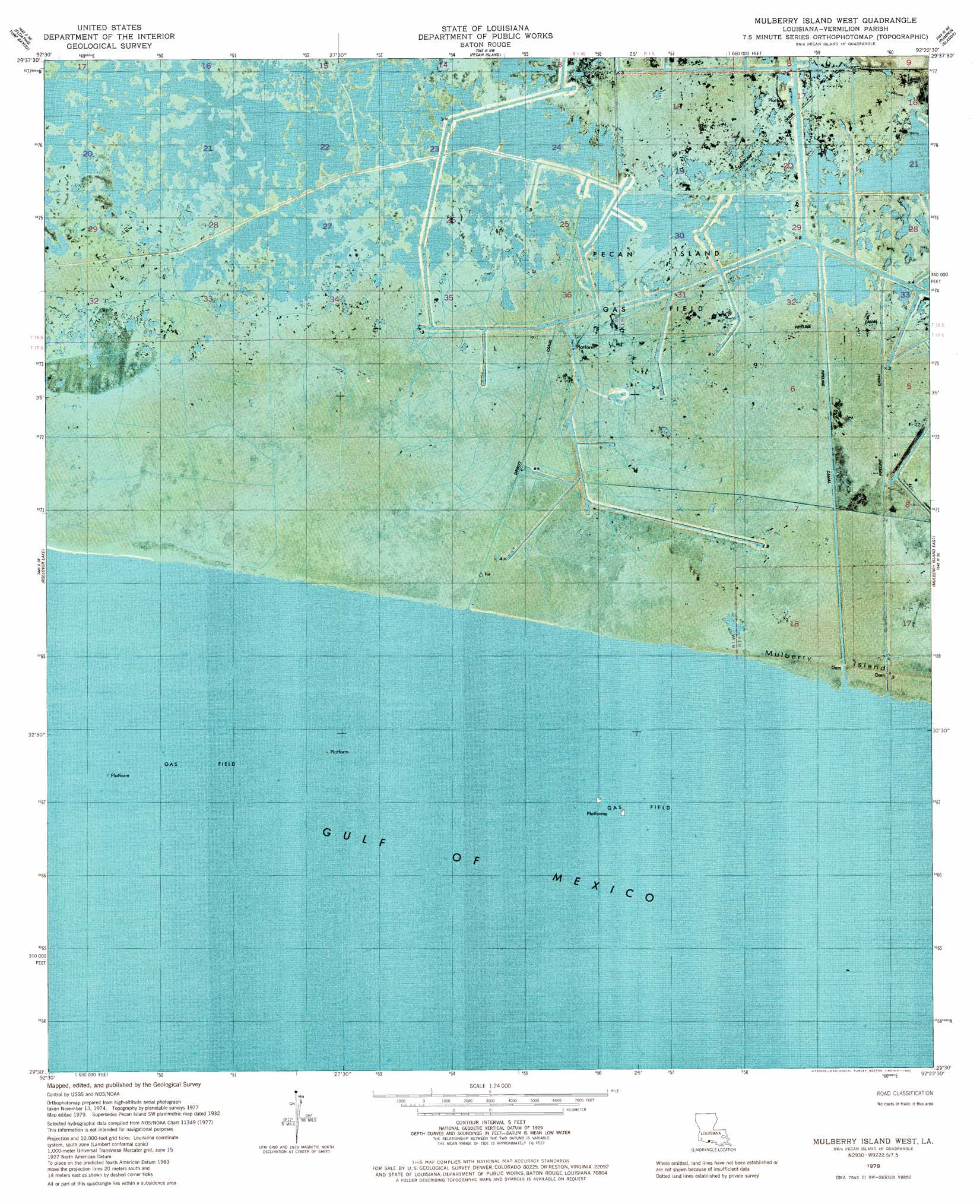
USGS Topo Quad 29092e4 - 1:24,000 scale
| Topo Map Name: | Mulberry Island West |
| USGS Topo Quad ID: | 29092e4 |
| Print Size: | ca. 21 1/4" wide x 27" high |
| Southeast Coordinates: | 29.5° N latitude / 92.375° W longitude |
| Map Center Coordinates: | 29.5625° N latitude / 92.4375° W longitude |
| U.S. State: | LA |
| Filename: | p29092e4.jpg |
| Download Map JPG Image: | Mulberry Island West topo map 1:24,000 scale |
| Map Type: | Orthophoto |
| Topo Series: | 7.5´ |
| Map Scale: | 1:24,000 |
| Source of Map Images: | United States Geological Survey (USGS) |
| Alternate Map Versions: |
Mulberry Island West LA 1979, updated 1980 Download PDF Buy paper map Mulberry Island West LA 2012 Download PDF Buy paper map Mulberry Island West LA 2015 Download PDF Buy paper map |
1:24,000 Topo Quads surrounding Mulberry Island West
Collicon Lake |
Lake Le Bleu |
Jacks Point Island |
Forked Island |
Intracoastal City |
Deep Lake |
Floating Turf Bayou |
Pecan Island |
Pumpkin Islands |
Fearman Lake |
Big Constance Lake |
Rollover Lake |
Mulberry Island West |
Mulberry Island East |
Cheniere Au Tigre |
> Back to 29092e1 at 1:100,000 scale
> Back to 29092a1 at 1:250,000 scale
> Back to U.S. Topo Maps home
Mulberry Island West topo map: Gazetteer
Mulberry Island West: Airports
Mud Hole Heliport elevation 1m 3′Mulberry Island West: Canals
Dewitt Canal elevation 0m 0′Mulberry Island West: Oilfields
Pecan Island Gas Field elevation 1m 3′Mulberry Island West digital topo map on disk
Buy this Mulberry Island West topo map showing relief, roads, GPS coordinates and other geographical features, as a high-resolution digital map file on DVD: