West Of Johnsons Bayou Topo Map Louisiana
To zoom in, hover over the map of West Of Johnsons Bayou
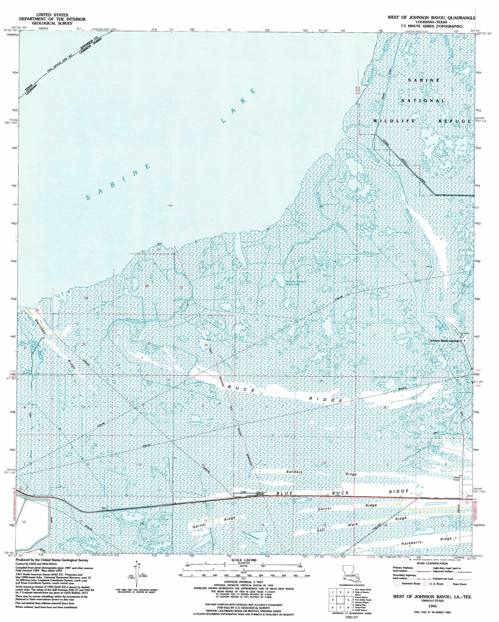
USGS Topo Quad 29093g7 - 1:24,000 scale
| Topo Map Name: | West Of Johnsons Bayou |
| USGS Topo Quad ID: | 29093g7 |
| Print Size: | ca. 21 1/4" wide x 27" high |
| Southeast Coordinates: | 29.75° N latitude / 93.75° W longitude |
| Map Center Coordinates: | 29.8125° N latitude / 93.8125° W longitude |
| U.S. States: | LA, TX |
| Filename: | o29093g7.jpg |
| Download Map JPG Image: | West Of Johnsons Bayou topo map 1:24,000 scale |
| Map Type: | Topographic |
| Topo Series: | 7.5´ |
| Map Scale: | 1:24,000 |
| Source of Map Images: | United States Geological Survey (USGS) |
| Alternate Map Versions: |
West of Johnson Bayou LA 1943, updated 1952 Download PDF Buy paper map West of Johnson Bayou LA 1957, updated 1958 Download PDF Buy paper map West of Johnson Bayou LA 1957, updated 1962 Download PDF Buy paper map West of Johnson Bayou LA 1957, updated 1972 Download PDF Buy paper map West of Johnson Bayou LA 1993, updated 1993 Download PDF Buy paper map West of Johnson Bayou LA 2010 Download PDF Buy paper map West of Johnson Bayou LA 2012 Download PDF Buy paper map West of Johnson Bayou LA 2015 Download PDF Buy paper map |
1:24,000 Topo Quads surrounding West Of Johnsons Bayou
Beaumont East |
Terry |
Orangefield |
Orange |
Cameron Farms |
Port Acres |
Port Arthur North |
West Of Greens Bayou |
Greens Bayou |
Five Lakes |
Big Hill Bayou |
Port Arthur South |
West Of Johnsons Bayou |
Johnsons Bayou |
Peveto Beach |
Clam Lake |
Sabine Pass |
Texas Point |
Smith Bayou |
|
> Back to 29093e1 at 1:100,000 scale
> Back to 29092a1 at 1:250,000 scale
> Back to U.S. Topo Maps home
West Of Johnsons Bayou topo map: Gazetteer
West Of Johnsons Bayou: Lakes
Madame Johnson Bayou Lake elevation 0m 0′West Of Johnsons Bayou: Oilfields
Northwest Johnson Bayou Gas Field elevation 1m 3′West Johnson Bayou Gas Field elevation 1m 3′
West Of Johnsons Bayou: Populated Places
Johnson Bayou Landing elevation 1m 3′West Of Johnsons Bayou: Ridges
Blue Buck Ridge elevation 1m 3′Buck Ridge elevation 0m 0′
Garner Ridge elevation 1m 3′
Garrison Ridge elevation 1m 3′
Hackberry Ridge elevation 1m 3′
Salt Work Ridge elevation 1m 3′
Sanders Ridge elevation 1m 3′
West Of Johnsons Bayou: Streams
Deep Bayou elevation 0m 0′Greens Bayou elevation 0m 0′
Johnson Bayou elevation 0m 0′
Madame Johnson Bayou elevation 0m 0′
Willow Bayou elevation 0m 0′
West Of Johnsons Bayou digital topo map on disk
Buy this West Of Johnsons Bayou topo map showing relief, roads, GPS coordinates and other geographical features, as a high-resolution digital map file on DVD: