Boudreaux Lake Topo Map Louisiana
To zoom in, hover over the map of Boudreaux Lake
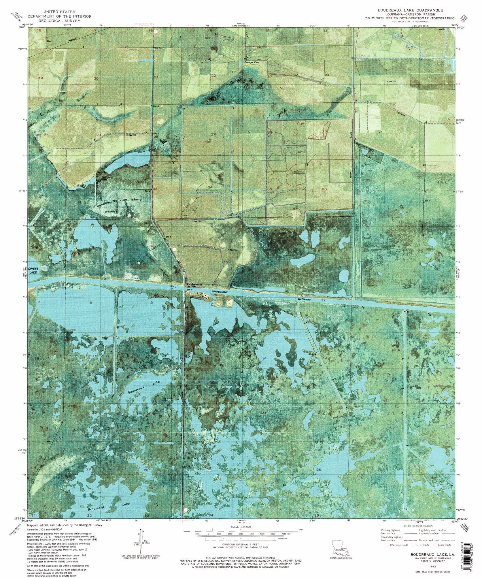
USGS Topo Quad 29093h1 - 1:24,000 scale
| Topo Map Name: | Boudreaux Lake |
| USGS Topo Quad ID: | 29093h1 |
| Print Size: | ca. 21 1/4" wide x 27" high |
| Southeast Coordinates: | 29.875° N latitude / 93° W longitude |
| Map Center Coordinates: | 29.9375° N latitude / 93.0625° W longitude |
| U.S. State: | LA |
| Filename: | p29093h1.jpg |
| Download Map JPG Image: | Boudreaux Lake topo map 1:24,000 scale |
| Map Type: | Orthophoto |
| Topo Series: | 7.5´ |
| Map Scale: | 1:24,000 |
| Source of Map Images: | United States Geological Survey (USGS) |
| Alternate Map Versions: |
Boudreaux Lake LA 1934, updated 1961 Download PDF Buy paper map Boudreaux Lake LA 1982, updated 1982 Download PDF Buy paper map Boudreaux Lake LA 1982, updated 1982 Download PDF Buy paper map Boudreaux Lake LA 2012 Download PDF Buy paper map Boudreaux Lake LA 2015 Download PDF Buy paper map |
1:24,000 Topo Quads surrounding Boudreaux Lake
Westlake |
Lake Charles |
Iowa |
Lacassine |
Welsh South |
Moss Lake |
Lake Charles Sw |
Lake Charles Se |
Hayes |
Thornwell |
Hackberry |
Sweet Lake |
Boudreaux Lake |
Lake Misere |
Latania Lake |
Cameron |
Grand Bayou |
Creole |
Grand Cheniere |
Catfish Lake |
Hackberry Beach |
Hog Bayou |
Cow Island |
> Back to 29093e1 at 1:100,000 scale
> Back to 29092a1 at 1:250,000 scale
> Back to U.S. Topo Maps home
Boudreaux Lake topo map: Gazetteer
Boudreaux Lake: Canals
North Canal elevation 2m 6′Boudreaux Lake: Islands
Savanne Neuville Island elevation 0m 0′Boudreaux Lake: Lakes
Boudreaux Lake elevation 0m 0′Boudreaux Lake: Populated Places
Gibbstown elevation 1m 3′Boudreaux Lake: Trails
Pirogue Trail elevation 0m 0′Boudreaux Lake digital topo map on disk
Buy this Boudreaux Lake topo map showing relief, roads, GPS coordinates and other geographical features, as a high-resolution digital map file on DVD: