Sweet Lake Topo Map Louisiana
To zoom in, hover over the map of Sweet Lake
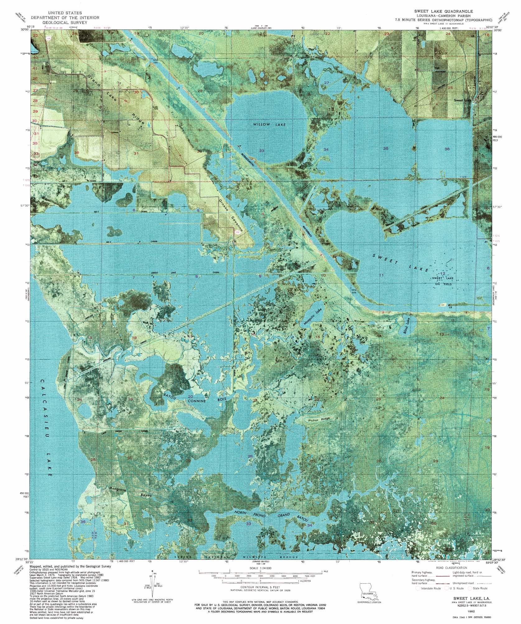
USGS Topo Quad 29093h2 - 1:24,000 scale
| Topo Map Name: | Sweet Lake |
| USGS Topo Quad ID: | 29093h2 |
| Print Size: | ca. 21 1/4" wide x 27" high |
| Southeast Coordinates: | 29.875° N latitude / 93.125° W longitude |
| Map Center Coordinates: | 29.9375° N latitude / 93.1875° W longitude |
| U.S. State: | LA |
| Filename: | p29093h2.jpg |
| Download Map JPG Image: | Sweet Lake topo map 1:24,000 scale |
| Map Type: | Orthophoto |
| Topo Series: | 7.5´ |
| Map Scale: | 1:24,000 |
| Source of Map Images: | United States Geological Survey (USGS) |
| Alternate Map Versions: |
Sweet Lake LA 1934, updated 1959 Download PDF Buy paper map Sweet Lake LA 1982, updated 1982 Download PDF Buy paper map Sweet Lake LA 1982, updated 1982 Download PDF Buy paper map Sweet Lake LA 2012 Download PDF Buy paper map Sweet Lake LA 2015 Download PDF Buy paper map |
1:24,000 Topo Quads surrounding Sweet Lake
Sulphur |
Westlake |
Lake Charles |
Iowa |
Lacassine |
Black Lake |
Moss Lake |
Lake Charles Sw |
Lake Charles Se |
Hayes |
Browns Lake |
Hackberry |
Sweet Lake |
Boudreaux Lake |
Lake Misere |
Holly Beach |
Cameron |
Grand Bayou |
Creole |
Grand Cheniere |
Hackberry Beach |
Hog Bayou |
> Back to 29093e1 at 1:100,000 scale
> Back to 29092a1 at 1:250,000 scale
> Back to U.S. Topo Maps home
Sweet Lake topo map: Gazetteer
Sweet Lake: Canals
Cross Canal elevation 0m 0′Lake Shore Canal elevation 0m 0′
Number One Canal elevation 1m 3′
Number Three Canal elevation 0m 0′
Number Two Canal elevation 0m 0′
Sweet Lake Canal elevation 1m 3′
Sweet Lake: Capes
Grosse Savanne elevation 1m 3′Sweet Lake: Lakes
Blind Lake elevation 0m 0′Mosquito Lake elevation 0m 0′
Sweet Lake elevation 0m 0′
Willow Lake elevation 0m 0′
Sweet Lake: Oilfields
Sweet Lake Oil Field elevation 0m 0′Sweet Lake: Populated Places
Sweet Lake elevation 1m 3′Sweet Lake: Ridges
Grand Lake Ridge elevation 2m 6′Pichot Ridge elevation 1m 3′
Sweet Lake: Streams
Bayou Bois Connine elevation 0m 0′Grand Gully elevation 0m 0′
Mangrove Bayou elevation 0m 0′
Sweet Lake digital topo map on disk
Buy this Sweet Lake topo map showing relief, roads, GPS coordinates and other geographical features, as a high-resolution digital map file on DVD: