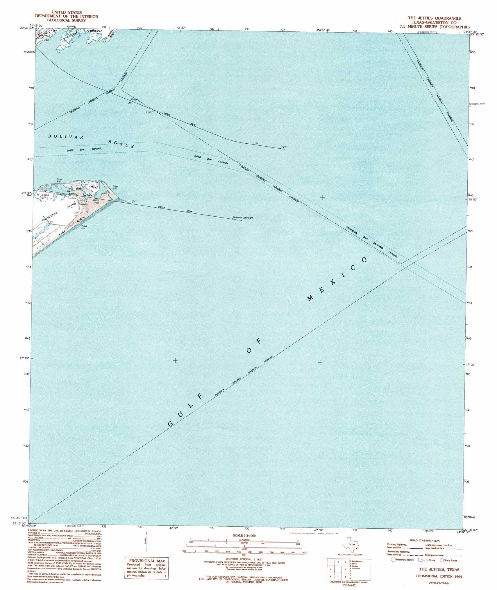
The Jetties Topo Map Texas
To zoom in, hover over the map of The Jetties
USGS Topo Quad 29094c6 - 1:24,000 scale
| Topo Map Name: | The Jetties |
| USGS Topo Quad ID: | 29094c6 |
| Print Size: | ca. 21 1/4" wide x 27" high |
| Southeast Coordinates: | 29.25° N latitude / 94.625° W longitude |
| Map Center Coordinates: | 29.3125° N latitude / 94.6875° W longitude |
| U.S. State: | TX |
| Filename: | o29094c6.jpg |
| Download Map JPG Image: | The Jetties topo map 1:24,000 scale |
| Map Type: | Topographic |
| Topo Series: | 7.5´ |
| Map Scale: | 1:24,000 |
| Source of Map Images: | United States Geological Survey (USGS) |
| Alternate Map Versions: |
The Jetties TX 1932 Download PDF Buy paper map The Jetties TX 1943, updated 1952 Download PDF Buy paper map The Jetties TX 1954, updated 1958 Download PDF Buy paper map The Jetties TX 1954, updated 1970 Download PDF Buy paper map The Jetties TX 1954, updated 1977 Download PDF Buy paper map The Jetties TX 1994, updated 1994 Download PDF Buy paper map The Jetties TX 2010 Download PDF Buy paper map The Jetties TX 2013 Download PDF Buy paper map The Jetties TX 2016 Download PDF Buy paper map |
1:24,000 Topo Quads surrounding The Jetties
Bacliff |
Smith Point |
Lake Stephenson |
Frozen Point |
High Island |
Texas City |
Port Bolivar |
Flake |
Caplen |
|
Virginia Point |
Galveston |
The Jetties |
||
Lake Como |
||||
> Back to 29094a1 at 1:100,000 scale
> Back to 29094a1 at 1:250,000 scale
> Back to U.S. Topo Maps home
The Jetties topo map: Gazetteer
The Jetties: Airports
Galvestonian Heliport elevation 1m 3′The Jetties: Channels
Galveston Bay Entrance Channel elevation 0m 0′Outer Bar Channel elevation 0m 0′
The Jetties: Islands
Big Reef elevation 0m 0′The Jetties: Parks
Big Reef Nature Park elevation 1m 3′R.A. Apffel Park elevation 1m 3′
The Jetties: Trails
Big Reef Nature Park Trail elevation 1m 3′The Jetties digital topo map on disk
Buy this The Jetties topo map showing relief, roads, GPS coordinates and other geographical features, as a high-resolution digital map file on DVD: