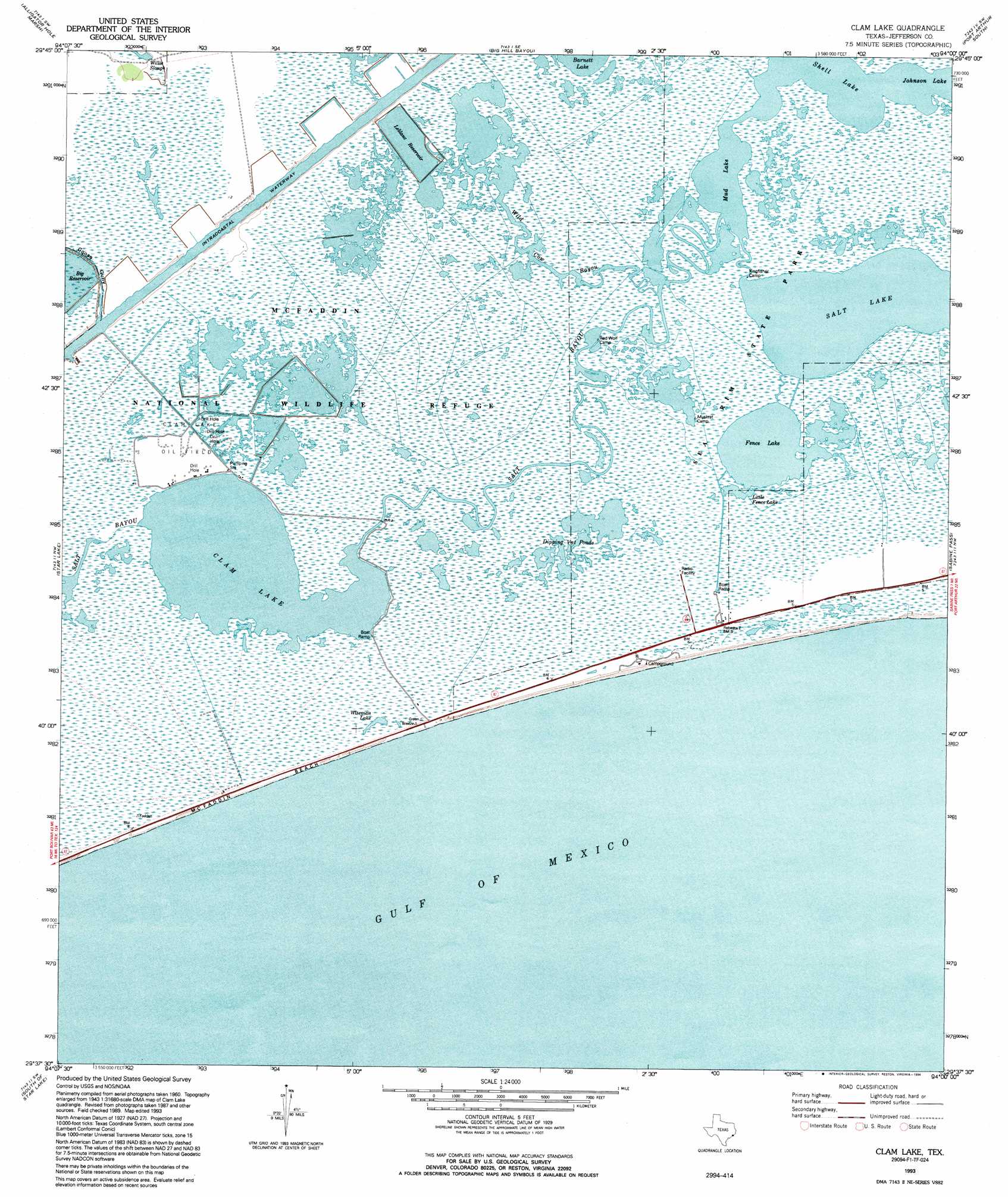
Clam Lake Topo Map Texas
To zoom in, hover over the map of Clam Lake
USGS Topo Quad 29094f1 - 1:24,000 scale
| Topo Map Name: | Clam Lake |
| USGS Topo Quad ID: | 29094f1 |
| Print Size: | ca. 21 1/4" wide x 27" high |
| Southeast Coordinates: | 29.625° N latitude / 94° W longitude |
| Map Center Coordinates: | 29.6875° N latitude / 94.0625° W longitude |
| U.S. State: | TX |
| Filename: | o29094f1.jpg |
| Download Map JPG Image: | Clam Lake topo map 1:24,000 scale |
| Map Type: | Topographic |
| Topo Series: | 7.5´ |
| Map Scale: | 1:24,000 |
| Source of Map Images: | United States Geological Survey (USGS) |
| Alternate Map Versions: |
Clam Lake TX 1961, updated 1964 Download PDF Buy paper map Clam Lake TX 1961, updated 1971 Download PDF Buy paper map Clam Lake TX 1993, updated 1994 Download PDF Buy paper map Clam Lake TX 2010 Download PDF Buy paper map Clam Lake TX 2013 Download PDF Buy paper map Clam Lake TX 2016 Download PDF Buy paper map |
1:24,000 Topo Quads surrounding Clam Lake
Fannett West |
Fannett East |
Port Acres |
Port Arthur North |
West Of Greens Bayou |
Hamshire |
Alligator Hole Marsh |
Big Hill Bayou |
Port Arthur South |
West Of Johnsons Bayou |
Whites Ranch |
Star Lake |
Clam Lake |
Sabine Pass |
Texas Point |
Mud Lake |
South Of Star Lake |
|||
> Back to 29094e1 at 1:100,000 scale
> Back to 29094a1 at 1:250,000 scale
> Back to U.S. Topo Maps home
Clam Lake topo map: Gazetteer
Clam Lake: Beaches
MacFadden Beach elevation 2m 6′McFaddin Beach elevation 1m 3′
Clam Lake: Guts
Tenmile Cut elevation 0m 0′Clam Lake: Lakes
Clam Lake elevation 1m 3′Dipping Vat Ponds elevation 0m 0′
Fence Lake elevation 0m 0′
Little Fence Lake elevation 2m 6′
Salt Lake elevation 0m 0′
Wiseman Lake elevation 2m 6′
Clam Lake: Oilfields
Clam Lake Oil Field elevation 2m 6′Clam Lake: Parks
Sea Rim State Park elevation 0m 0′Clam Lake: Streams
Salt Bayou elevation 1m 3′Clam Lake digital topo map on disk
Buy this Clam Lake topo map showing relief, roads, GPS coordinates and other geographical features, as a high-resolution digital map file on DVD: