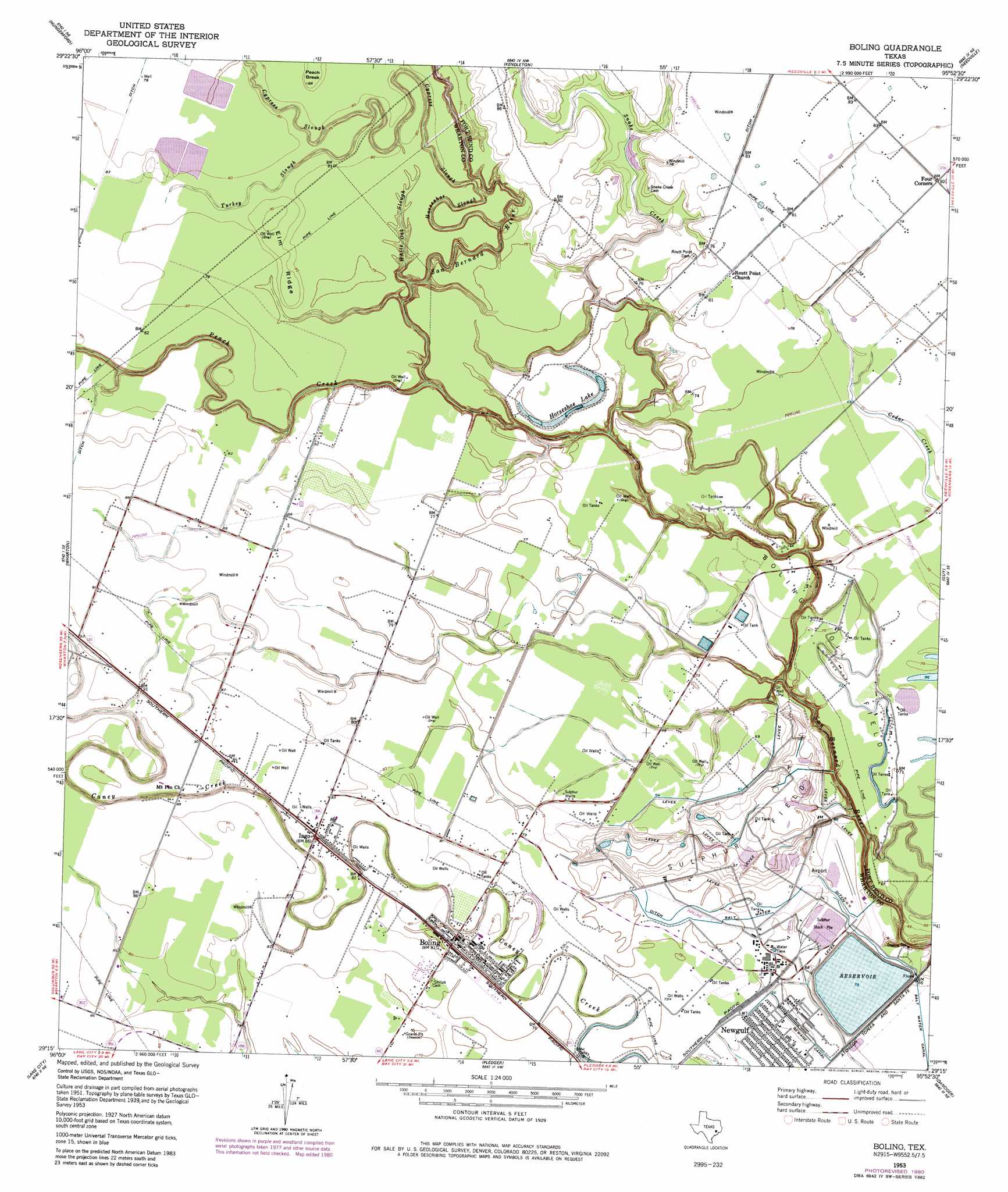
Boling Topo Map Texas
To zoom in, hover over the map of Boling
USGS Topo Quad 29095c8 - 1:24,000 scale
| Topo Map Name: | Boling |
| USGS Topo Quad ID: | 29095c8 |
| Print Size: | ca. 21 1/4" wide x 27" high |
| Southeast Coordinates: | 29.25° N latitude / 95.875° W longitude |
| Map Center Coordinates: | 29.3125° N latitude / 95.9375° W longitude |
| U.S. State: | TX |
| Filename: | o29095c8.jpg |
| Download Map JPG Image: | Boling topo map 1:24,000 scale |
| Map Type: | Topographic |
| Topo Series: | 7.5´ |
| Map Scale: | 1:24,000 |
| Source of Map Images: | United States Geological Survey (USGS) |
| Alternate Map Versions: |
Boling TX 1953, updated 1955 Download PDF Buy paper map Boling TX 1953, updated 1963 Download PDF Buy paper map Boling TX 1953, updated 1981 Download PDF Buy paper map Boling TX 2010 Download PDF Buy paper map Boling TX 2013 Download PDF Buy paper map Boling TX 2016 Download PDF Buy paper map |
1:24,000 Topo Quads surrounding Boling
Lissie |
East Bernard |
Orchard |
Richmond |
Sugar Land |
Egypt |
Hungerford |
Kendleton |
Needville |
Smithers Lake |
Glen Flora |
Wharton |
Boling |
Guy |
Damon |
Pierce |
Lane City |
Pledger |
Danciger |
West Columbia |
Danevang |
Lane City Se |
Van Vleck |
Ashwood |
Sweeny |
> Back to 29095a1 at 1:100,000 scale
> Back to 29094a1 at 1:250,000 scale
> Back to U.S. Topo Maps home
Boling topo map: Gazetteer
Boling: Airports
Newgulf Airport elevation 20m 65′Boling: Dams
Texas Gulf Incorporated Reservoir Dam elevation 19m 62′Boling: Guts
Cypress Slough elevation 22m 72′Horseshoe Slough elevation 17m 55′
Boling: Lakes
Horseshoe Lake elevation 23m 75′Boling: Oilfields
Boling Oil Field elevation 21m 68′Boling: Populated Places
Boling elevation 24m 78′Iago elevation 26m 85′
Newgulf elevation 21m 68′
Boling: Reservoirs
New Gulf Reservoir elevation 19m 62′Boling: Ridges
Elm Ridge elevation 26m 85′Boling: Streams
Peach Creek elevation 15m 49′Snake Creek elevation 9m 29′
Turkey Slough elevation 22m 72′
White Oak Slough elevation 13m 42′
Boling: Summits
Peach Break elevation 27m 88′Boling digital topo map on disk
Buy this Boling topo map showing relief, roads, GPS coordinates and other geographical features, as a high-resolution digital map file on DVD: