Dickinson Topo Map Texas
To zoom in, hover over the map of Dickinson
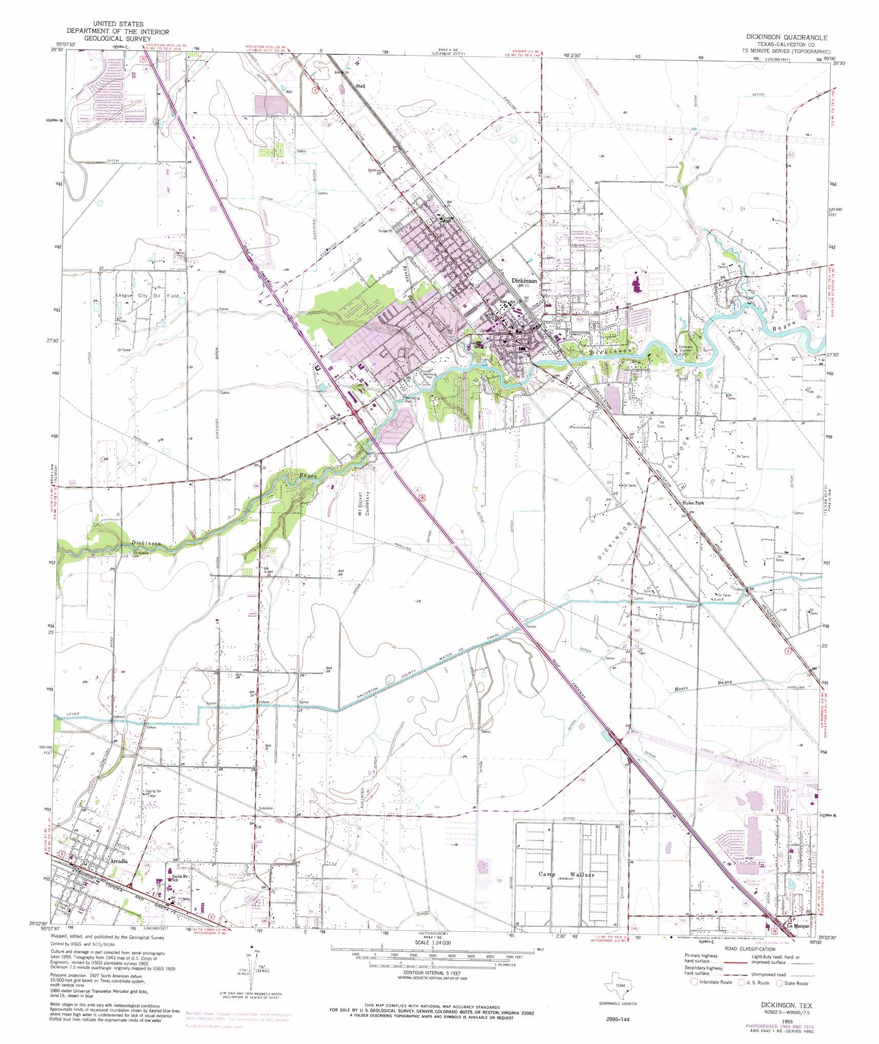
USGS Topo Quad 29095d1 - 1:24,000 scale
| Topo Map Name: | Dickinson |
| USGS Topo Quad ID: | 29095d1 |
| Print Size: | ca. 21 1/4" wide x 27" high |
| Southeast Coordinates: | 29.375° N latitude / 95° W longitude |
| Map Center Coordinates: | 29.4375° N latitude / 95.0625° W longitude |
| U.S. State: | TX |
| Filename: | o29095d1.jpg |
| Download Map JPG Image: | Dickinson topo map 1:24,000 scale |
| Map Type: | Topographic |
| Topo Series: | 7.5´ |
| Map Scale: | 1:24,000 |
| Source of Map Images: | United States Geological Survey (USGS) |
| Alternate Map Versions: |
Dickinson TX 1929 Download PDF Buy paper map Dickinson TX 1943, updated 1953 Download PDF Buy paper map Dickinson TX 1955, updated 1957 Download PDF Buy paper map Dickinson TX 1955, updated 1970 Download PDF Buy paper map Dickinson TX 1955, updated 1975 Download PDF Buy paper map Dickinson TX 1955, updated 1977 Download PDF Buy paper map Dickinson TX 1955, updated 1984 Download PDF Buy paper map Dickinson TX 1995, updated 1999 Download PDF Buy paper map Dickinson TX 2010 Download PDF Buy paper map Dickinson TX 2013 Download PDF Buy paper map Dickinson TX 2016 Download PDF Buy paper map |
1:24,000 Topo Quads surrounding Dickinson
Park Place |
Pasadena |
La Porte |
Morgan Point |
Umbrella Point |
Pearland |
Friendswood |
League City |
Bacliff |
Smith Point |
Manvel |
Algoa |
Dickinson |
Texas City |
Port Bolivar |
Liverpool |
Mustang Bayou |
Hitchcock |
Virginia Point |
Galveston |
Danbury |
Hoskins Mound |
Sea Isle |
Lake Como |
> Back to 29095a1 at 1:100,000 scale
> Back to 29094a1 at 1:250,000 scale
> Back to U.S. Topo Maps home
Dickinson topo map: Gazetteer
Dickinson: Airports
Bay Electric Supply Heliport elevation 8m 26′Laseair Airport elevation 4m 13′
Rebel Field elevation 8m 26′
Dickinson: Canals
Galveston County Water Company Canal elevation 7m 22′Dickinson: Crossings
Interchange 10 elevation 6m 19′Interchange 12 elevation 6m 19′
Interchange 15 elevation 7m 22′
Interchange 18 elevation 6m 19′
Interchange 19 elevation 11m 36′
Interchange 20 elevation 6m 19′
Dickinson: Oilfields
Dickinson Gillock Oil Field elevation 6m 19′League City Oil Field elevation 7m 22′
Dickinson: Parks
Bunge Park elevation 9m 29′Indian Stadium elevation 9m 29′
Runge Park elevation 9m 29′
Sam Vitanza Stadium elevation 6m 19′
Dickinson: Populated Places
Arcadia elevation 9m 29′Brittany Bay elevation 7m 22′
Dickinson elevation 5m 16′
Oaks of Clear Creek elevation 8m 26′
Santa Fe elevation 9m 29′
Dickinson: Streams
Benson Bayou elevation 1m 3′Dickinson digital topo map on disk
Buy this Dickinson topo map showing relief, roads, GPS coordinates and other geographical features, as a high-resolution digital map file on DVD: