Richmond Topo Map Texas
To zoom in, hover over the map of Richmond
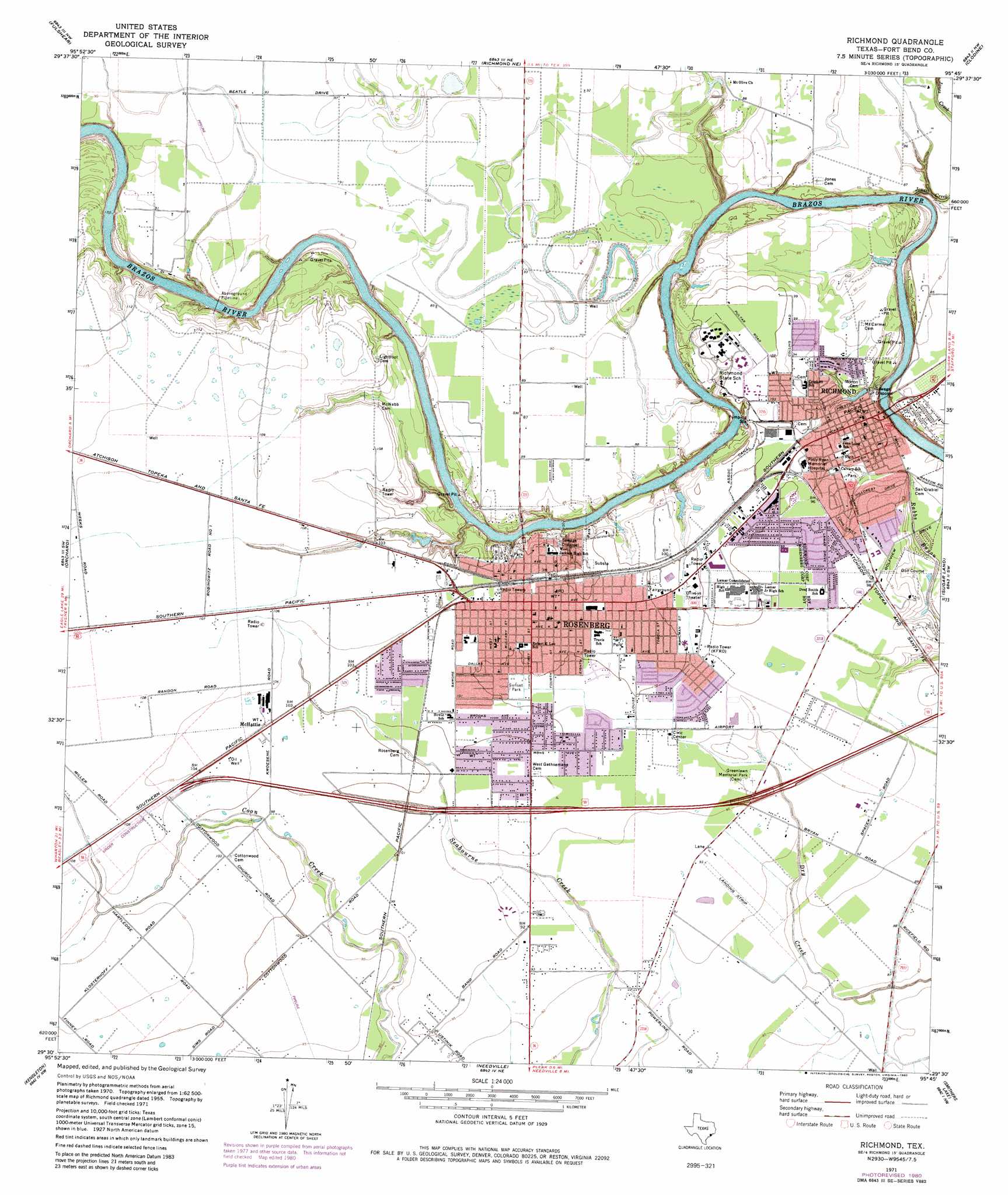
USGS Topo Quad 29095e7 - 1:24,000 scale
| Topo Map Name: | Richmond |
| USGS Topo Quad ID: | 29095e7 |
| Print Size: | ca. 21 1/4" wide x 27" high |
| Southeast Coordinates: | 29.5° N latitude / 95.75° W longitude |
| Map Center Coordinates: | 29.5625° N latitude / 95.8125° W longitude |
| U.S. State: | TX |
| Filename: | o29095e7.jpg |
| Download Map JPG Image: | Richmond topo map 1:24,000 scale |
| Map Type: | Topographic |
| Topo Series: | 7.5´ |
| Map Scale: | 1:24,000 |
| Source of Map Images: | United States Geological Survey (USGS) |
| Alternate Map Versions: |
Richmond TX 1971, updated 1973 Download PDF Buy paper map Richmond TX 1971, updated 1980 Download PDF Buy paper map Richmond TX 2010 Download PDF Buy paper map Richmond TX 2013 Download PDF Buy paper map Richmond TX 2016 Download PDF Buy paper map |
1:24,000 Topo Quads surrounding Richmond
San Felipe |
Brookshire |
Katy |
Addicks |
Hedwig Village |
Wallis |
Fulshear |
Richmond Ne |
Clodine |
Alief |
East Bernard |
Orchard |
Richmond |
Sugar Land |
Missouri City |
Hungerford |
Kendleton |
Needville |
Smithers Lake |
Thompsons |
Wharton |
Boling |
Guy |
Damon |
Otey |
> Back to 29095e1 at 1:100,000 scale
> Back to 29094a1 at 1:250,000 scale
> Back to U.S. Topo Maps home
Richmond topo map: Gazetteer
Richmond: Airports
Lane Airpark elevation 28m 91′Richmond: Canals
Assoc Canal elevation 30m 98′Richmond: Parks
Brazos Park elevation 31m 101′Davis Memorial Park elevation 26m 85′
Garcia Memorial Park elevation 30m 98′
Greenlawn Memorial Park elevation 28m 91′
Richmond City Park elevation 29m 95′
River Bend Park elevation 28m 91′
Sunset Park elevation 30m 98′
Travis Park elevation 31m 101′
Traylor Stadium elevation 30m 98′
Richmond: Populated Places
Cumings elevation 26m 85′McHattie elevation 32m 104′
Richmond elevation 28m 91′
Rosenberg elevation 32m 104′
Richmond: Streams
Jones Creek elevation 18m 59′Richmond digital topo map on disk
Buy this Richmond topo map showing relief, roads, GPS coordinates and other geographical features, as a high-resolution digital map file on DVD: