Lane City Topo Map Texas
To zoom in, hover over the map of Lane City
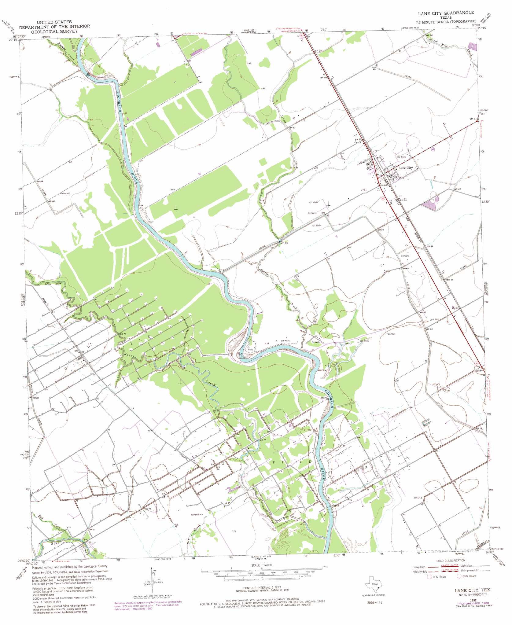
USGS Topo Quad 29096b1 - 1:24,000 scale
| Topo Map Name: | Lane City |
| USGS Topo Quad ID: | 29096b1 |
| Print Size: | ca. 21 1/4" wide x 27" high |
| Southeast Coordinates: | 29.125° N latitude / 96° W longitude |
| Map Center Coordinates: | 29.1875° N latitude / 96.0625° W longitude |
| U.S. State: | TX |
| Filename: | o29096b1.jpg |
| Download Map JPG Image: | Lane City topo map 1:24,000 scale |
| Map Type: | Topographic |
| Topo Series: | 7.5´ |
| Map Scale: | 1:24,000 |
| Source of Map Images: | United States Geological Survey (USGS) |
| Alternate Map Versions: |
Lane City TX 1952, updated 1953 Download PDF Buy paper map Lane City TX 1952, updated 1973 Download PDF Buy paper map Lane City TX 1952, updated 1980 Download PDF Buy paper map Lane City TX 2010 Download PDF Buy paper map Lane City TX 2013 Download PDF Buy paper map Lane City TX 2016 Download PDF Buy paper map |
1:24,000 Topo Quads surrounding Lane City
Bonus |
Egypt |
Hungerford |
Kendleton |
Needville |
New Taiton |
Glen Flora |
Wharton |
Boling |
Guy |
El Campo |
Pierce |
Lane City |
Pledger |
Danciger |
El Campo Se |
Danevang |
Lane City Se |
Van Vleck |
Ashwood |
Francitas Ne |
Midfield |
Markham |
Bay City |
Bay City Ne |
> Back to 29096a1 at 1:100,000 scale
> Back to 29096a1 at 1:250,000 scale
> Back to U.S. Topo Maps home
Lane City topo map: Gazetteer
Lane City: Canals
Pierce Canal elevation 24m 78′Lane City: Populated Places
Lane City elevation 26m 85′Lane City: Streams
Bosque Creek elevation 25m 82′East Fork Blue Creek elevation 20m 65′
Jarvis Creek elevation 15m 49′
Jones Creek elevation 21m 68′
Lane City digital topo map on disk
Buy this Lane City topo map showing relief, roads, GPS coordinates and other geographical features, as a high-resolution digital map file on DVD: