Morales Topo Map Texas
To zoom in, hover over the map of Morales
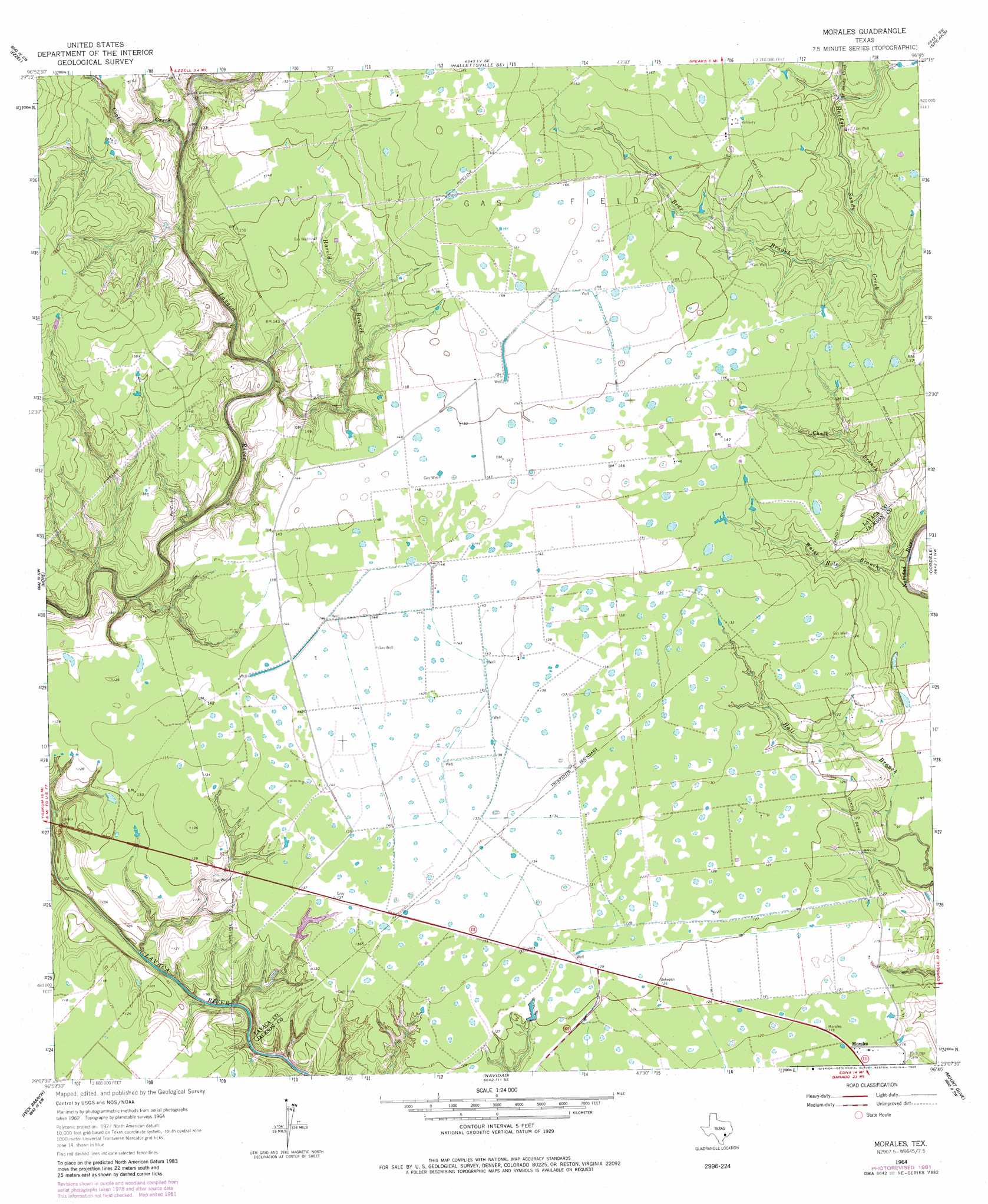
USGS Topo Quad 29096b7 - 1:24,000 scale
| Topo Map Name: | Morales |
| USGS Topo Quad ID: | 29096b7 |
| Print Size: | ca. 21 1/4" wide x 27" high |
| Southeast Coordinates: | 29.125° N latitude / 96.75° W longitude |
| Map Center Coordinates: | 29.1875° N latitude / 96.8125° W longitude |
| U.S. State: | TX |
| Filename: | o29096b7.jpg |
| Download Map JPG Image: | Morales topo map 1:24,000 scale |
| Map Type: | Topographic |
| Topo Series: | 7.5´ |
| Map Scale: | 1:24,000 |
| Source of Map Images: | United States Geological Survey (USGS) |
| Alternate Map Versions: |
Morales TX 1964, updated 1966 Download PDF Buy paper map Morales TX 1964, updated 1983 Download PDF Buy paper map Morales TX 2010 Download PDF Buy paper map Morales TX 2013 Download PDF Buy paper map Morales TX 2016 Download PDF Buy paper map |
1:24,000 Topo Quads surrounding Morales
Wied |
Hallettsville |
Sublime |
Sheridan |
Sheridan Ne |
Sweet Home |
Ezzell |
Hallettsville Se |
Speaks |
Sheridan Se |
Terryville |
Hope |
Morales |
Cordele |
Ganado Ne |
Fordtran |
Peck Branch |
Navidad |
Mount Olive |
Ganado |
Nursery |
Inez Nw |
Inez |
Edna |
Manson |
> Back to 29096a1 at 1:100,000 scale
> Back to 29096a1 at 1:250,000 scale
> Back to U.S. Topo Maps home
Morales topo map: Gazetteer
Morales: Bridges
Wallace Bridge elevation 35m 114′Morales: Populated Places
Morales elevation 37m 121′Morales: Streams
Bear Branch elevation 36m 118′Chalk Branch elevation 26m 85′
Coal Creek elevation 31m 101′
Harold Branch elevation 30m 98′
Water Hole Branch elevation 29m 95′
West Sandy Creek elevation 38m 124′
Morales digital topo map on disk
Buy this Morales topo map showing relief, roads, GPS coordinates and other geographical features, as a high-resolution digital map file on DVD: