Hope Topo Map Texas
To zoom in, hover over the map of Hope
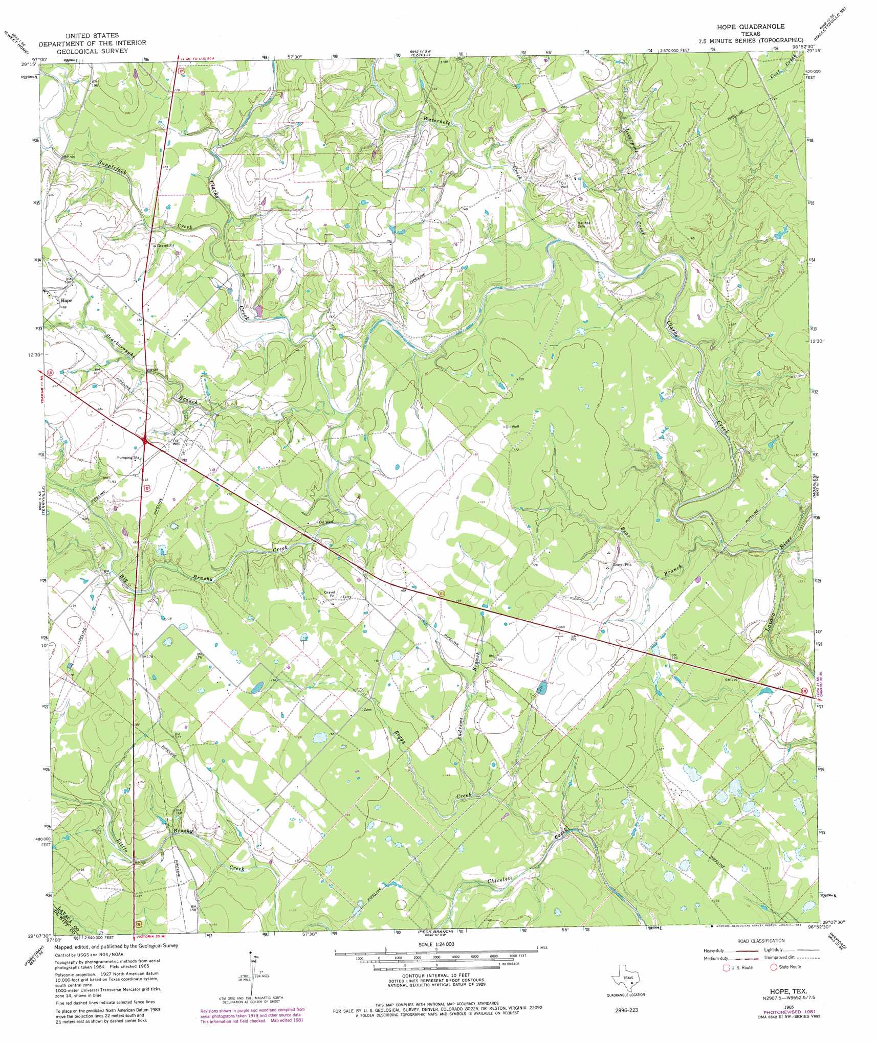
USGS Topo Quad 29096b8 - 1:24,000 scale
| Topo Map Name: | Hope |
| USGS Topo Quad ID: | 29096b8 |
| Print Size: | ca. 21 1/4" wide x 27" high |
| Southeast Coordinates: | 29.125° N latitude / 96.875° W longitude |
| Map Center Coordinates: | 29.1875° N latitude / 96.9375° W longitude |
| U.S. State: | TX |
| Filename: | o29096b8.jpg |
| Download Map JPG Image: | Hope topo map 1:24,000 scale |
| Map Type: | Topographic |
| Topo Series: | 7.5´ |
| Map Scale: | 1:24,000 |
| Source of Map Images: | United States Geological Survey (USGS) |
| Alternate Map Versions: |
Hope TX 1965, updated 1967 Download PDF Buy paper map Hope TX 1965, updated 1983 Download PDF Buy paper map Hope TX 2010 Download PDF Buy paper map Hope TX 2013 Download PDF Buy paper map Hope TX 2016 Download PDF Buy paper map |
1:24,000 Topo Quads surrounding Hope
Shiner |
Wied |
Hallettsville |
Sublime |
Sheridan |
Yoakum |
Sweet Home |
Ezzell |
Hallettsville Se |
Speaks |
Edgar |
Terryville |
Hope |
Morales |
Cordele |
Verhelle |
Fordtran |
Peck Branch |
Navidad |
Mount Olive |
Mission Valley |
Nursery |
Inez Nw |
Inez |
Edna |
> Back to 29096a1 at 1:100,000 scale
> Back to 29096a1 at 1:250,000 scale
> Back to U.S. Topo Maps home
Hope topo map: Gazetteer
Hope: Populated Places
Hope elevation 59m 193′Hope: Streams
Andrews Branch elevation 37m 121′Bear Branch elevation 27m 88′
Big Brushy Creek elevation 40m 131′
Boggy Creek elevation 37m 121′
Clarks Creek elevation 27m 88′
Liverpool Creek elevation 36m 118′
Scarboroughs Branch elevation 38m 124′
Supplejack Creek elevation 43m 141′
Waterhole Creek elevation 33m 108′
Hope digital topo map on disk
Buy this Hope topo map showing relief, roads, GPS coordinates and other geographical features, as a high-resolution digital map file on DVD: