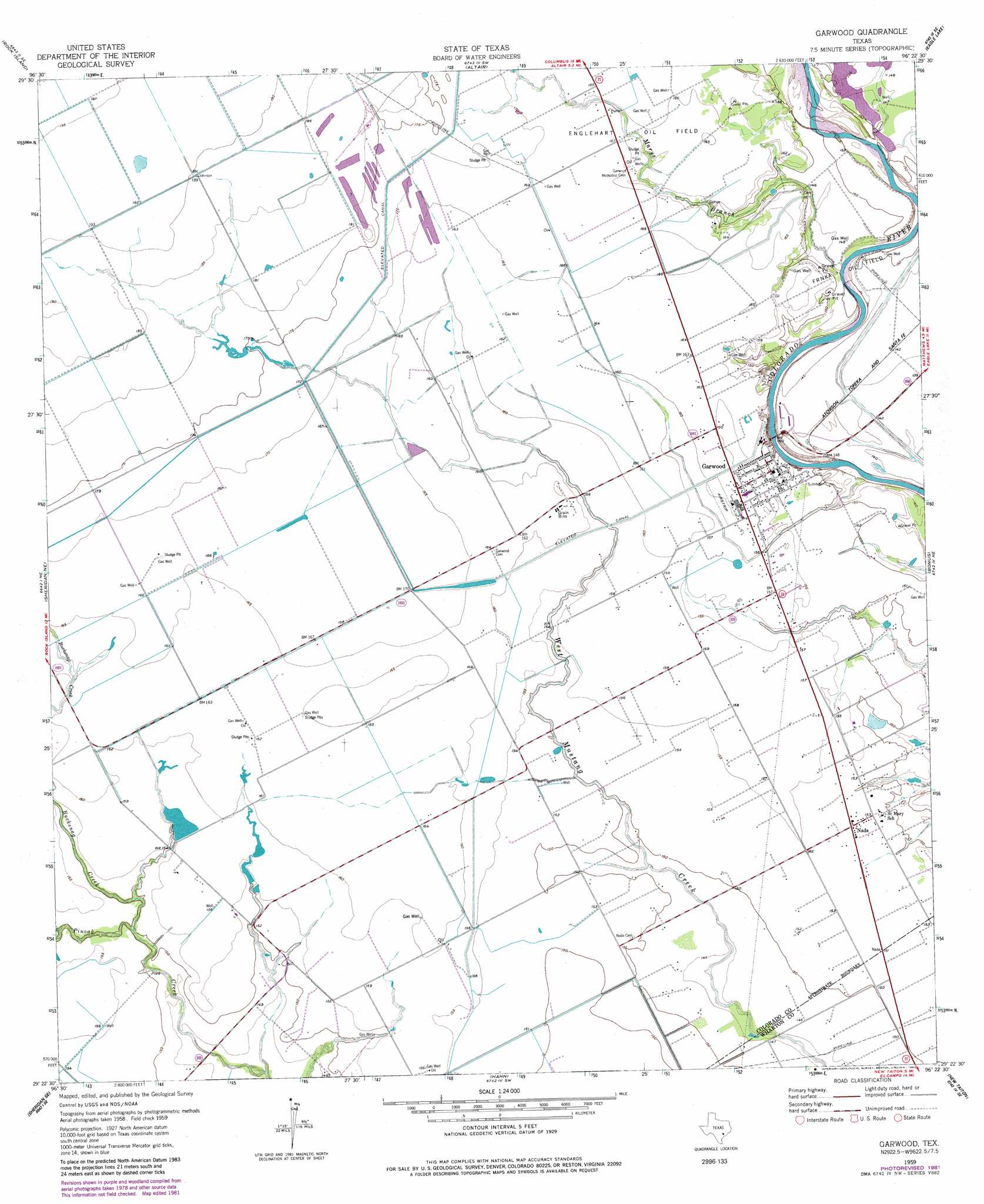
Garwood Topo Map Texas
To zoom in, hover over the map of Garwood
USGS Topo Quad 29096d4 - 1:24,000 scale
| Topo Map Name: | Garwood |
| USGS Topo Quad ID: | 29096d4 |
| Print Size: | ca. 21 1/4" wide x 27" high |
| Southeast Coordinates: | 29.375° N latitude / 96.375° W longitude |
| Map Center Coordinates: | 29.4375° N latitude / 96.4375° W longitude |
| U.S. State: | TX |
| Filename: | o29096d4.jpg |
| Download Map JPG Image: | Garwood topo map 1:24,000 scale |
| Map Type: | Topographic |
| Topo Series: | 7.5´ |
| Map Scale: | 1:24,000 |
| Source of Map Images: | United States Geological Survey (USGS) |
| Alternate Map Versions: |
Garwood TX 1959, updated 1960 Download PDF Buy paper map Garwood TX 1959, updated 1977 Download PDF Buy paper map Garwood TX 1959, updated 1983 Download PDF Buy paper map Garwood TX 2010 Download PDF Buy paper map Garwood TX 2013 Download PDF Buy paper map Garwood TX 2016 Download PDF Buy paper map |
1:24,000 Topo Quads surrounding Garwood
Borden |
Columbus |
Alleyton |
Eagle Lake Ne |
Rexville |
Sawmill Branch |
Rock Island |
Altair |
Eagle Lake |
Lissie |
Sheridan |
Sheridan Ne |
Garwood |
Bonus |
Egypt |
Speaks |
Sheridan Se |
Hahn |
New Taiton |
Glen Flora |
Cordele |
Ganado Ne |
Gobbler Creek |
El Campo |
Pierce |
> Back to 29096a1 at 1:100,000 scale
> Back to 29096a1 at 1:250,000 scale
> Back to U.S. Topo Maps home
Garwood topo map: Gazetteer
Garwood: Dams
Engstrom Lake Number 2 Dam elevation 47m 154′Rees Reservoir Dam elevation 52m 170′
Garwood: Oilfields
Englehart Oil Field elevation 52m 170′Frnka Oil Field elevation 46m 150′
Garwood: Populated Places
Garwood elevation 47m 154′Nada elevation 47m 154′
Garwood: Reservoirs
Engstrom Lake Number 2 elevation 47m 154′Rees Reservoir elevation 52m 170′
Garwood: Streams
Bucksnag Creek elevation 44m 144′Marys Branch elevation 43m 141′
Garwood digital topo map on disk
Buy this Garwood topo map showing relief, roads, GPS coordinates and other geographical features, as a high-resolution digital map file on DVD: