Sheridan Topo Map Texas
To zoom in, hover over the map of Sheridan
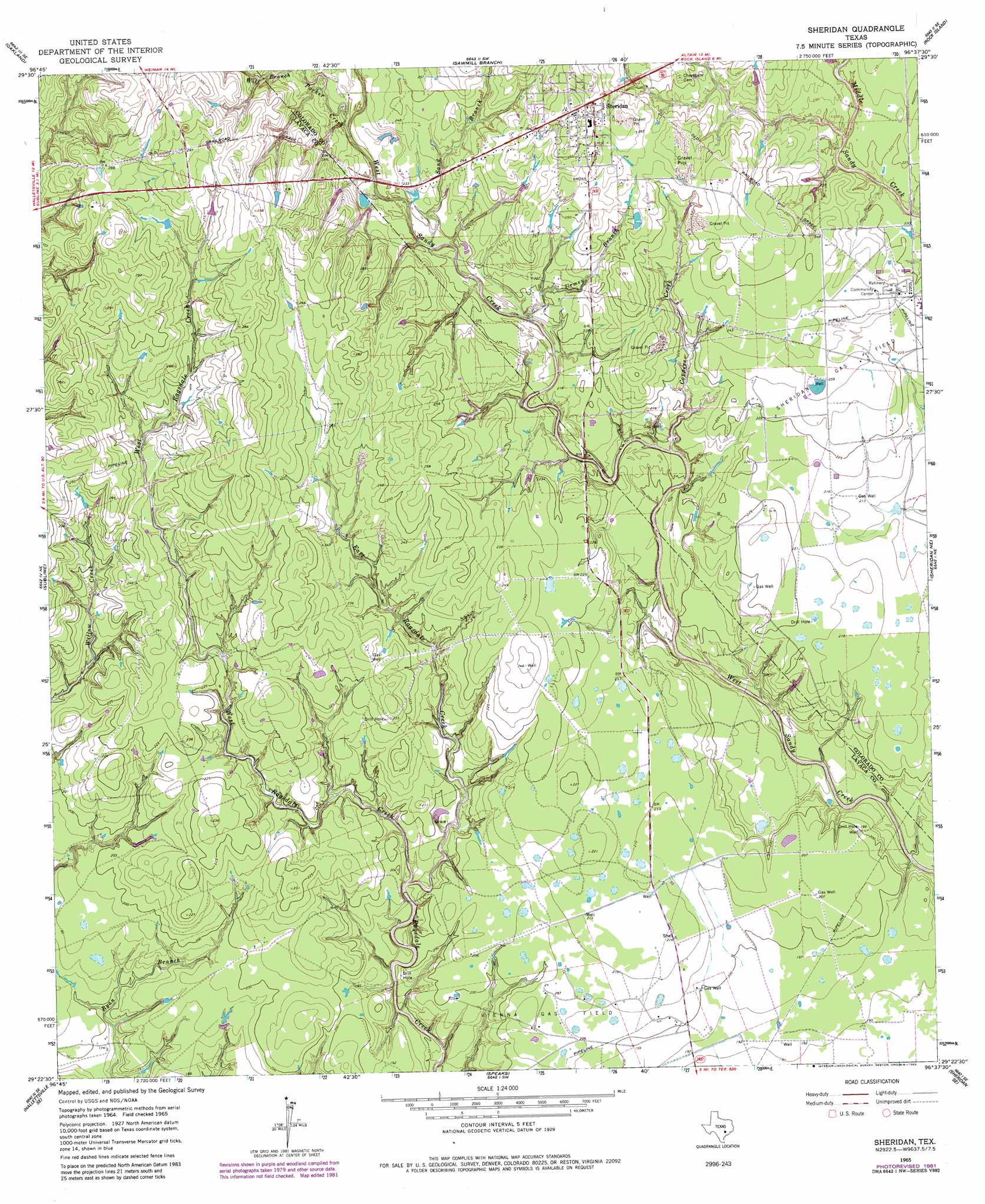
USGS Topo Quad 29096d6 - 1:24,000 scale
| Topo Map Name: | Sheridan |
| USGS Topo Quad ID: | 29096d6 |
| Print Size: | ca. 21 1/4" wide x 27" high |
| Southeast Coordinates: | 29.375° N latitude / 96.625° W longitude |
| Map Center Coordinates: | 29.4375° N latitude / 96.6875° W longitude |
| U.S. State: | TX |
| Filename: | o29096d6.jpg |
| Download Map JPG Image: | Sheridan topo map 1:24,000 scale |
| Map Type: | Topographic |
| Topo Series: | 7.5´ |
| Map Scale: | 1:24,000 |
| Source of Map Images: | United States Geological Survey (USGS) |
| Alternate Map Versions: |
Sheridan TX 1965, updated 1967 Download PDF Buy paper map Sheridan TX 1965, updated 1983 Download PDF Buy paper map Sheridan TX 2010 Download PDF Buy paper map Sheridan TX 2013 Download PDF Buy paper map Sheridan TX 2016 Download PDF Buy paper map |
1:24,000 Topo Quads surrounding Sheridan
Schulenburg |
Weimar |
Borden |
Columbus |
Alleyton |
Moravia |
Oakland |
Sawmill Branch |
Rock Island |
Altair |
Hallettsville |
Sublime |
Sheridan |
Sheridan Ne |
Garwood |
Ezzell |
Hallettsville Se |
Speaks |
Sheridan Se |
Hahn |
Hope |
Morales |
Cordele |
Ganado Ne |
Gobbler Creek |
> Back to 29096a1 at 1:100,000 scale
> Back to 29096a1 at 1:250,000 scale
> Back to U.S. Topo Maps home
Sheridan topo map: Gazetteer
Sheridan: Oilfields
Vienna Gas Field elevation 64m 209′Sheridan: Populated Places
Sheridan elevation 84m 275′Sheridan: Streams
Coppers Creek elevation 59m 193′East Ragsdale Creek elevation 54m 177′
Parker Creek elevation 67m 219′
Sand Branch elevation 64m 209′
Urmey Branch elevation 63m 206′
West Ragsdale Creek elevation 54m 177′
Wolf Branch elevation 70m 229′
Sheridan digital topo map on disk
Buy this Sheridan topo map showing relief, roads, GPS coordinates and other geographical features, as a high-resolution digital map file on DVD: