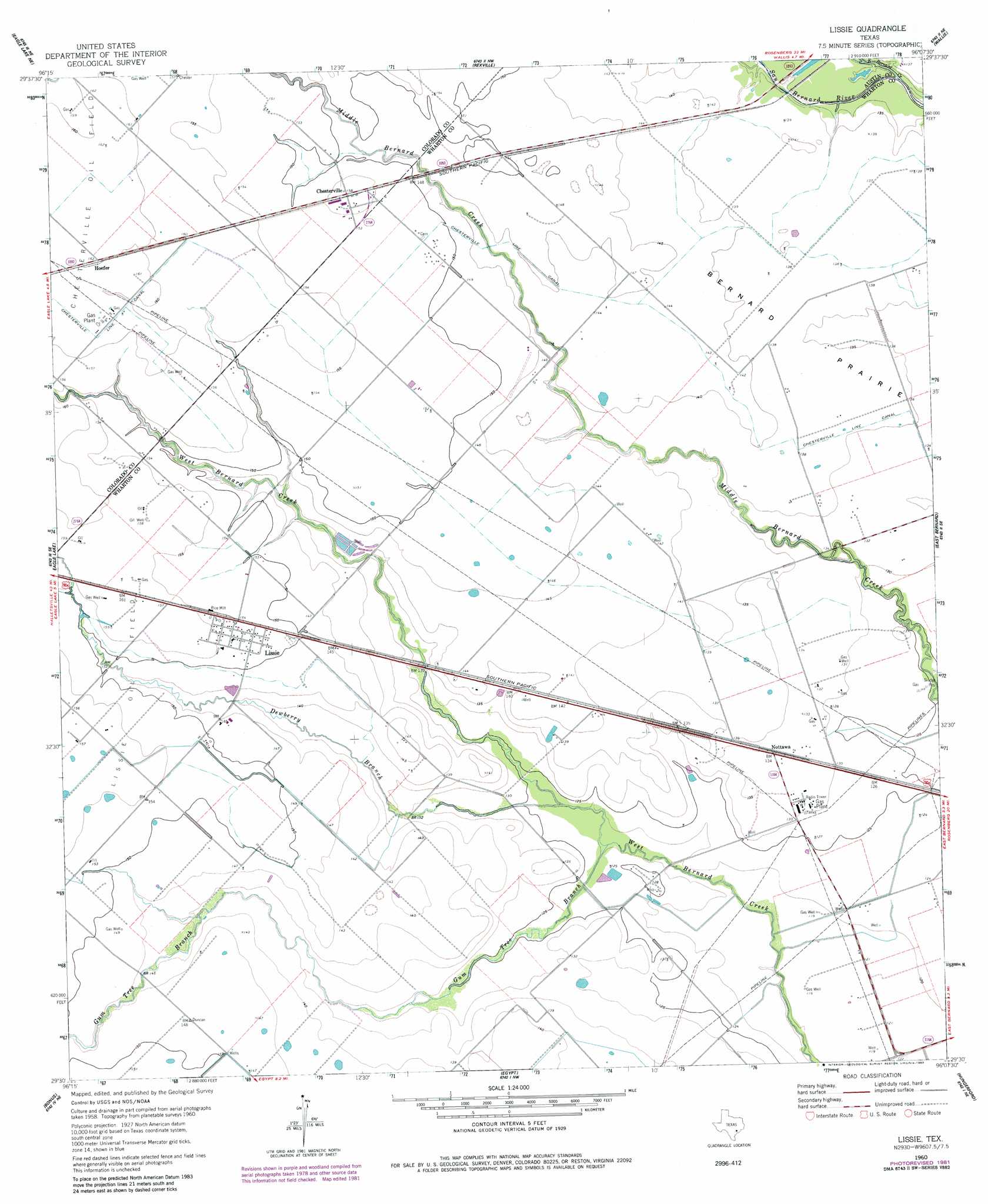
Lissie Topo Map Texas
To zoom in, hover over the map of Lissie
USGS Topo Quad 29096e2 - 1:24,000 scale
| Topo Map Name: | Lissie |
| USGS Topo Quad ID: | 29096e2 |
| Print Size: | ca. 21 1/4" wide x 27" high |
| Southeast Coordinates: | 29.5° N latitude / 96.125° W longitude |
| Map Center Coordinates: | 29.5625° N latitude / 96.1875° W longitude |
| U.S. State: | TX |
| Filename: | o29096e2.jpg |
| Download Map JPG Image: | Lissie topo map 1:24,000 scale |
| Map Type: | Topographic |
| Topo Series: | 7.5´ |
| Map Scale: | 1:24,000 |
| Source of Map Images: | United States Geological Survey (USGS) |
| Alternate Map Versions: |
Lissie TX 1960, updated 1961 Download PDF Buy paper map Lissie TX 1960, updated 1983 Download PDF Buy paper map Lissie TX 2010 Download PDF Buy paper map Lissie TX 2013 Download PDF Buy paper map Lissie TX 2016 Download PDF Buy paper map |
1:24,000 Topo Quads surrounding Lissie
Bernardo |
Cat Spring |
Sealy |
San Felipe |
Brookshire |
Alleyton |
Eagle Lake Ne |
Rexville |
Wallis |
Fulshear |
Altair |
Eagle Lake |
Lissie |
East Bernard |
Orchard |
Garwood |
Bonus |
Egypt |
Hungerford |
Kendleton |
Hahn |
New Taiton |
Glen Flora |
Wharton |
Boling |
> Back to 29096e1 at 1:100,000 scale
> Back to 29096a1 at 1:250,000 scale
> Back to U.S. Topo Maps home
Lissie topo map: Gazetteer
Lissie: Airports
TGP 17 Heliport elevation 40m 131′Lissie: Canals
Chesterville Line Canal elevation 46m 150′Lissie: Oilfields
Lissie Oil Field elevation 48m 157′Lissie: Populated Places
Chesterville elevation 47m 154′Hoefer elevation 49m 160′
Lissie elevation 47m 154′
Nottawa elevation 41m 134′
Lissie: Streams
Dewberry Branch elevation 37m 121′East Bernard Creek elevation 38m 124′
Gum Tree Branch elevation 35m 114′
Lissie digital topo map on disk
Buy this Lissie topo map showing relief, roads, GPS coordinates and other geographical features, as a high-resolution digital map file on DVD: