Rock Island Topo Map Texas
To zoom in, hover over the map of Rock Island
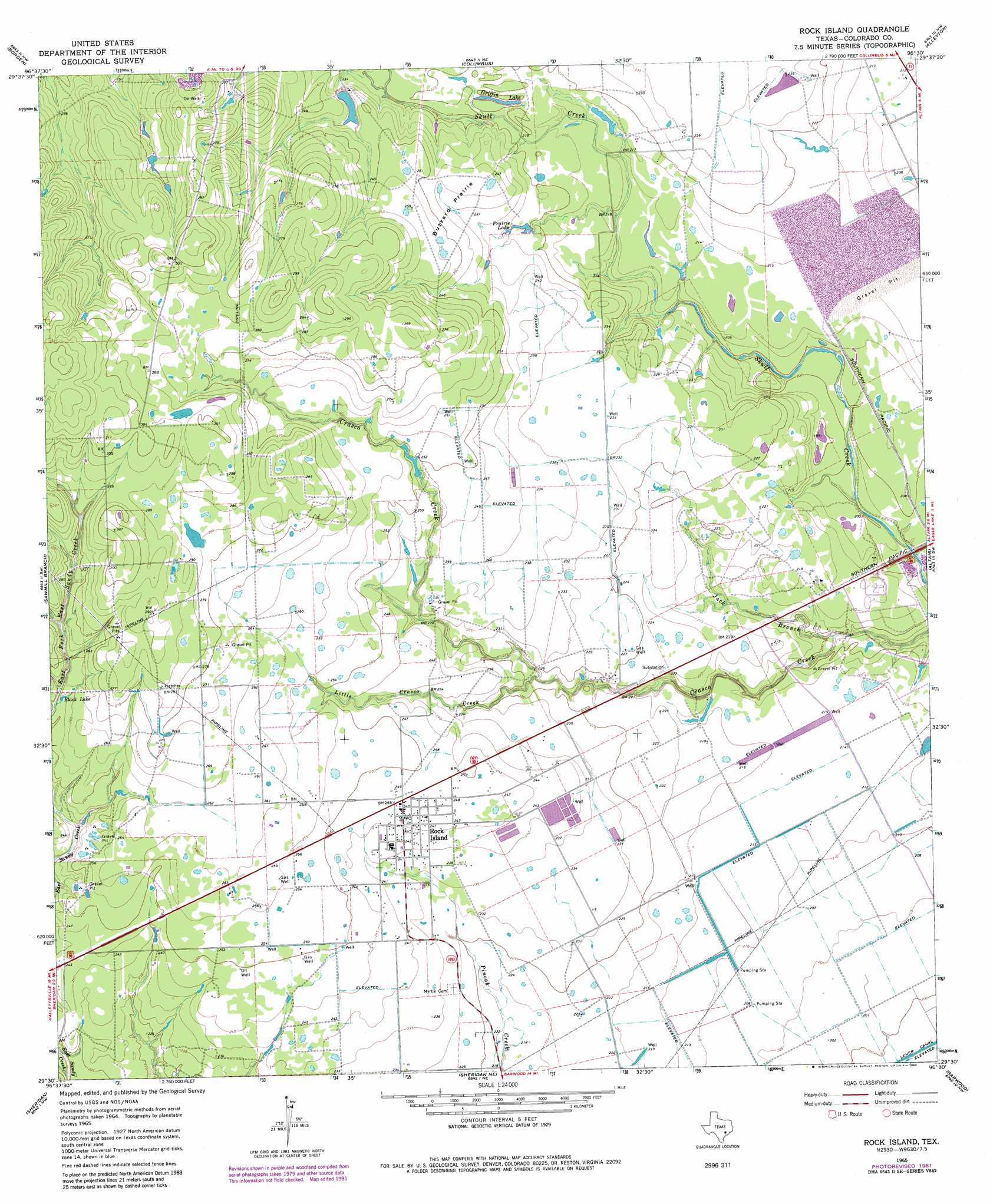
USGS Topo Quad 29096e5 - 1:24,000 scale
| Topo Map Name: | Rock Island |
| USGS Topo Quad ID: | 29096e5 |
| Print Size: | ca. 21 1/4" wide x 27" high |
| Southeast Coordinates: | 29.5° N latitude / 96.5° W longitude |
| Map Center Coordinates: | 29.5625° N latitude / 96.5625° W longitude |
| U.S. State: | TX |
| Filename: | o29096e5.jpg |
| Download Map JPG Image: | Rock Island topo map 1:24,000 scale |
| Map Type: | Topographic |
| Topo Series: | 7.5´ |
| Map Scale: | 1:24,000 |
| Source of Map Images: | United States Geological Survey (USGS) |
| Alternate Map Versions: |
Rock Island TX 1965, updated 1967 Download PDF Buy paper map Rock Island TX 1965, updated 1983 Download PDF Buy paper map Rock Island TX 2010 Download PDF Buy paper map Rock Island TX 2013 Download PDF Buy paper map Rock Island TX 2016 Download PDF Buy paper map |
1:24,000 Topo Quads surrounding Rock Island
Ammannsville |
Ellinger |
Frelsburg |
Bernardo |
Cat Spring |
Weimar |
Borden |
Columbus |
Alleyton |
Eagle Lake Ne |
Oakland |
Sawmill Branch |
Rock Island |
Altair |
Eagle Lake |
Sublime |
Sheridan |
Sheridan Ne |
Garwood |
Bonus |
Hallettsville Se |
Speaks |
Sheridan Se |
Hahn |
New Taiton |
> Back to 29096e1 at 1:100,000 scale
> Back to 29096a1 at 1:250,000 scale
> Back to U.S. Topo Maps home
Rock Island topo map: Gazetteer
Rock Island: Flats
Buzzard Prairie elevation 73m 239′Rock Island: Lakes
Black Lake elevation 77m 252′Griffin Lake elevation 69m 226′
Prairie Lake elevation 69m 226′
Rock Island: Populated Places
Rock Island elevation 75m 246′Rock Island: Streams
Jack Branch elevation 58m 190′Little Crasco Creek elevation 65m 213′
Rock Island digital topo map on disk
Buy this Rock Island topo map showing relief, roads, GPS coordinates and other geographical features, as a high-resolution digital map file on DVD: