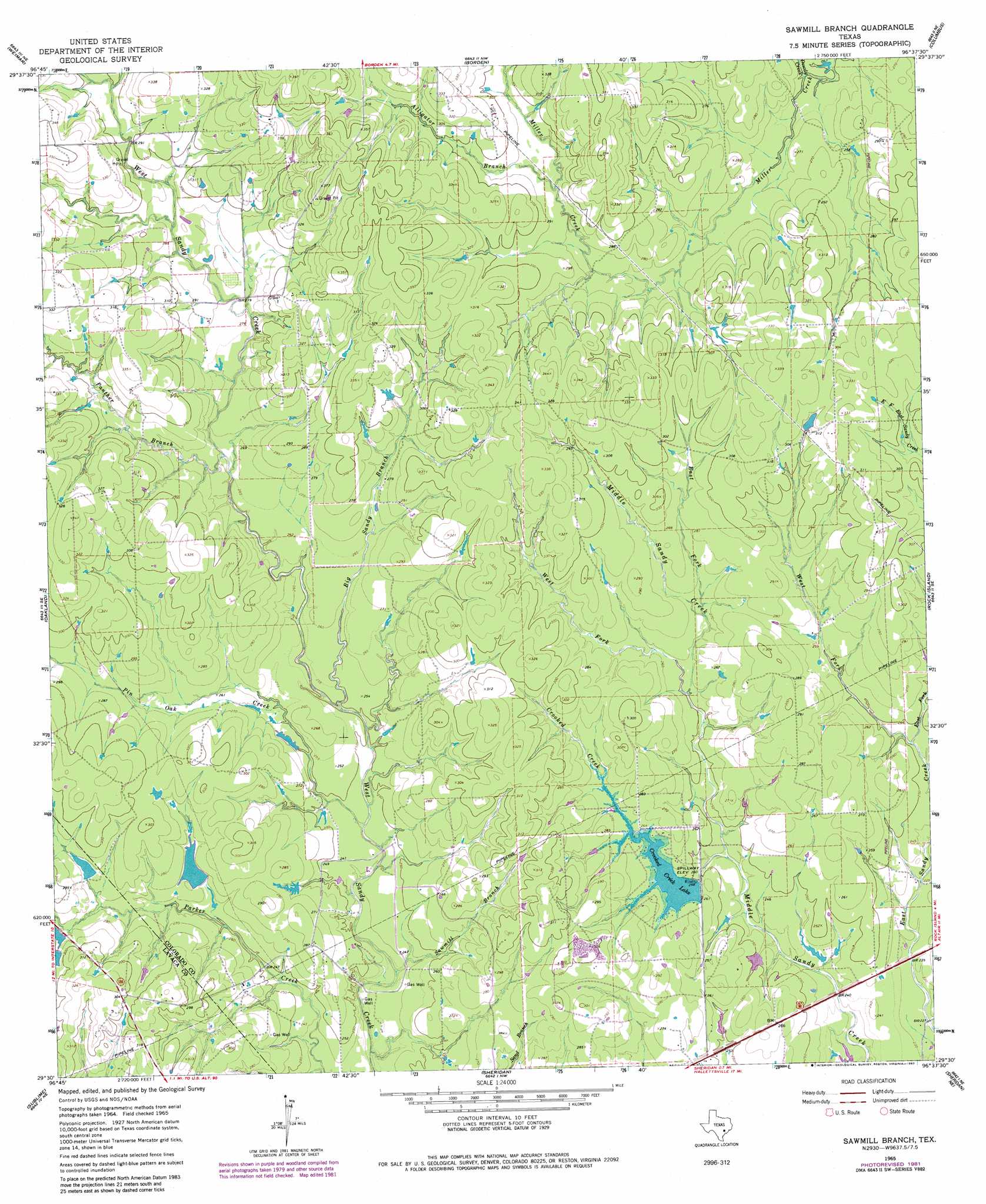
Sawmill Branch Topo Map Texas
To zoom in, hover over the map of Sawmill Branch
USGS Topo Quad 29096e6 - 1:24,000 scale
| Topo Map Name: | Sawmill Branch |
| USGS Topo Quad ID: | 29096e6 |
| Print Size: | ca. 21 1/4" wide x 27" high |
| Southeast Coordinates: | 29.5° N latitude / 96.625° W longitude |
| Map Center Coordinates: | 29.5625° N latitude / 96.6875° W longitude |
| U.S. State: | TX |
| Filename: | o29096e6.jpg |
| Download Map JPG Image: | Sawmill Branch topo map 1:24,000 scale |
| Map Type: | Topographic |
| Topo Series: | 7.5´ |
| Map Scale: | 1:24,000 |
| Source of Map Images: | United States Geological Survey (USGS) |
| Alternate Map Versions: |
Sawmill Branch TX 1965, updated 1967 Download PDF Buy paper map Sawmill Branch TX 1965, updated 1983 Download PDF Buy paper map Sawmill Branch TX 2010 Download PDF Buy paper map Sawmill Branch TX 2013 Download PDF Buy paper map Sawmill Branch TX 2016 Download PDF Buy paper map |
1:24,000 Topo Quads surrounding Sawmill Branch
Swiss Alp |
Ammannsville |
Ellinger |
Frelsburg |
Bernardo |
Schulenburg |
Weimar |
Borden |
Columbus |
Alleyton |
Moravia |
Oakland |
Sawmill Branch |
Rock Island |
Altair |
Hallettsville |
Sublime |
Sheridan |
Sheridan Ne |
Garwood |
Ezzell |
Hallettsville Se |
Speaks |
Sheridan Se |
Hahn |
> Back to 29096e1 at 1:100,000 scale
> Back to 29096a1 at 1:250,000 scale
> Back to U.S. Topo Maps home
Sawmill Branch topo map: Gazetteer
Sawmill Branch: Dams
Lake Sheridan Dam elevation 74m 242′Scott Lake Dam elevation 81m 265′
Stockton Lake Dam elevation 84m 275′
Sawmill Branch: Lakes
Crooked Creek Lake elevation 75m 246′Sawmill Branch: Reservoirs
Lake Sheridan elevation 74m 242′Scott Lake elevation 81m 265′
Stockton Lake elevation 84m 275′
Sawmill Branch: Streams
Alligator Branch elevation 85m 278′Big Sandy Branch elevation 74m 242′
Crooked Creek elevation 72m 236′
Dowdy Creek elevation 76m 249′
East Fork East Sandy Creek elevation 73m 239′
East Fork Middle Sandy Creek elevation 79m 259′
Panther Branch elevation 79m 259′
Pin Oak Creek elevation 73m 239′
Sawmill Branch elevation 71m 232′
West Fork Middle Sandy Creek elevation 76m 249′
West Fork Sandy Creek elevation 73m 239′
Sawmill Branch digital topo map on disk
Buy this Sawmill Branch topo map showing relief, roads, GPS coordinates and other geographical features, as a high-resolution digital map file on DVD: