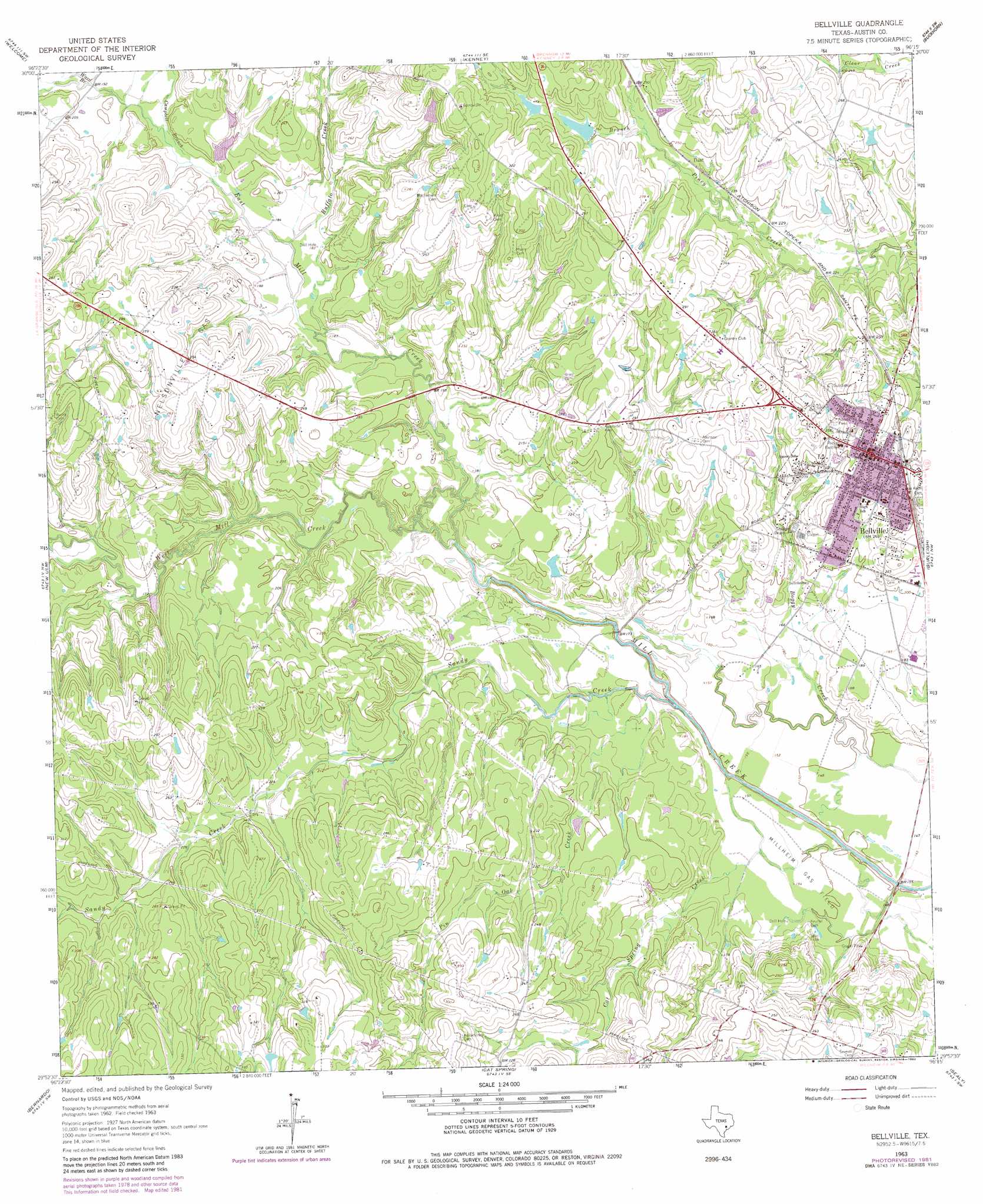
Bellville Topo Map Texas
To zoom in, hover over the map of Bellville
USGS Topo Quad 29096h3 - 1:24,000 scale
| Topo Map Name: | Bellville |
| USGS Topo Quad ID: | 29096h3 |
| Print Size: | ca. 21 1/4" wide x 27" high |
| Southeast Coordinates: | 29.875° N latitude / 96.25° W longitude |
| Map Center Coordinates: | 29.9375° N latitude / 96.3125° W longitude |
| U.S. State: | TX |
| Filename: | o29096h3.jpg |
| Download Map JPG Image: | Bellville topo map 1:24,000 scale |
| Map Type: | Topographic |
| Topo Series: | 7.5´ |
| Map Scale: | 1:24,000 |
| Source of Map Images: | United States Geological Survey (USGS) |
| Alternate Map Versions: |
Bellville TX 1963, updated 1982 Download PDF Buy paper map Bellville TX 2010 Download PDF Buy paper map Bellville TX 2013 Download PDF Buy paper map Bellville TX 2016 Download PDF Buy paper map |
1:24,000 Topo Quads surrounding Bellville
Burton |
Brenham |
Chappell Hill |
Daniels |
Howth |
Greenvine |
Welcome |
Kenney |
Buckhorn |
Hempstead |
Industry |
New Ulm |
Bellville |
Burleigh |
Sunny Side |
Frelsburg |
Bernardo |
Cat Spring |
Sealy |
San Felipe |
Columbus |
Alleyton |
Eagle Lake Ne |
Rexville |
Wallis |
> Back to 29096e1 at 1:100,000 scale
> Back to 29096a1 at 1:250,000 scale
> Back to U.S. Topo Maps home
Bellville topo map: Gazetteer
Bellville: Airports
Traylor Tick Farm Airport elevation 78m 255′Bellville: Dams
Mawis Lake Dam elevation 82m 269′Mewis Lake Dam elevation 80m 262′
Bellville: Oilfields
Millheim Gas Field elevation 46m 150′Nelsonville Gas Field elevation 77m 252′
Bellville: Populated Places
Bellville elevation 89m 291′Bellville: Reservoirs
Mawis Lake elevation 82m 269′Mewis Lake elevation 80m 262′
Bellville: Streams
Buffalo Creek elevation 55m 180′Campbell Branch elevation 57m 187′
Cat Spring Creek elevation 40m 131′
East Mill Creek elevation 47m 154′
Long Branch elevation 72m 236′
Pin Oak Creek elevation 45m 147′
Sandy Creek elevation 39m 127′
Ward Branch elevation 58m 190′
West Mill Creek elevation 48m 157′
Bellville digital topo map on disk
Buy this Bellville topo map showing relief, roads, GPS coordinates and other geographical features, as a high-resolution digital map file on DVD: