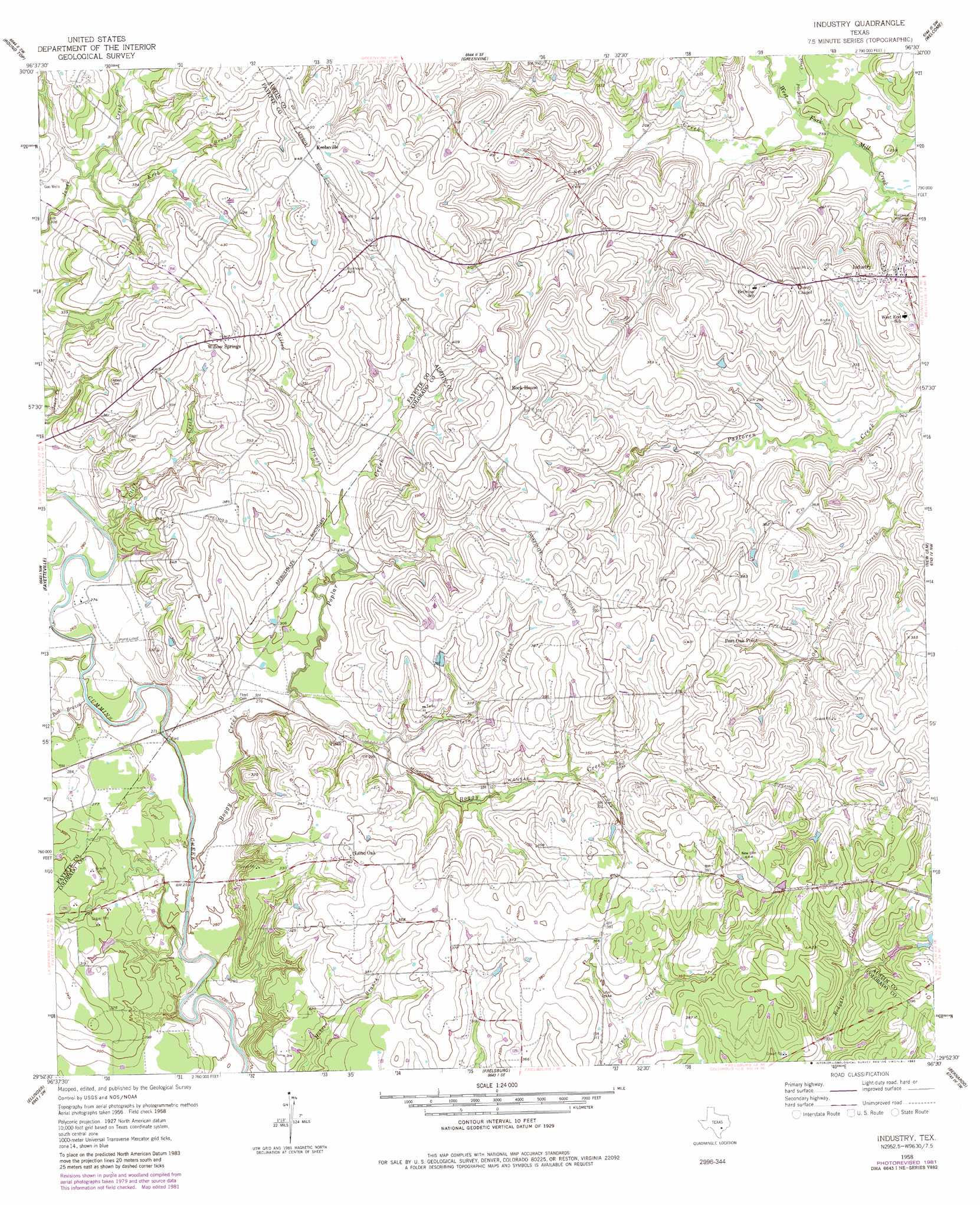
Industry Topo Map Texas
To zoom in, hover over the map of Industry
USGS Topo Quad 29096h5 - 1:24,000 scale
| Topo Map Name: | Industry |
| USGS Topo Quad ID: | 29096h5 |
| Print Size: | ca. 21 1/4" wide x 27" high |
| Southeast Coordinates: | 29.875° N latitude / 96.5° W longitude |
| Map Center Coordinates: | 29.9375° N latitude / 96.5625° W longitude |
| U.S. State: | TX |
| Filename: | o29096h5.jpg |
| Download Map JPG Image: | Industry topo map 1:24,000 scale |
| Map Type: | Topographic |
| Topo Series: | 7.5´ |
| Map Scale: | 1:24,000 |
| Source of Map Images: | United States Geological Survey (USGS) |
| Alternate Map Versions: |
Industry TX 1958, updated 1959 Download PDF Buy paper map Industry TX 2010 Download PDF Buy paper map Industry TX 2013 Download PDF Buy paper map Industry TX 2016 Download PDF Buy paper map |
1:24,000 Topo Quads surrounding Industry
Ledbetter |
Carmine |
Burton |
Brenham |
Chappell Hill |
Nechanitz |
Round Top |
Greenvine |
Welcome |
Kenney |
La Grange East |
Fayetteville |
Industry |
New Ulm |
Bellville |
Ammannsville |
Ellinger |
Frelsburg |
Bernardo |
Cat Spring |
Weimar |
Borden |
Columbus |
Alleyton |
Eagle Lake Ne |
> Back to 29096e1 at 1:100,000 scale
> Back to 29096a1 at 1:250,000 scale
> Back to U.S. Topo Maps home
Industry topo map: Gazetteer
Industry: Dams
Soil Conservation Service Site 26 Dam elevation 96m 314′Industry: Populated Places
Industry elevation 95m 311′Krebsville elevation 135m 442′
Lone Oak elevation 111m 364′
Pisek elevation 88m 288′
Post Oak Point elevation 118m 387′
Rockhouse elevation 116m 380′
Willow Springs elevation 128m 419′
Industry: Reservoirs
Soil Conservation Service Site 26 Reservoir elevation 96m 314′Industry: Streams
Boggy Creek elevation 74m 242′Cliff Creek elevation 79m 259′
Dogwood Creek elevation 74m 242′
Kreb Branch elevation 95m 311′
Pool Branch elevation 76m 249′
Poplar Creek elevation 79m 259′
Sawmill Creek elevation 73m 239′
Stein Branch elevation 85m 278′
Willow Branch elevation 89m 291′
Industry digital topo map on disk
Buy this Industry topo map showing relief, roads, GPS coordinates and other geographical features, as a high-resolution digital map file on DVD: