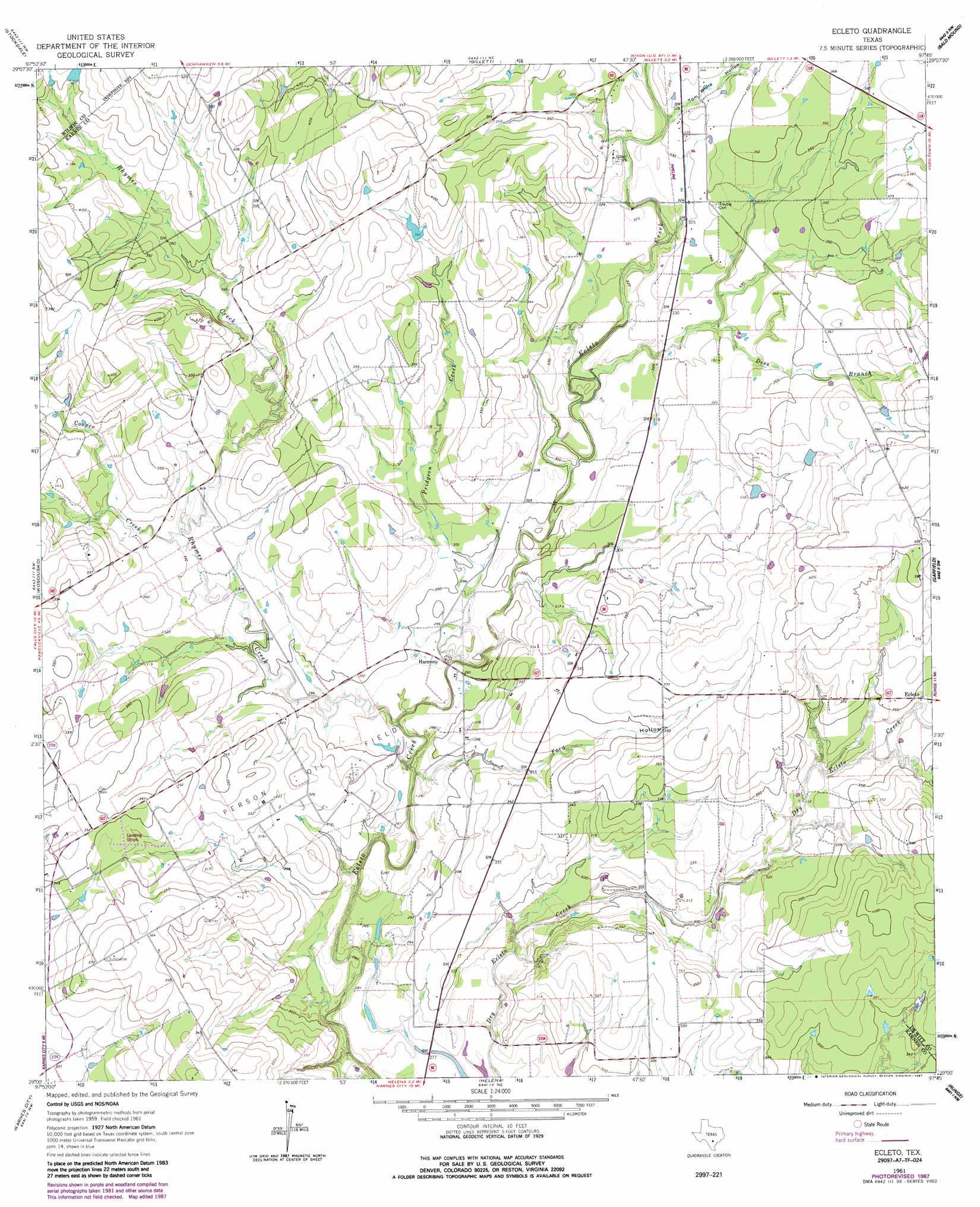
Ecleto Topo Map Texas
To zoom in, hover over the map of Ecleto
USGS Topo Quad 29097a7 - 1:24,000 scale
| Topo Map Name: | Ecleto |
| USGS Topo Quad ID: | 29097a7 |
| Print Size: | ca. 21 1/4" wide x 27" high |
| Southeast Coordinates: | 29° N latitude / 97.75° W longitude |
| Map Center Coordinates: | 29.0625° N latitude / 97.8125° W longitude |
| U.S. State: | TX |
| Filename: | o29097a7.jpg |
| Download Map JPG Image: | Ecleto topo map 1:24,000 scale |
| Map Type: | Topographic |
| Topo Series: | 7.5´ |
| Map Scale: | 1:24,000 |
| Source of Map Images: | United States Geological Survey (USGS) |
| Alternate Map Versions: |
Ecleto TX 1961, updated 1964 Download PDF Buy paper map Ecleto TX 1961, updated 1987 Download PDF Buy paper map Ecleto TX 2010 Download PDF Buy paper map Ecleto TX 2013 Download PDF Buy paper map Ecleto TX 2016 Download PDF Buy paper map |
1:24,000 Topo Quads surrounding Ecleto
La Vernia |
Alum |
Nixon |
Smiley |
Pilgrim |
Marcelinas Hills |
Stockdale |
Gillett |
Bald Mound |
Sample |
Poth |
Kosciusko |
Ecleto |
Garfield |
New Davy |
Falls City |
Karnes City |
Helena |
Runge |
Yorktown West |
Coy City |
Lenz |
Kenedy |
Choate |
Runge Se |
> Back to 29097a1 at 1:100,000 scale
> Back to 29096a1 at 1:250,000 scale
> Back to U.S. Topo Maps home
Ecleto topo map: Gazetteer
Ecleto: Dams
Korth Lake Dam elevation 112m 367′Texas No Name Number 18 Dam elevation 123m 403′
Ecleto: Oilfields
Person Oil Field elevation 101m 331′Ecleto: Populated Places
Ecleto elevation 103m 337′Harmony elevation 91m 298′
Ecleto: Reservoirs
Korth Lake elevation 112m 367′Ecleto: Streams
Cooper Creek elevation 95m 311′Dees Branch elevation 95m 311′
Pridgeon Creek elevation 88m 288′
Rhymes Creek elevation 89m 291′
Ecleto: Valleys
Ford Hollow elevation 86m 282′Tom White Hollow elevation 99m 324′
Ecleto digital topo map on disk
Buy this Ecleto topo map showing relief, roads, GPS coordinates and other geographical features, as a high-resolution digital map file on DVD: