Sample Topo Map Texas
To zoom in, hover over the map of Sample
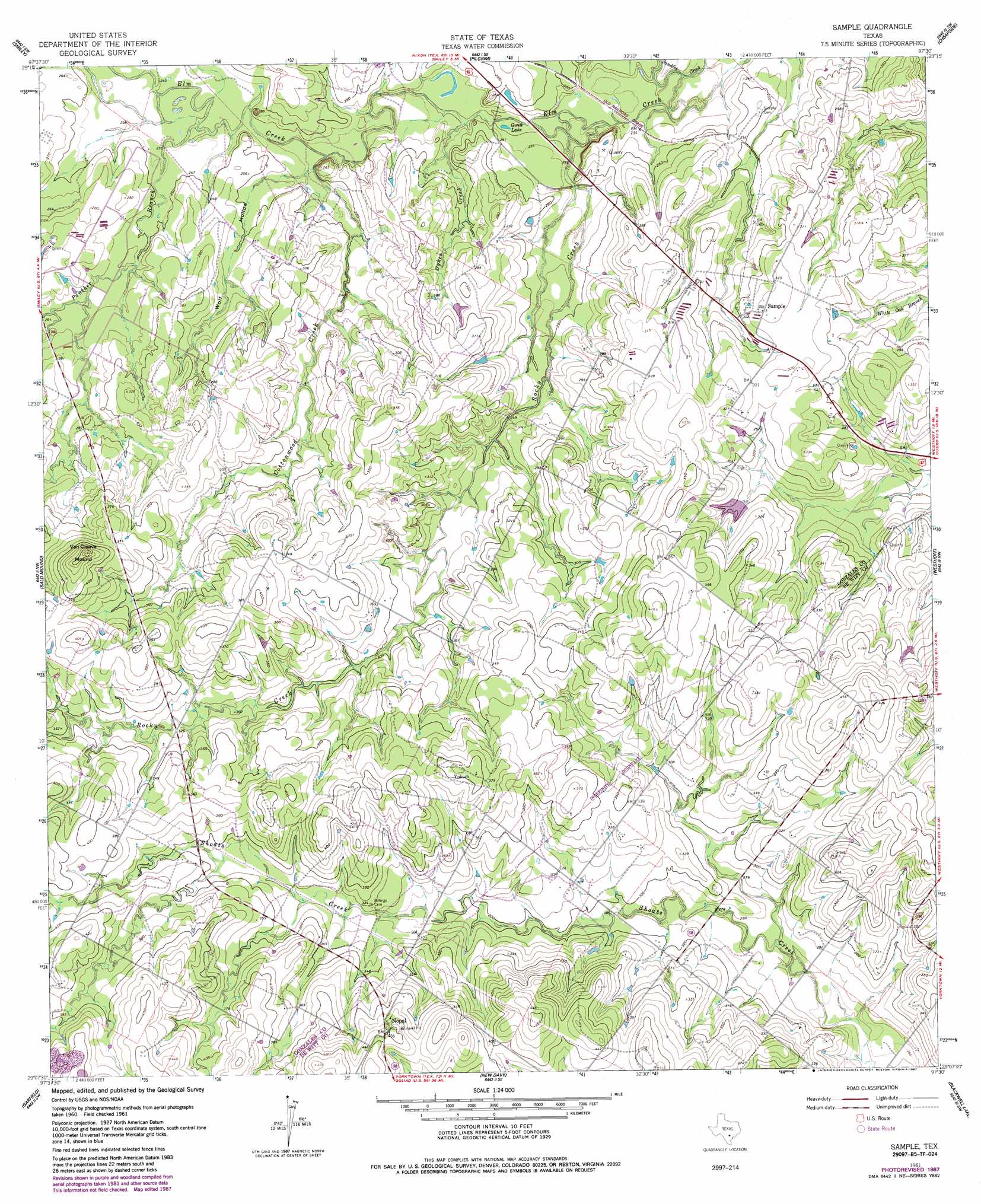
USGS Topo Quad 29097b5 - 1:24,000 scale
| Topo Map Name: | Sample |
| USGS Topo Quad ID: | 29097b5 |
| Print Size: | ca. 21 1/4" wide x 27" high |
| Southeast Coordinates: | 29.125° N latitude / 97.5° W longitude |
| Map Center Coordinates: | 29.1875° N latitude / 97.5625° W longitude |
| U.S. State: | TX |
| Filename: | o29097b5.jpg |
| Download Map JPG Image: | Sample topo map 1:24,000 scale |
| Map Type: | Topographic |
| Topo Series: | 7.5´ |
| Map Scale: | 1:24,000 |
| Source of Map Images: | United States Geological Survey (USGS) |
| Alternate Map Versions: |
Sample TX 1961, updated 1963 Download PDF Buy paper map Sample TX 1961, updated 1978 Download PDF Buy paper map Sample TX 1961, updated 1987 Download PDF Buy paper map Sample TX 2010 Download PDF Buy paper map Sample TX 2013 Download PDF Buy paper map Sample TX 2016 Download PDF Buy paper map |
1:24,000 Topo Quads surrounding Sample
Dewville |
Leesville |
Cost |
Gonzales South |
Hamon |
Nixon |
Smiley |
Pilgrim |
Cheapside |
Hochheim |
Gillett |
Bald Mound |
Sample |
Westhoff |
Concrete |
Ecleto |
Garfield |
New Davy |
Blackwell Lake |
Cuero |
Helena |
Runge |
Yorktown West |
Yorktown East |
Meyersville |
> Back to 29097a1 at 1:100,000 scale
> Back to 29096a1 at 1:250,000 scale
> Back to U.S. Topo Maps home
Sample topo map: Gazetteer
Sample: Lakes
Gwen Lake elevation 69m 226′Sample: Populated Places
Nopal elevation 130m 426′Sample elevation 98m 321′
Yokum elevation 121m 396′
Sample: Streams
Cottonwood Creek elevation 70m 229′Dykes Creek elevation 70m 229′
Elm Creek elevation 67m 219′
Jack Hand Branch elevation 79m 259′
Panther Branch elevation 73m 239′
Rocky Creek elevation 68m 223′
Sample: Summits
Van Cleave Mound elevation 143m 469′Sample: Valleys
Wolf Hollow elevation 70m 229′Sample digital topo map on disk
Buy this Sample topo map showing relief, roads, GPS coordinates and other geographical features, as a high-resolution digital map file on DVD: