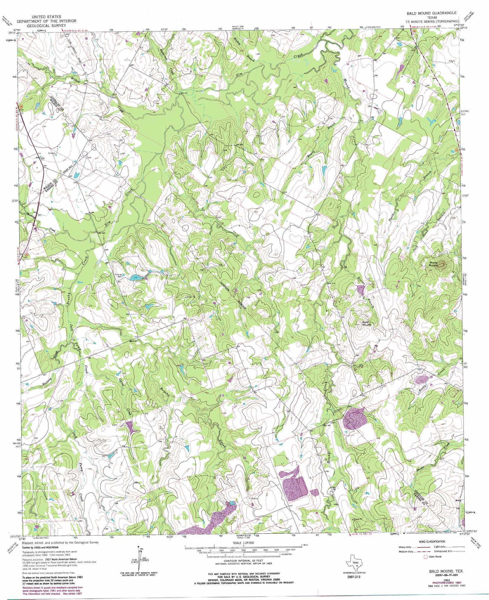
Bald Mound Topo Map Texas
To zoom in, hover over the map of Bald Mound
USGS Topo Quad 29097b6 - 1:24,000 scale
| Topo Map Name: | Bald Mound |
| USGS Topo Quad ID: | 29097b6 |
| Print Size: | ca. 21 1/4" wide x 27" high |
| Southeast Coordinates: | 29.125° N latitude / 97.625° W longitude |
| Map Center Coordinates: | 29.1875° N latitude / 97.6875° W longitude |
| U.S. State: | TX |
| Filename: | o29097b6.jpg |
| Download Map JPG Image: | Bald Mound topo map 1:24,000 scale |
| Map Type: | Topographic |
| Topo Series: | 7.5´ |
| Map Scale: | 1:24,000 |
| Source of Map Images: | United States Geological Survey (USGS) |
| Alternate Map Versions: |
Bald Mound TX 1963, updated 1965 Download PDF Buy paper map Bald Mound TX 1963, updated 1980 Download PDF Buy paper map Bald Mound TX 1963, updated 1987 Download PDF Buy paper map Bald Mound TX 2010 Download PDF Buy paper map Bald Mound TX 2013 Download PDF Buy paper map Bald Mound TX 2016 Download PDF Buy paper map |
1:24,000 Topo Quads surrounding Bald Mound
Thomas Springs |
Dewville |
Leesville |
Cost |
Gonzales South |
Alum |
Nixon |
Smiley |
Pilgrim |
Cheapside |
Stockdale |
Gillett |
Bald Mound |
Sample |
Westhoff |
Kosciusko |
Ecleto |
Garfield |
New Davy |
Blackwell Lake |
Karnes City |
Helena |
Runge |
Yorktown West |
Yorktown East |
> Back to 29097a1 at 1:100,000 scale
> Back to 29096a1 at 1:250,000 scale
> Back to U.S. Topo Maps home
Bald Mound topo map: Gazetteer
Bald Mound: Airports
Joye Ranch Airport elevation 86m 282′Bald Mound: Dams
Kelly Lake Dam elevation 103m 337′Texas No Name Number 15 Dam elevation 95m 311′
Bald Mound: Reservoirs
Kelly Lake elevation 103m 337′Bald Mound: Streams
Board Branch elevation 79m 259′Brushy Creek elevation 88m 288′
Corral Creek elevation 93m 305′
Jack Pump Creek elevation 90m 295′
Mound Creek elevation 76m 249′
Mustang Creek elevation 91m 298′
Racetrack Creek elevation 82m 269′
Rusten Branch elevation 92m 301′
Shockley Creek elevation 88m 288′
Wickey Branch elevation 79m 259′
Willow Creek elevation 82m 269′
Bald Mound: Summits
Bald Mound elevation 142m 465′Rocky Mound elevation 132m 433′
Bald Mound digital topo map on disk
Buy this Bald Mound topo map showing relief, roads, GPS coordinates and other geographical features, as a high-resolution digital map file on DVD: