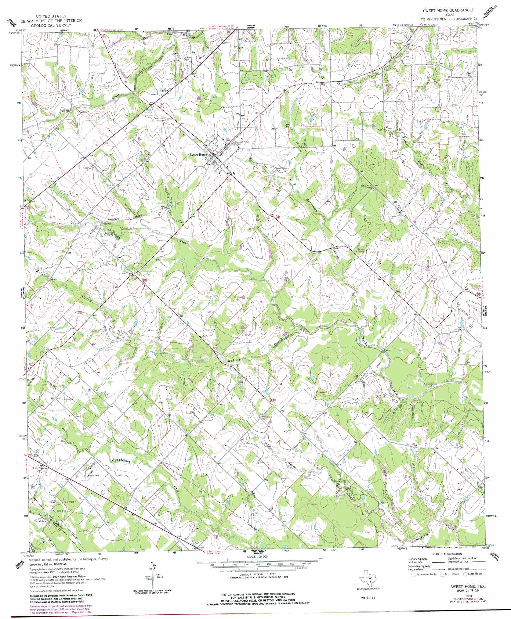
Sweet Home Topo Map Texas
To zoom in, hover over the map of Sweet Home
USGS Topo Quad 29097c1 - 1:24,000 scale
| Topo Map Name: | Sweet Home |
| USGS Topo Quad ID: | 29097c1 |
| Print Size: | ca. 21 1/4" wide x 27" high |
| Southeast Coordinates: | 29.25° N latitude / 97° W longitude |
| Map Center Coordinates: | 29.3125° N latitude / 97.0625° W longitude |
| U.S. State: | TX |
| Filename: | o29097c1.jpg |
| Download Map JPG Image: | Sweet Home topo map 1:24,000 scale |
| Map Type: | Topographic |
| Topo Series: | 7.5´ |
| Map Scale: | 1:24,000 |
| Source of Map Images: | United States Geological Survey (USGS) |
| Alternate Map Versions: |
Sweet Home TX 1963, updated 1964 Download PDF Buy paper map Sweet Home TX 1963, updated 1987 Download PDF Buy paper map Sweet Home TX 2010 Download PDF Buy paper map Sweet Home TX 2013 Download PDF Buy paper map Sweet Home TX 2016 Download PDF Buy paper map |
1:24,000 Topo Quads surrounding Sweet Home
Dilworth |
Moulton |
Komensky |
Moravia |
Oakland |
Hamon |
Shiner |
Wied |
Hallettsville |
Sublime |
Hochheim |
Yoakum |
Sweet Home |
Ezzell |
Hallettsville Se |
Concrete |
Edgar |
Terryville |
Hope |
Morales |
Cuero |
Verhelle |
Fordtran |
Peck Branch |
Navidad |
> Back to 29097a1 at 1:100,000 scale
> Back to 29096a1 at 1:250,000 scale
> Back to U.S. Topo Maps home
Sweet Home topo map: Gazetteer
Sweet Home: Populated Places
Sweet Home elevation 87m 285′Sweet Home: Streams
Burncamp Creek elevation 58m 190′Kelley Creek elevation 61m 200′
North Fork Mustang Creek elevation 74m 242′
Pilot Grove Branch elevation 51m 167′
South Fork Mustang Creek elevation 74m 242′
Sweet Home digital topo map on disk
Buy this Sweet Home topo map showing relief, roads, GPS coordinates and other geographical features, as a high-resolution digital map file on DVD: