Pilgrim Topo Map Texas
To zoom in, hover over the map of Pilgrim
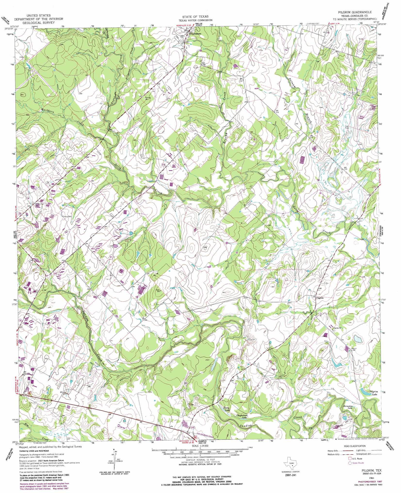
USGS Topo Quad 29097c5 - 1:24,000 scale
| Topo Map Name: | Pilgrim |
| USGS Topo Quad ID: | 29097c5 |
| Print Size: | ca. 21 1/4" wide x 27" high |
| Southeast Coordinates: | 29.25° N latitude / 97.5° W longitude |
| Map Center Coordinates: | 29.3125° N latitude / 97.5625° W longitude |
| U.S. State: | TX |
| Filename: | o29097c5.jpg |
| Download Map JPG Image: | Pilgrim topo map 1:24,000 scale |
| Map Type: | Topographic |
| Topo Series: | 7.5´ |
| Map Scale: | 1:24,000 |
| Source of Map Images: | United States Geological Survey (USGS) |
| Alternate Map Versions: |
Pilgrim TX 1961, updated 1963 Download PDF Buy paper map Pilgrim TX 1961, updated 1987 Download PDF Buy paper map Pilgrim TX 2010 Download PDF Buy paper map Pilgrim TX 2013 Download PDF Buy paper map Pilgrim TX 2016 Download PDF Buy paper map |
1:24,000 Topo Quads surrounding Pilgrim
Darst Creek |
Belmont |
Ottine |
Gonzales North |
Dilworth |
Dewville |
Leesville |
Cost |
Gonzales South |
Hamon |
Nixon |
Smiley |
Pilgrim |
Cheapside |
Hochheim |
Gillett |
Bald Mound |
Sample |
Westhoff |
Concrete |
Ecleto |
Garfield |
New Davy |
Blackwell Lake |
Cuero |
> Back to 29097a1 at 1:100,000 scale
> Back to 29096a1 at 1:250,000 scale
> Back to U.S. Topo Maps home
Pilgrim topo map: Gazetteer
Pilgrim: Lakes
Claybottom Lake elevation 70m 229′Horseshoe Lake elevation 67m 219′
Pilgrim Lake elevation 64m 209′
Seeny Lake elevation 70m 229′
Pilgrim: Populated Places
Pilgrim elevation 84m 275′Wrightsboro elevation 91m 298′
Pilgrim: Streams
Alligator Creek elevation 80m 262′Brushy Creek elevation 73m 239′
Buckhorn Creek elevation 76m 249′
Cottonwood Creek elevation 82m 269′
Putnam Branch elevation 70m 229′
Sugar Creek elevation 76m 249′
Pilgrim: Summits
Windy Hill elevation 71m 232′Pilgrim digital topo map on disk
Buy this Pilgrim topo map showing relief, roads, GPS coordinates and other geographical features, as a high-resolution digital map file on DVD: