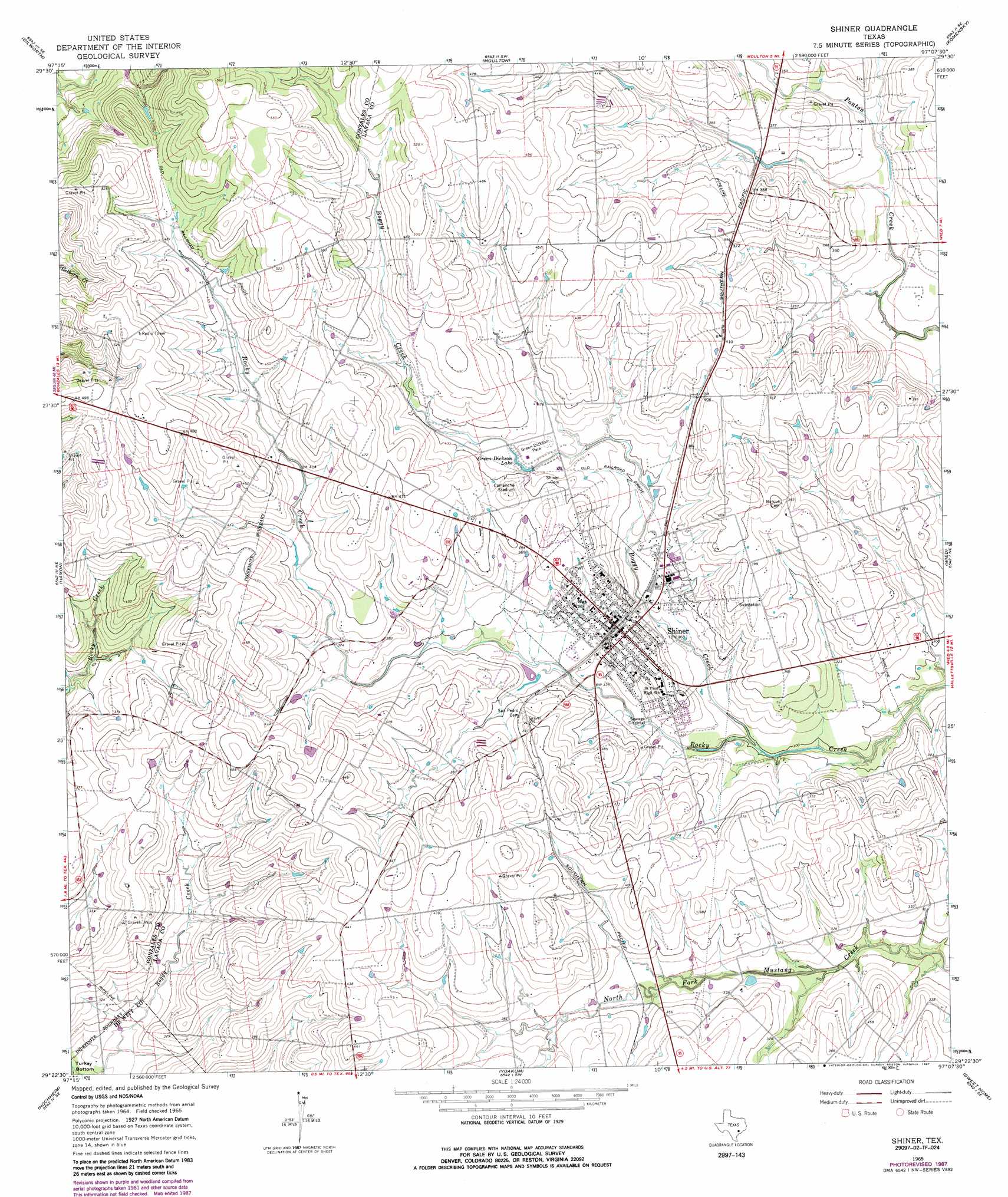
Shiner Topo Map Texas
To zoom in, hover over the map of Shiner
USGS Topo Quad 29097d2 - 1:24,000 scale
| Topo Map Name: | Shiner |
| USGS Topo Quad ID: | 29097d2 |
| Print Size: | ca. 21 1/4" wide x 27" high |
| Southeast Coordinates: | 29.375° N latitude / 97.125° W longitude |
| Map Center Coordinates: | 29.4375° N latitude / 97.1875° W longitude |
| U.S. State: | TX |
| Filename: | o29097d2.jpg |
| Download Map JPG Image: | Shiner topo map 1:24,000 scale |
| Map Type: | Topographic |
| Topo Series: | 7.5´ |
| Map Scale: | 1:24,000 |
| Source of Map Images: | United States Geological Survey (USGS) |
| Alternate Map Versions: |
Shiner TX 1965, updated 1968 Download PDF Buy paper map Shiner TX 1965, updated 1987 Download PDF Buy paper map Shiner TX 2010 Download PDF Buy paper map Shiner TX 2013 Download PDF Buy paper map Shiner TX 2016 Download PDF Buy paper map |
1:24,000 Topo Quads surrounding Shiner
Sandy Fork |
Waelder |
Flatonia Nw |
Flatonia |
Schulenburg |
Gonzales North |
Dilworth |
Moulton |
Komensky |
Moravia |
Gonzales South |
Hamon |
Shiner |
Wied |
Hallettsville |
Cheapside |
Hochheim |
Yoakum |
Sweet Home |
Ezzell |
Westhoff |
Concrete |
Edgar |
Terryville |
Hope |
> Back to 29097a1 at 1:100,000 scale
> Back to 29096a1 at 1:250,000 scale
> Back to U.S. Topo Maps home
Shiner topo map: Gazetteer
Shiner: Airports
Gerum Farm Airport elevation 129m 423′Shiner: Parks
Comanche Stadium elevation 128m 419′Green-Dickson Park elevation 115m 377′
Shiner: Populated Places
Shiner elevation 109m 357′Shiner: Reservoirs
Green-Dickson Lake elevation 113m 370′Shiner: Streams
Boggy Creek elevation 89m 291′Turkey Creek elevation 79m 259′
Shiner digital topo map on disk
Buy this Shiner topo map showing relief, roads, GPS coordinates and other geographical features, as a high-resolution digital map file on DVD: