Thomas Springs Topo Map Texas
To zoom in, hover over the map of Thomas Springs
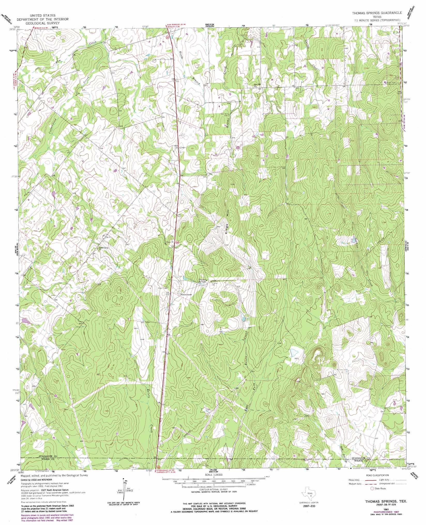
USGS Topo Quad 29097d8 - 1:24,000 scale
| Topo Map Name: | Thomas Springs |
| USGS Topo Quad ID: | 29097d8 |
| Print Size: | ca. 21 1/4" wide x 27" high |
| Southeast Coordinates: | 29.375° N latitude / 97.875° W longitude |
| Map Center Coordinates: | 29.4375° N latitude / 97.9375° W longitude |
| U.S. State: | TX |
| Filename: | o29097d8.jpg |
| Download Map JPG Image: | Thomas Springs topo map 1:24,000 scale |
| Map Type: | Topographic |
| Topo Series: | 7.5´ |
| Map Scale: | 1:24,000 |
| Source of Map Images: | United States Geological Survey (USGS) |
| Alternate Map Versions: |
Thomas Springs TX 1961, updated 1963 Download PDF Buy paper map Thomas Springs TX 1961, updated 1985 Download PDF Buy paper map Thomas Springs TX 1961, updated 1987 Download PDF Buy paper map Thomas Springs TX 2010 Download PDF Buy paper map Thomas Springs TX 2013 Download PDF Buy paper map Thomas Springs TX 2016 Download PDF Buy paper map |
1:24,000 Topo Quads surrounding Thomas Springs
New Braunfels West |
New Braunfels East |
Geronimo |
Kingsbury |
Luling |
Marion |
Mcqueeney |
Seguin |
Darst Creek |
Belmont |
Saint Hedwig |
New Berlin |
Thomas Springs |
Dewville |
Leesville |
La Vernia Sw |
La Vernia |
Alum |
Nixon |
Smiley |
Floresville |
Marcelinas Hills |
Stockdale |
Gillett |
Bald Mound |
> Back to 29097a1 at 1:100,000 scale
> Back to 29096a1 at 1:250,000 scale
> Back to U.S. Topo Maps home
Thomas Springs topo map: Gazetteer
Thomas Springs: Populated Places
Jakes Colony elevation 186m 610′Thomas Springs: Springs
Thomas Springs elevation 218m 715′Thomas Springs: Streams
Campbell Branch elevation 148m 485′Cordell Creek elevation 160m 524′
Elm Creek elevation 148m 485′
Thomas Springs: Summits
Kings Hill elevation 228m 748′Thomas Springs digital topo map on disk
Buy this Thomas Springs topo map showing relief, roads, GPS coordinates and other geographical features, as a high-resolution digital map file on DVD: